

Maps available from the Lancaster University Library collection attract different copyright terms, which will be highlighted wherever possible.
Many maps are available under a Creative Commons (CC BY 4.0) licence where highlighted to allow easy reuse. If this licence does not suit your particular use, please contact the library.
You can use our maps on Blogs, Social Networking or even Commercial Products, but always credit Lancaster University Library.


The following maps have been scanned from the Lancaster University Library Map Collection (unless otherwise stated). The jpeg images may be reduced to fit the screen and can usually be enlarged, depending on your browser. The library is able to provide uncompressed original digital files, upon request.
Warning: File sizes for some maps are large, and may download slowly especially on mobile connections. If you right click on the image, and click 'Save Link As' you can save the map and open it in a desktop image viewer, rather than browser, for easier zooming in on details on slower computers.
| Year | Name | Image | Attribution |
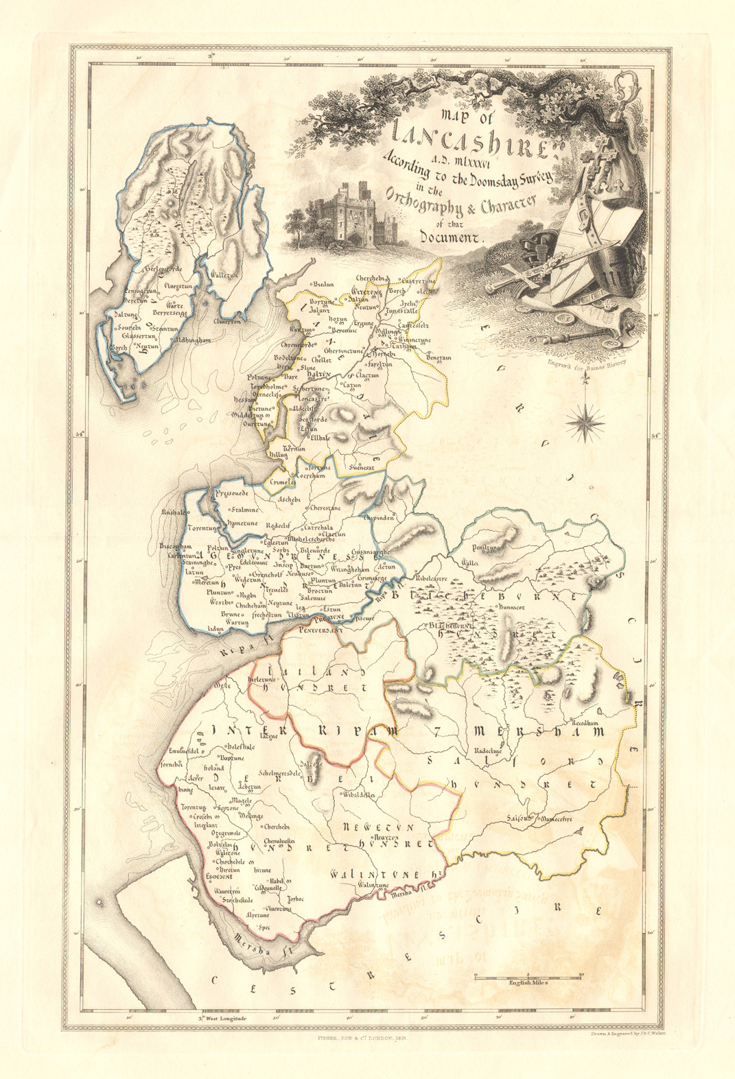
| 1086 | J. and C. Walker. ‘Lancashire A.D. 1086 according to the Doomsday Survey’ from Baines’s History of the County of Lancaster. Published 1836. |
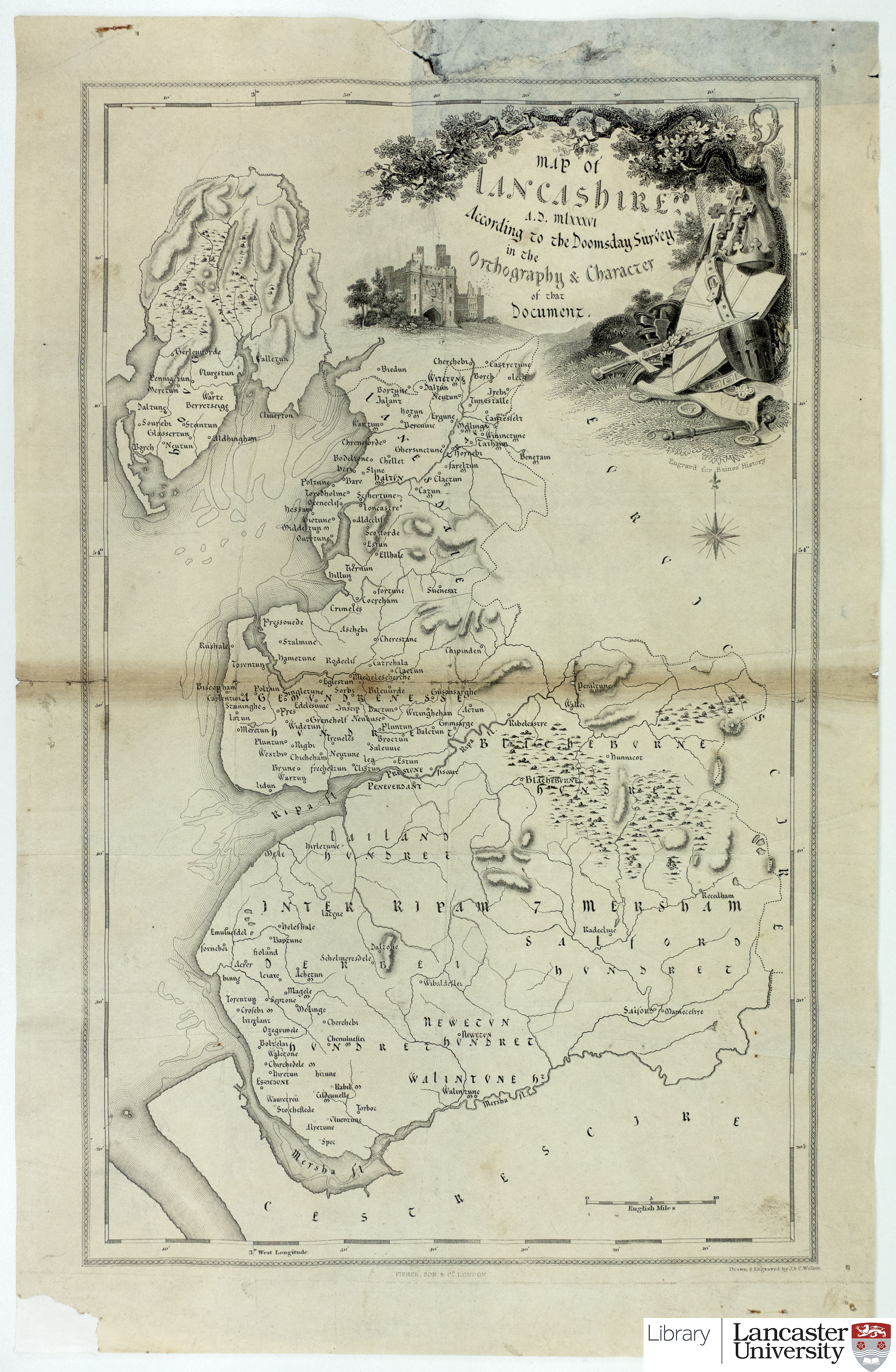 |
CC BY-SA 4.0 |
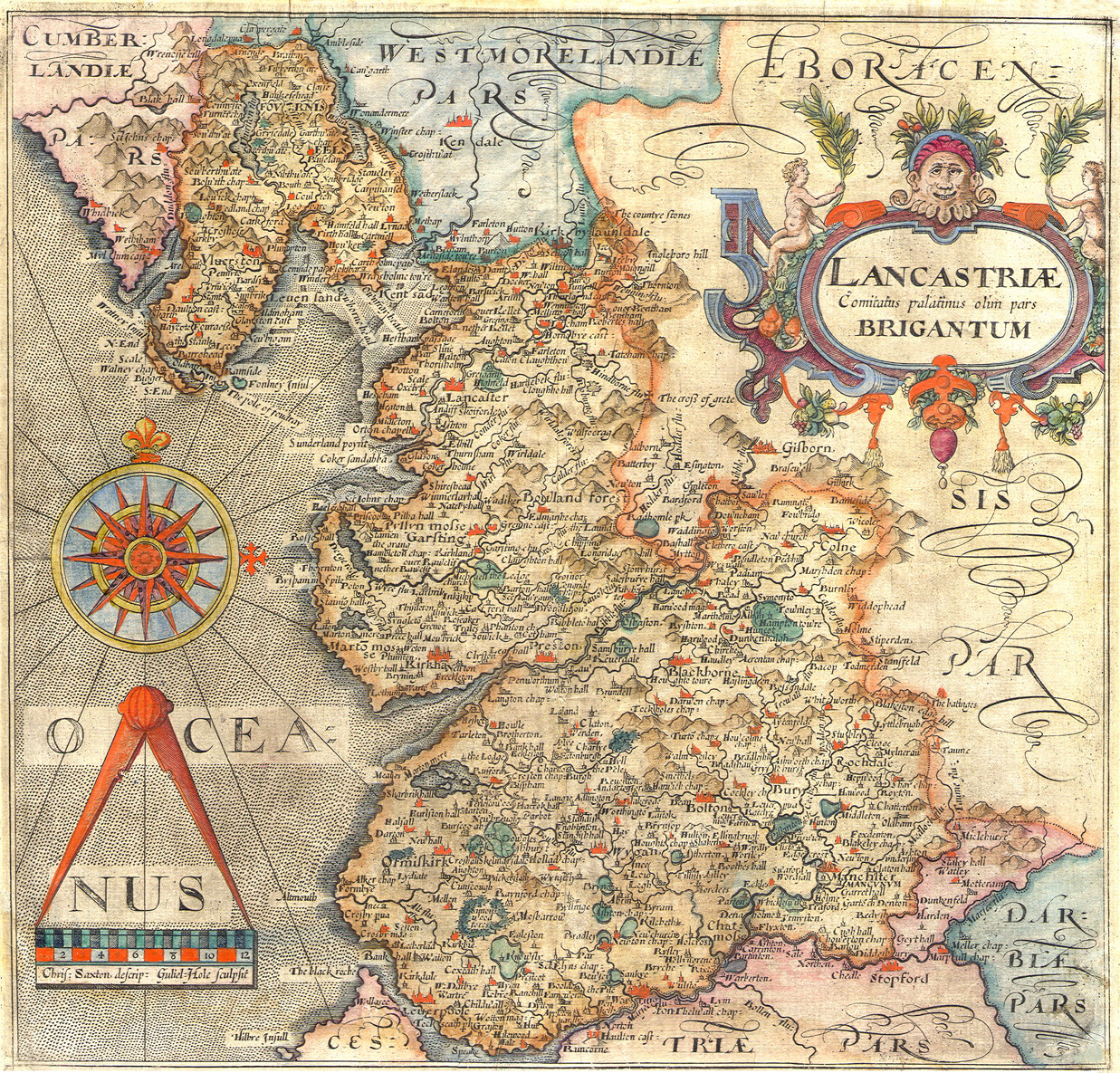
| 1607 | Christopher Saxton & William Hole. 'Lancastriae Comitatus palatinus olim pars Brigantum'. | 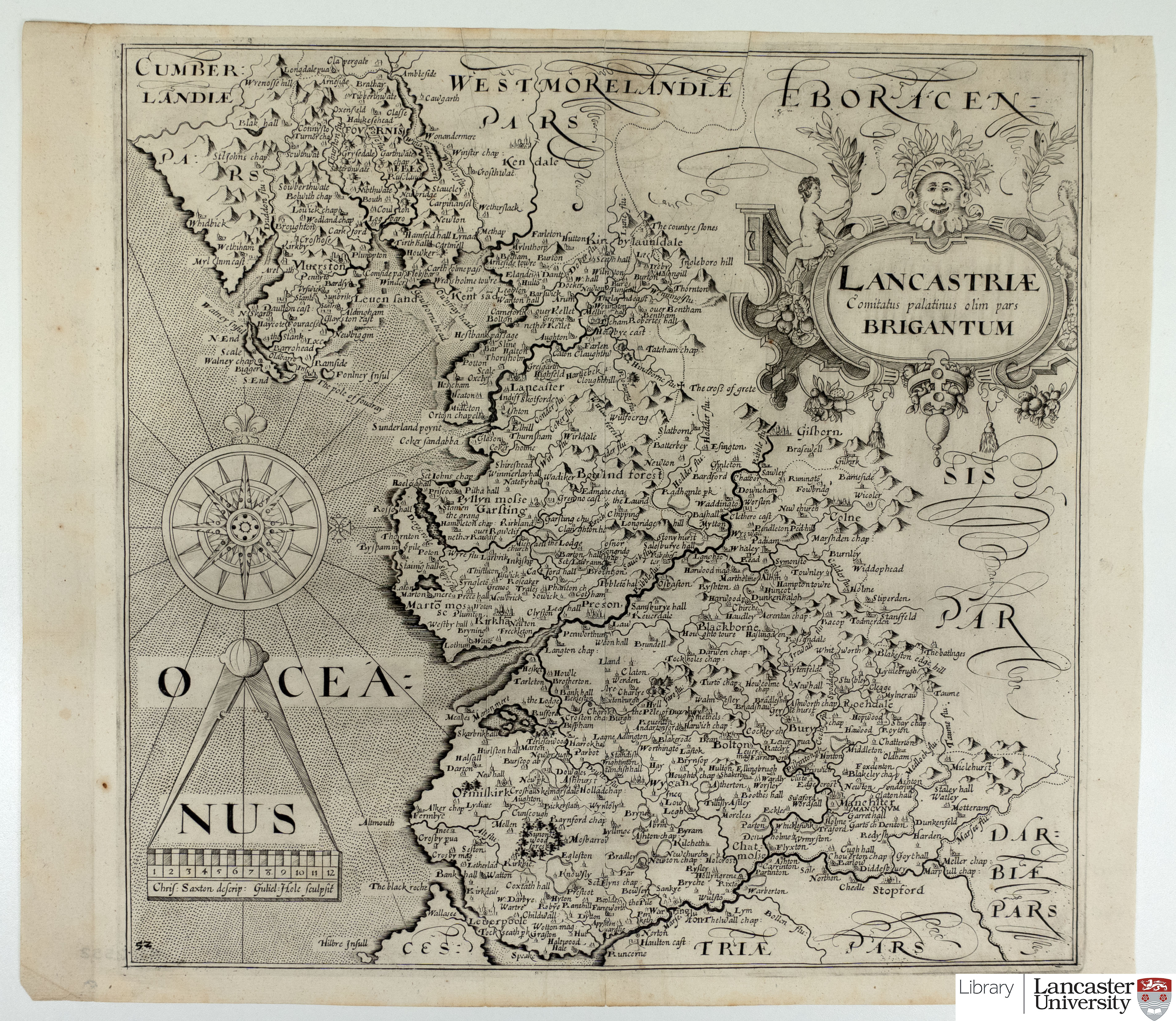 |
CC BY-SA 4.0 |
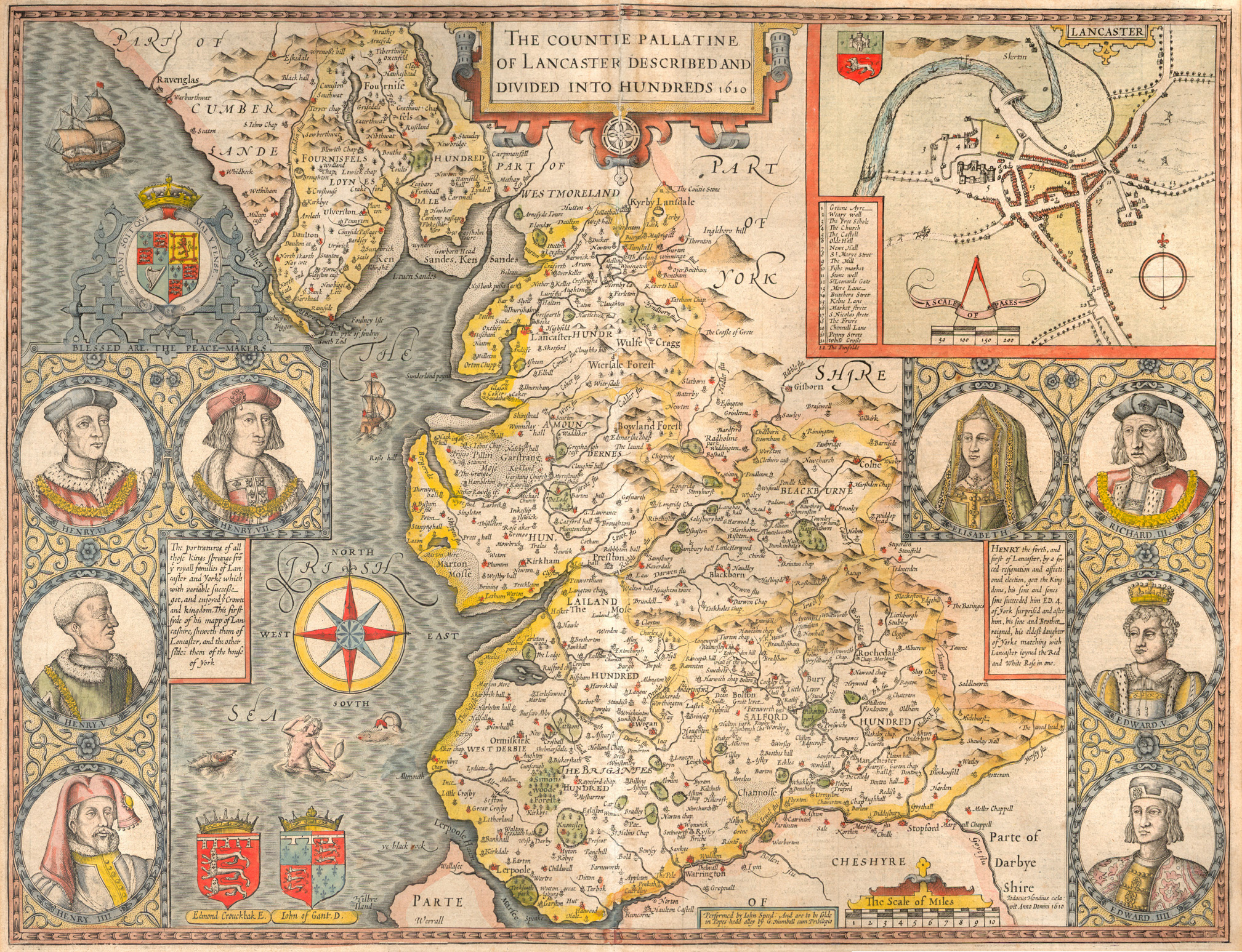
| 1610 |
Map from "The Countie Pallatine of Lancaster described and divided into hundreds, 1610" by John Speed. A non colourised version can be downloaded at Wikimedia, with a similar licence. |
 |
Public Domain |
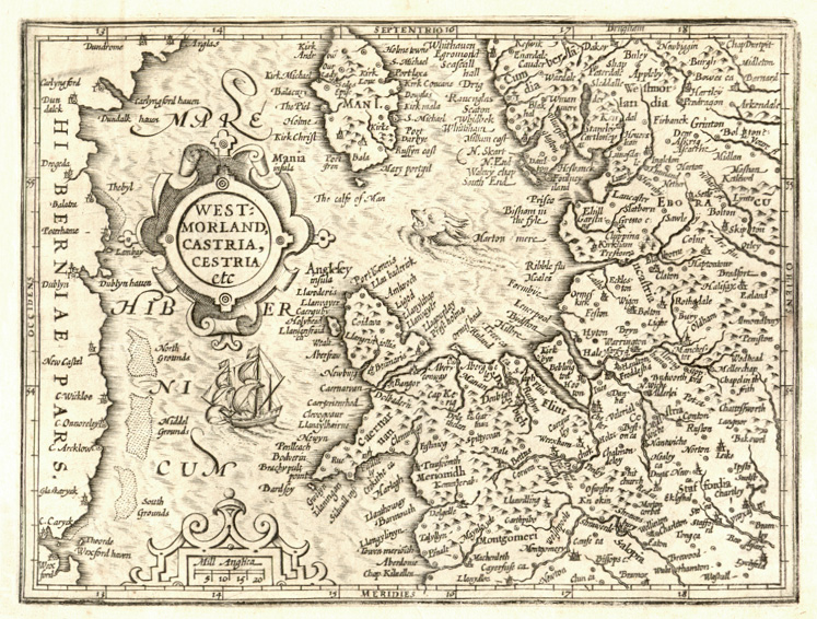
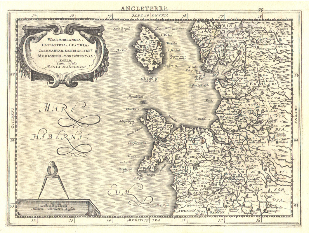
| c.1620 | Gerard Mercator. Westmorlandia Lancastria Cestria Caernarvan Denbigh, Flint Merionidh, Montgomery Sa Lopia Cum Insulis Mania Et Anglesey. | 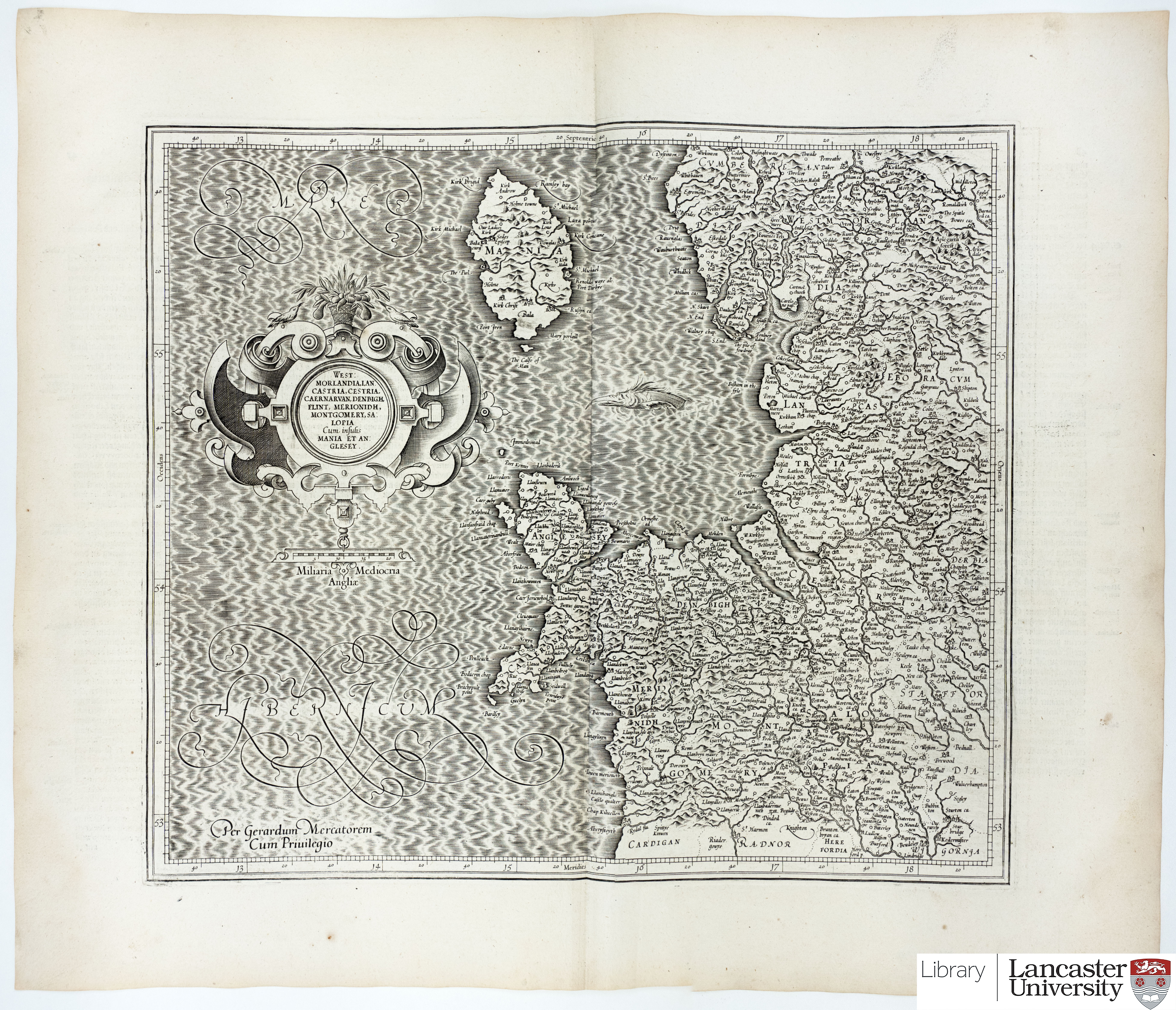 |
CC BY-SA 4.0 |
| 1662 | John Blaeu. Lancastria Palatinatus from Atlas Major. This is a reproduction, published 1893 by R. S. Shearer & Son. | 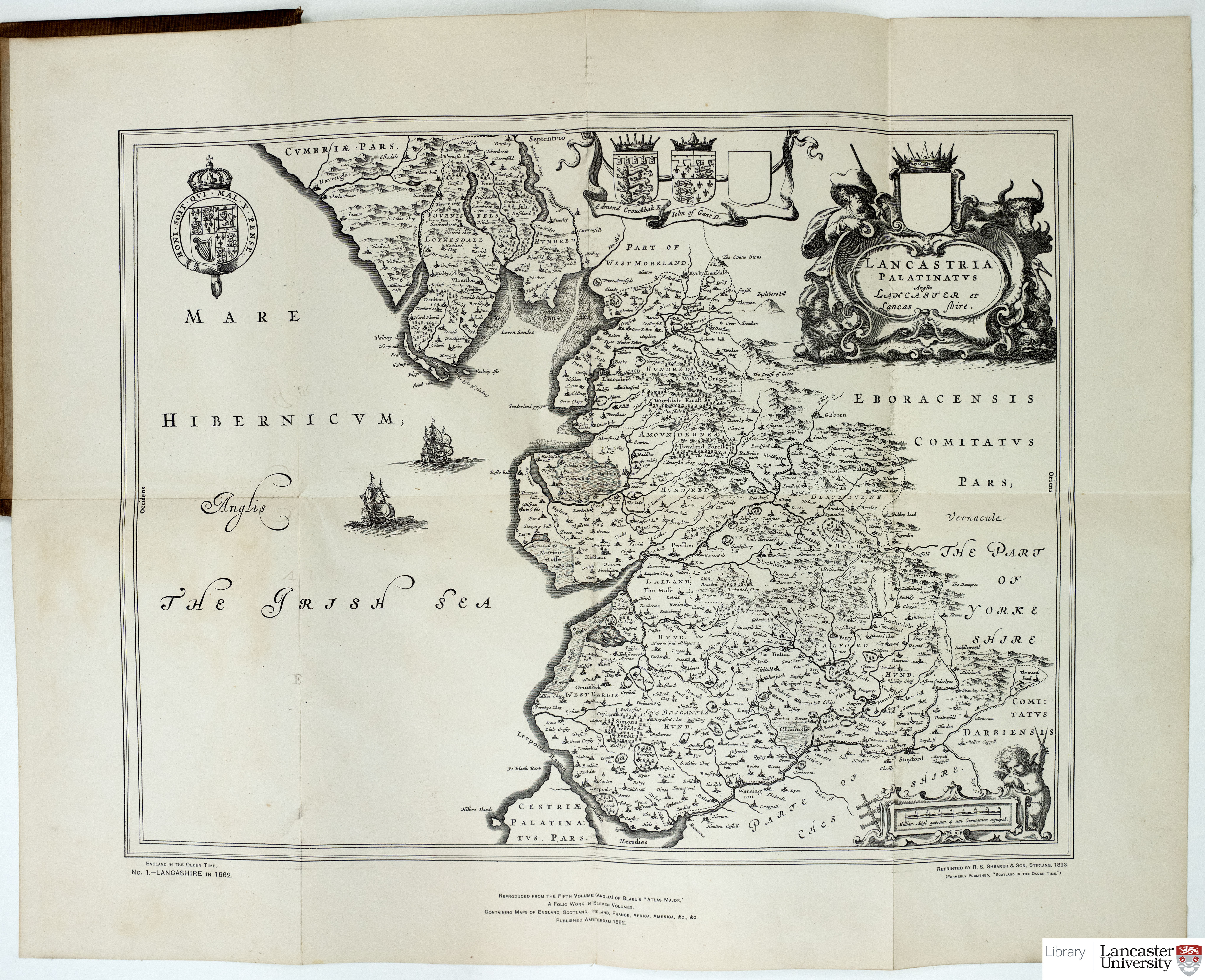 |
|
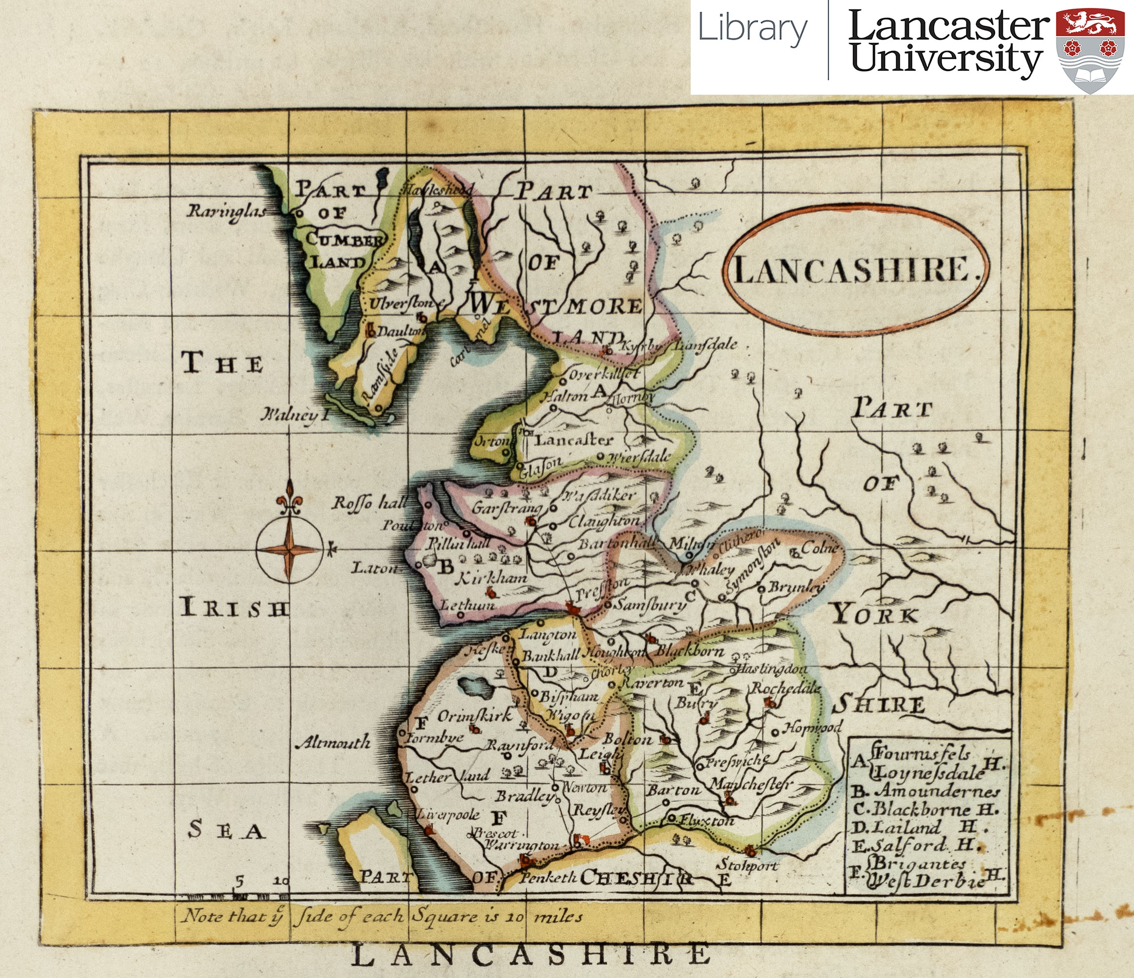
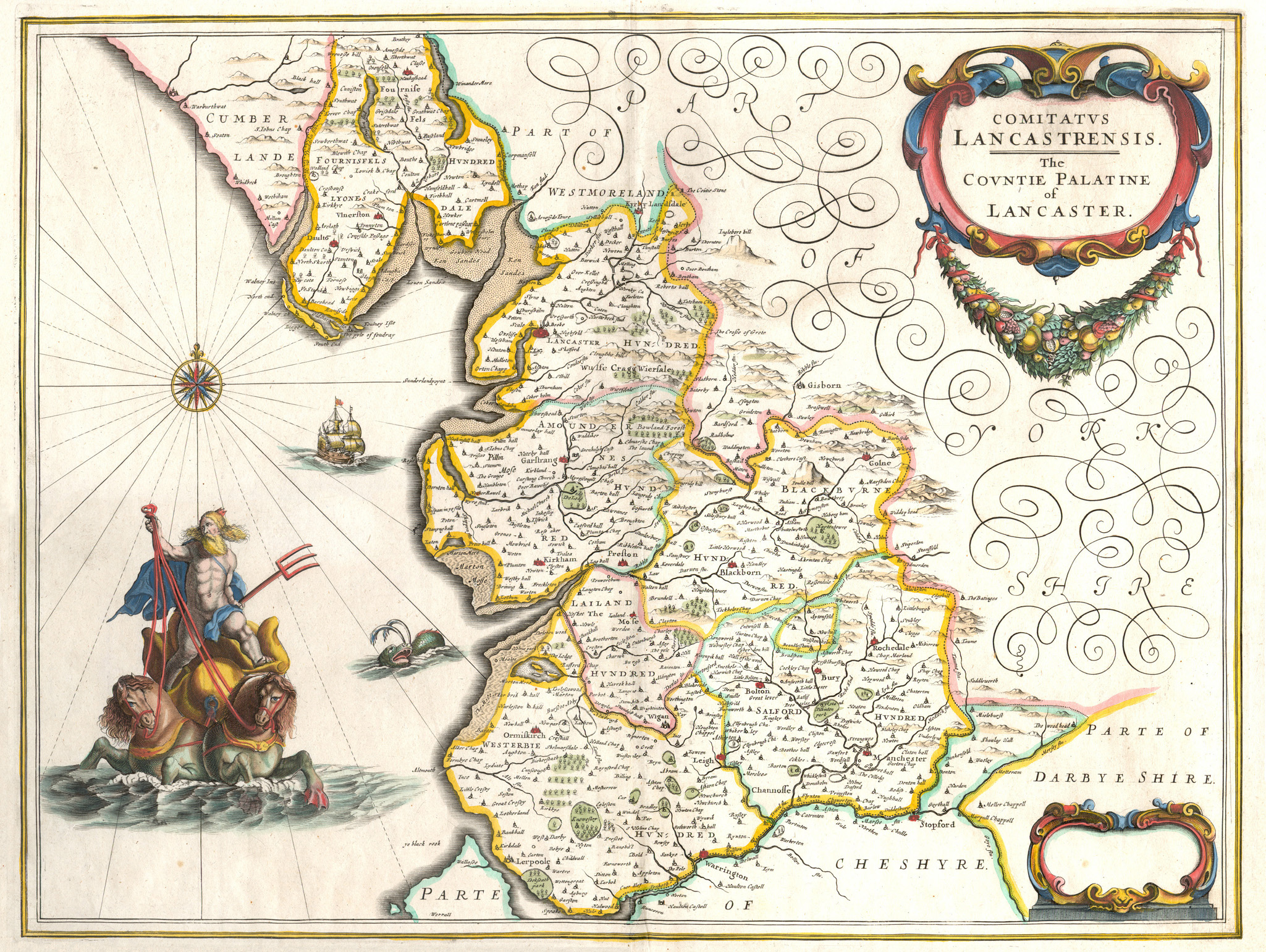
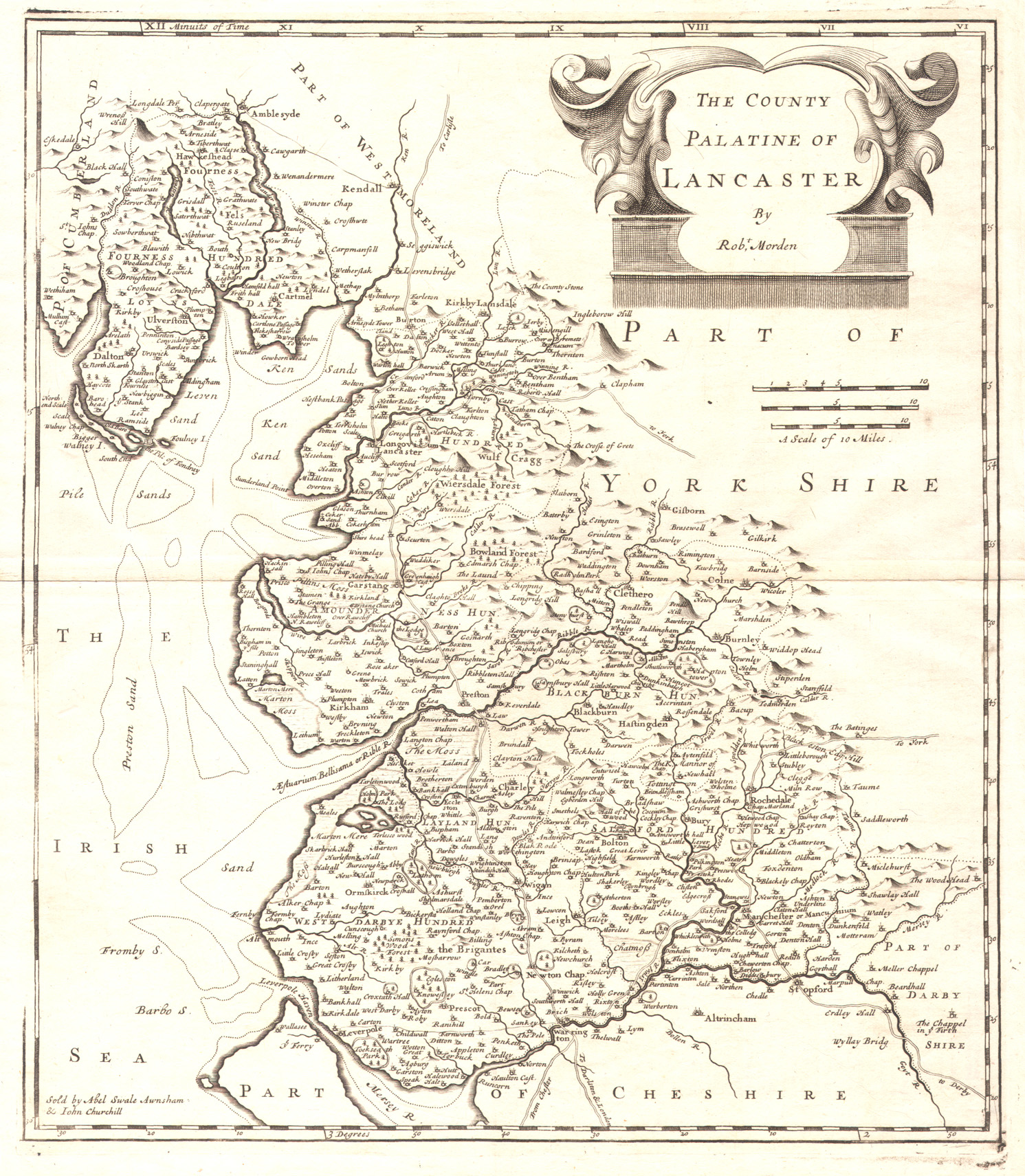
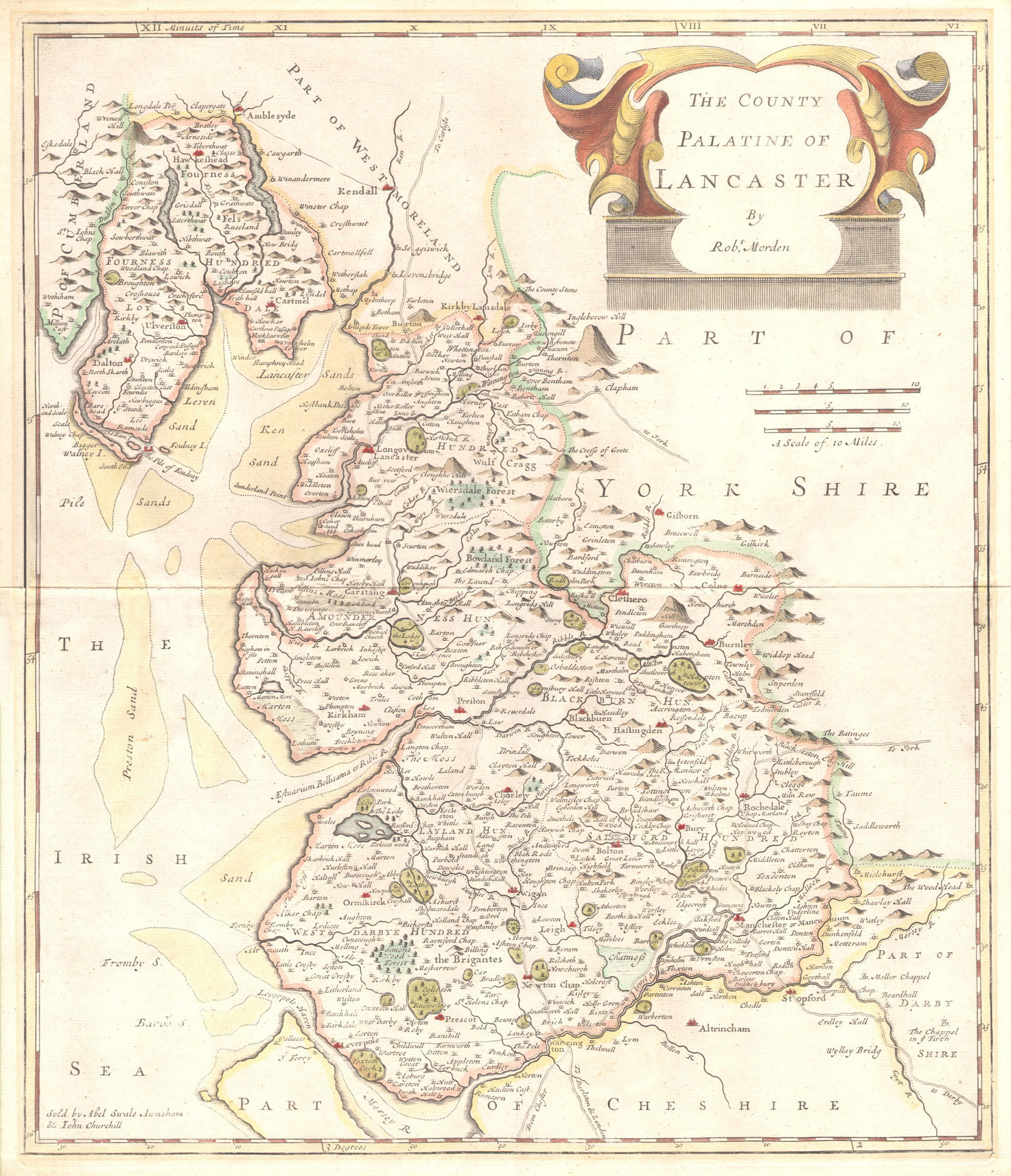
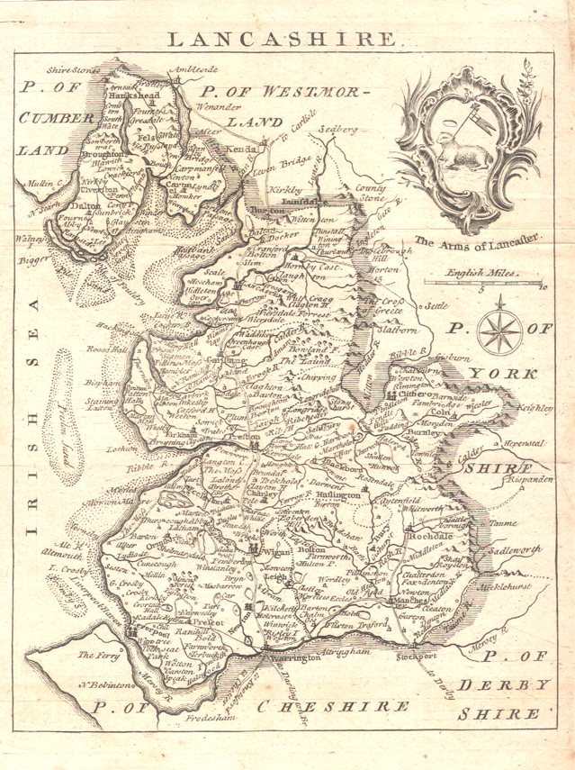
| 1695 | Robert Morden. ‘The County Palatine of Lancaster’ Morden’s large map from Camden’s Britannia (London, 1695) |
 |
CC BY-SA 4.0 |
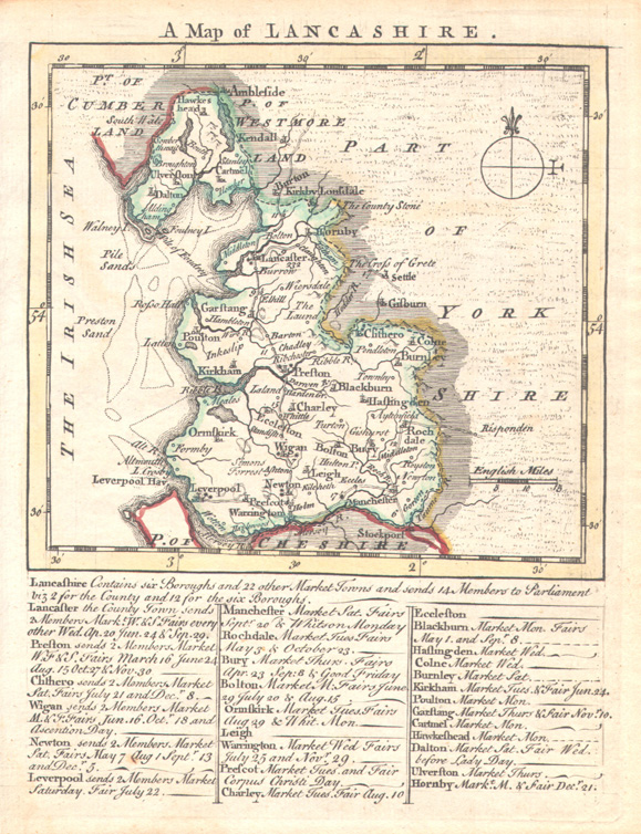
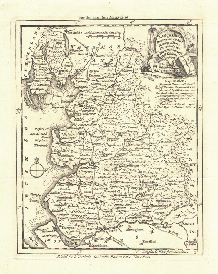
| 1750 | Thomas Kitchin. ‘Lancashire... Corrected from Astronl. Observatns...’ from The London Magazine (London, 1750) |
 |
CC BY-SA 4.0 |
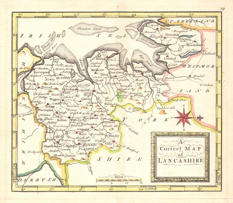
| 1764 | Thomas Kitchin. 'A New Map of Lancashire...' from England Illustrated (London, 1764) |
 |
CC BY-SA 4.0 |
| 1775 | M. Mackenzie Senior. Part of the West Coast of England from Formby Point to Walney I. |  |
CC BY-SA 4.0 |
| 1787 | John Seller. ‘Lancashire’ (c.1694) final state from Francis Grose’s Antiquities of England... (London, 1787) |
 |
CC BY-SA 4.0 |
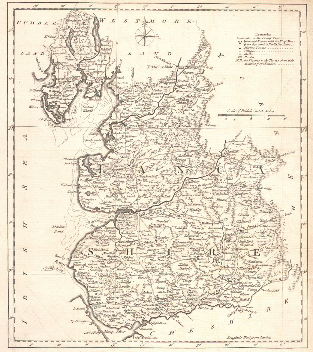
| 1789 | John Cary. ‘Lancashire...’ from Cary’s New and Correct English Atlas (London, 1789) misleadingly dated 1787 in the imprint |
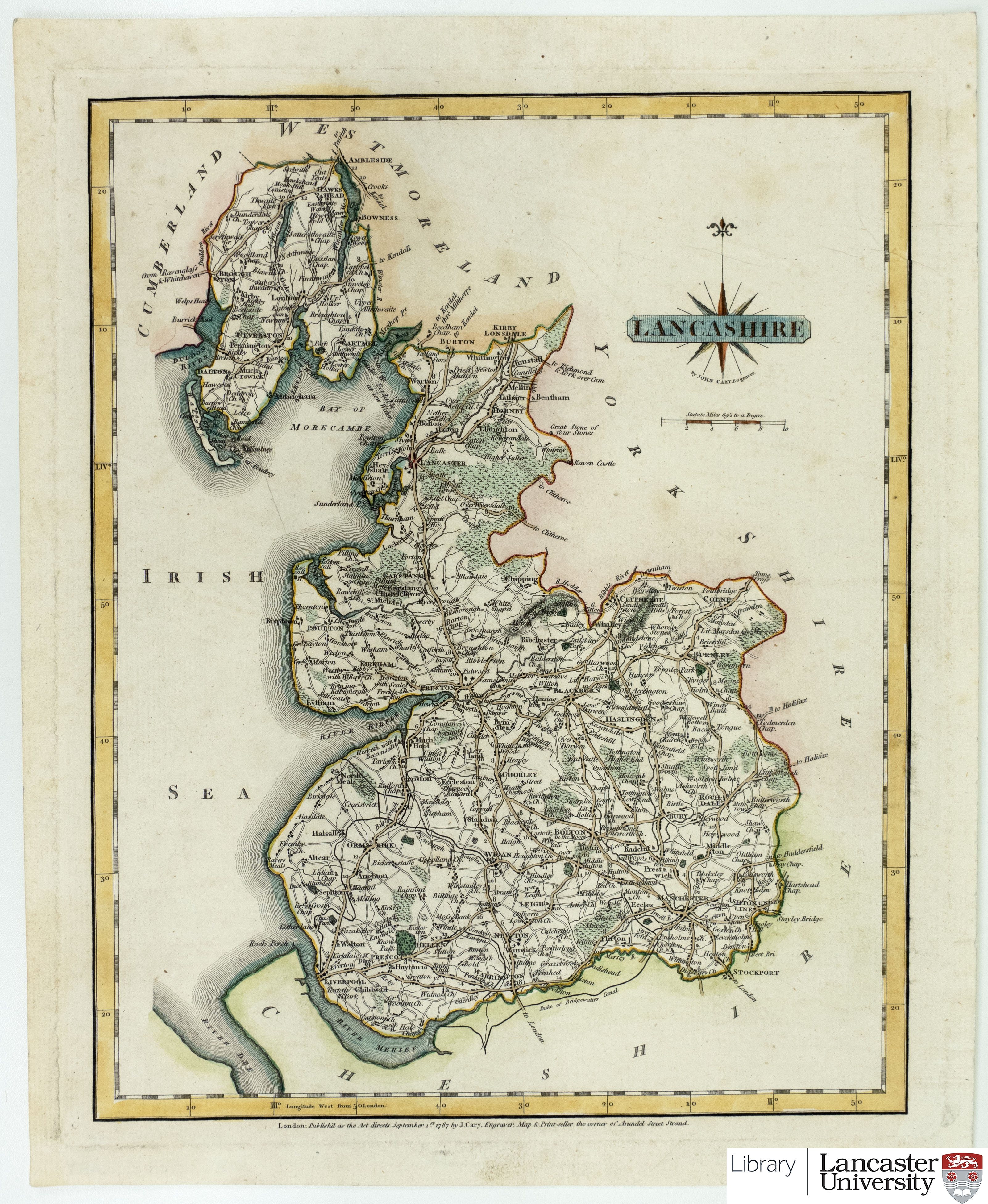 |
CC BY-SA 4.0 |
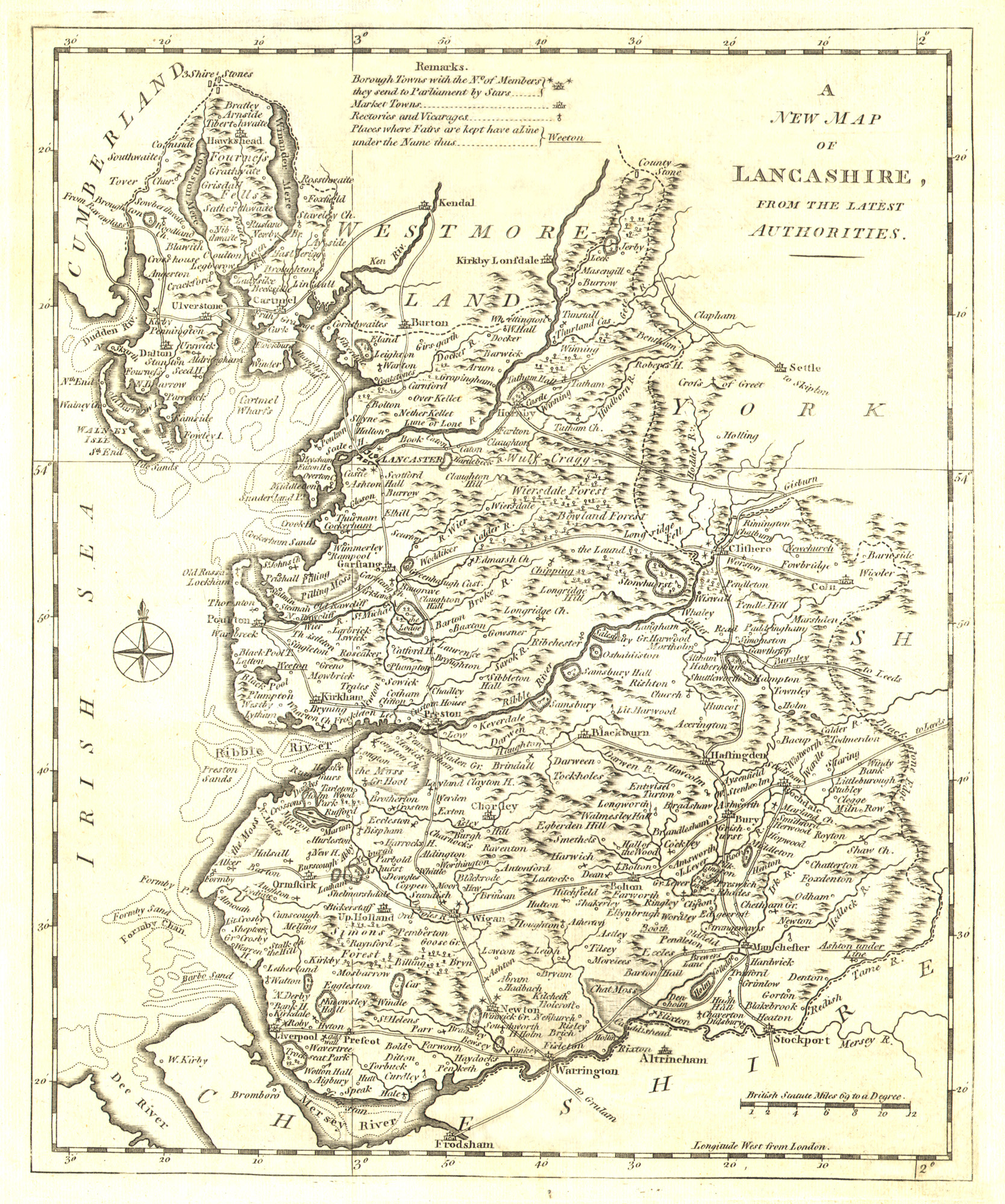
| 1816 | A New Map of the County of Lancashire Divided into Hundreds by Mr. Thomas Dixon. Published by William Darton. | 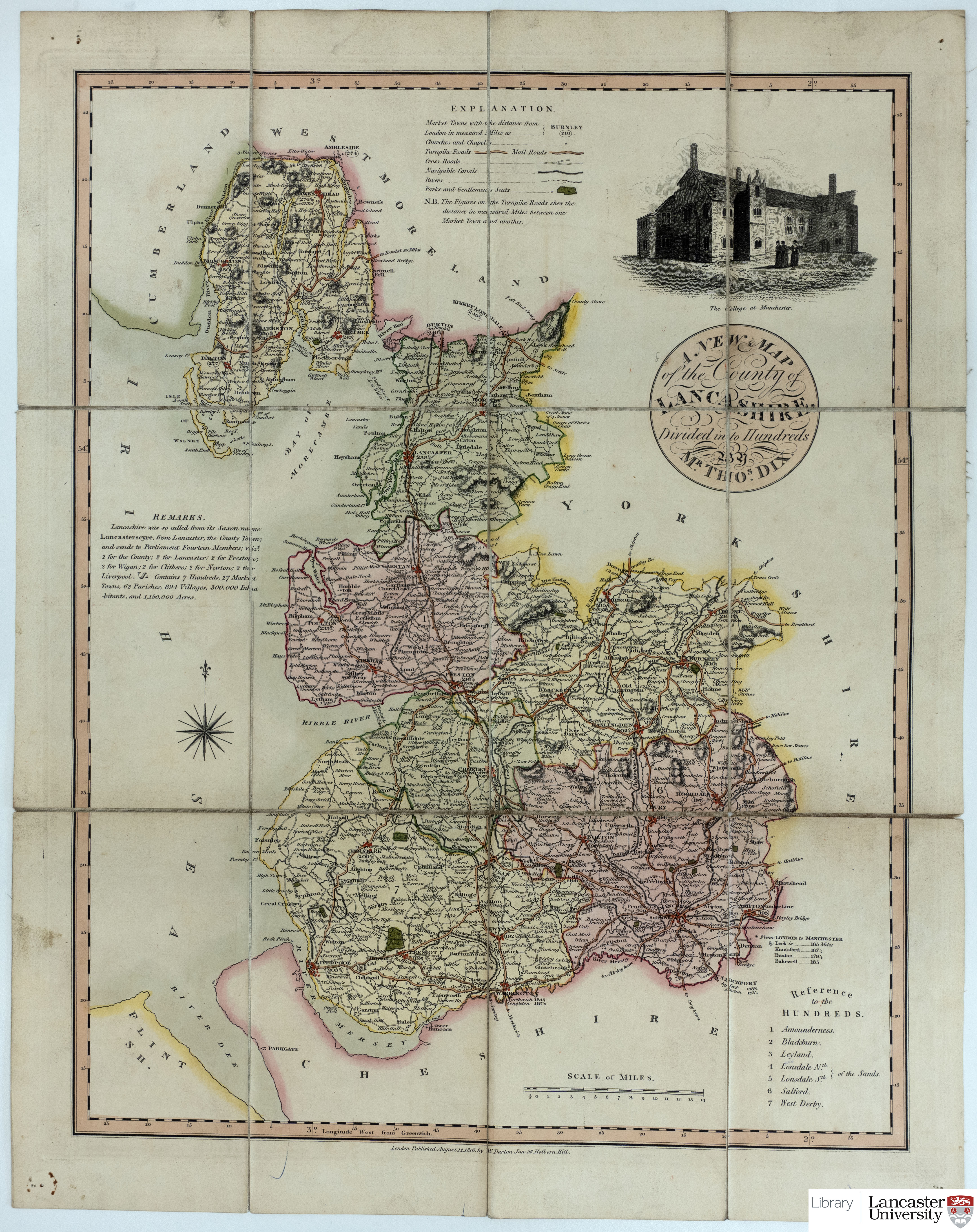 |
|
| 1818 |
Christopher Greenwood. Map of the County Palatine of Lancaster. |
|
|
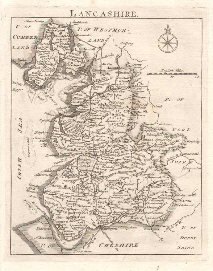
| 1824 |
Franks & Johnson. Map of the County Palatine of Lancaster with the Latest Improvements. For 'Baines' Lancashire'. |
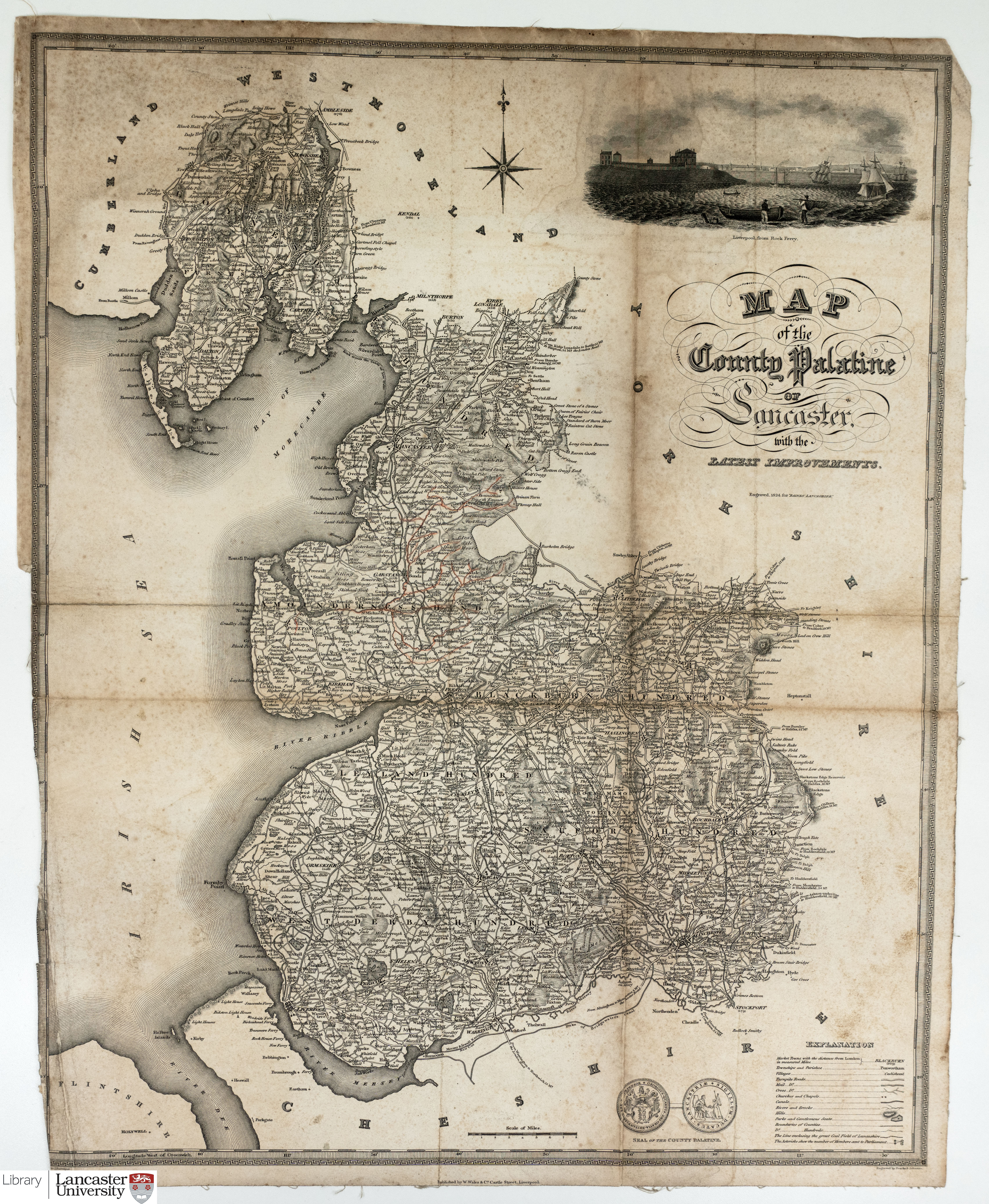 |
CC BY-SA 4.0 |
| 1830 | G. Hennet. Map of the County Palatine of Lancaster. From a survey made in 1828 & 1829 by G. Hennet. Published by Henry Teesdale. |  |
|
| 1845 | Joshua Archer. Lancashire. | 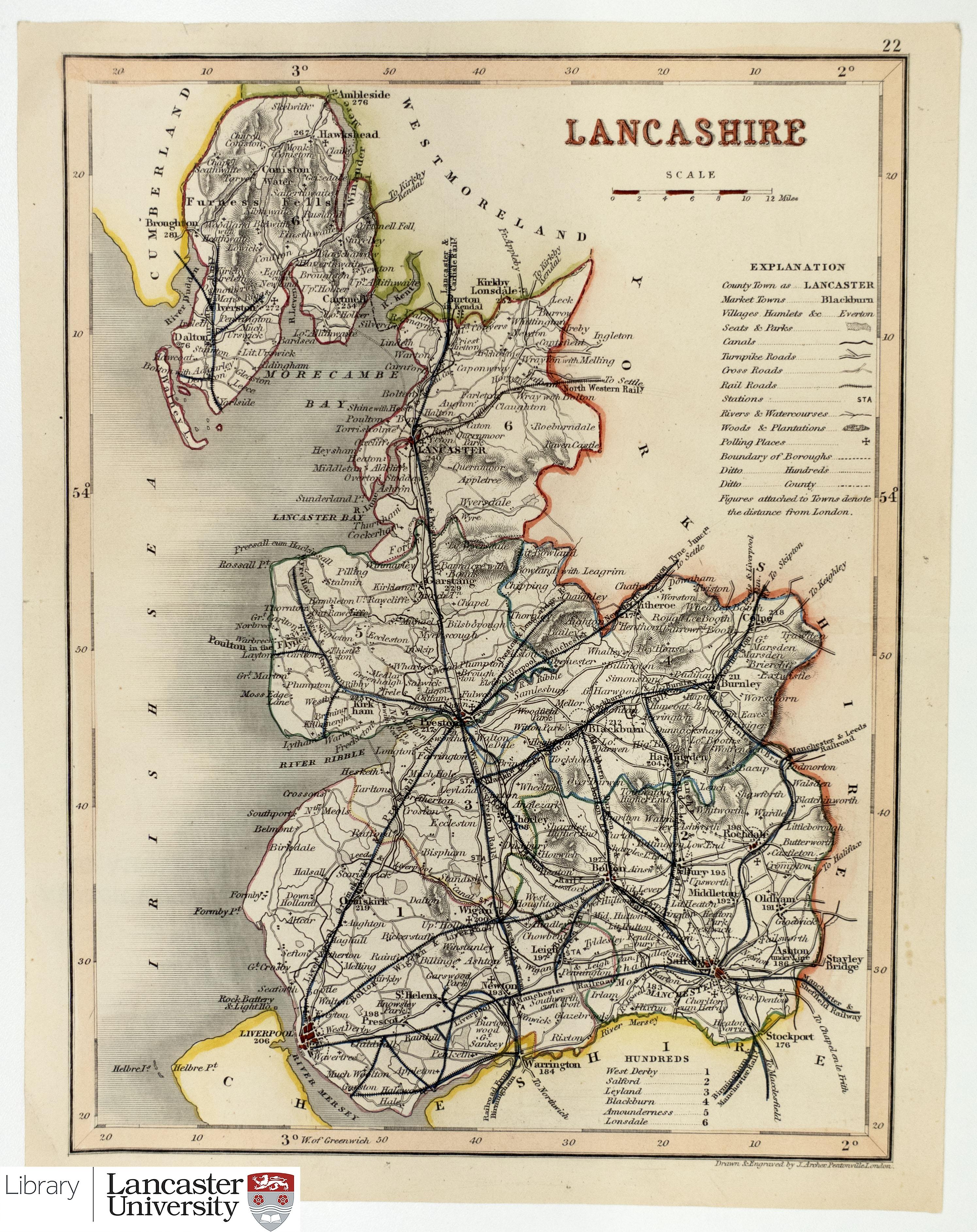 |
CC BY-SA 4.0 |
| c.1849 |
J. & C. Walker. Lancashire. Engraved and drawn for Lewis' Topographical Dictionary. |
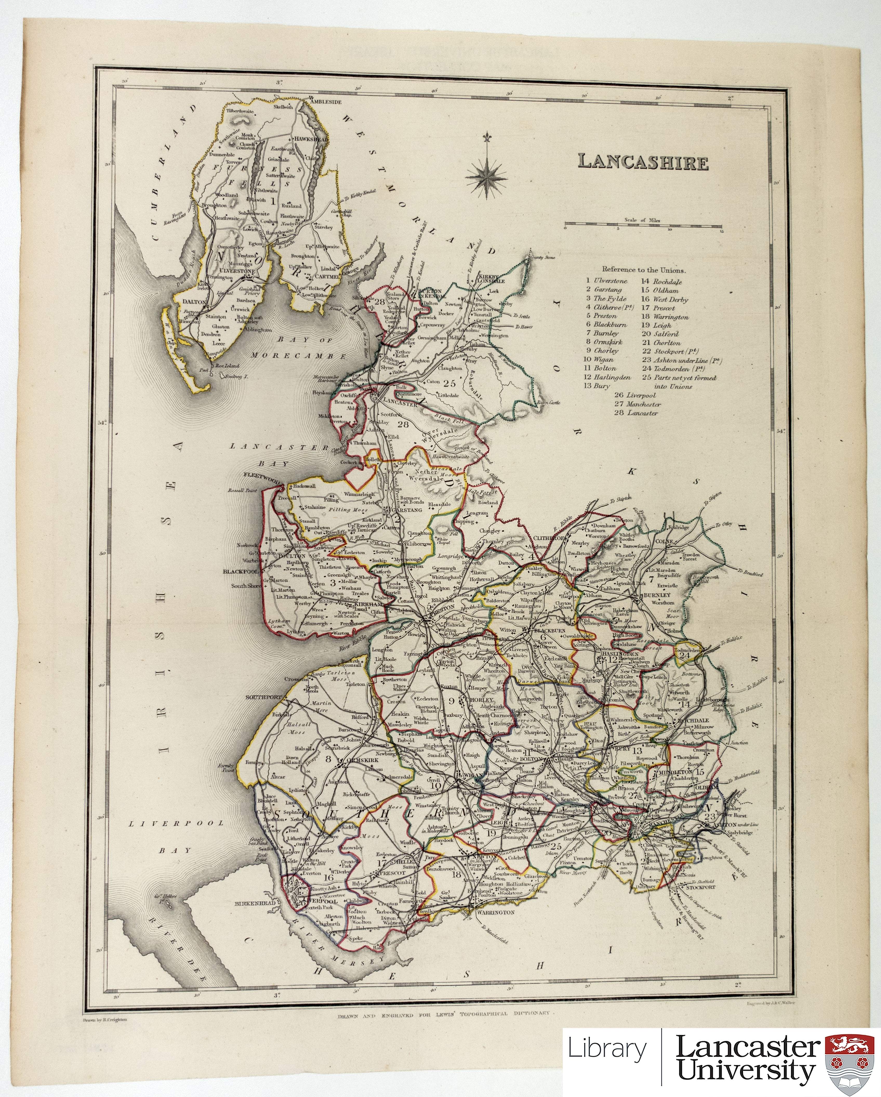 |
CC BY-SA 4.0 |
| c.1895 | Lancashire from the book Pocket County Companion: Lancashire compiled by Robert Dodwell. |  |
 The following images have been scanned from maps in the collection of Dr Ian Saunders (unless otherwise stated) and have been used as illustrations in Printed Maps of Lancashire: the first two hundred years (CNWRS, Lancaster, 2013). The map reference numbers in that book are included in the list below after the date, which is usually the year of the first issue, but in some cases is that for the particular edition illustrated. The jpeg images may be reduced to fit the screen and can usually be enlarged, depending on your browser.
Warning: File sizes for some maps may be large.
Please note that 'thumb-nail' illustrations displayed on this page are sometimes distorted, to be wider or narrower than the original map shape. When you click through to the full size image no such distortion will show.
You are welcome to use the images of these maps for personal, educational or research purposes. They must not be used for commercial purposes without the permission of Lancaster University Library and the copyright holder.
| Name | Image | Attribution |
| 1578 (Map 1A) Gerardus Mercator. ‘Europae I Tabula’ from Tabulae Geographicae Cl. Ptolomaei (Duisberg, 1578) |
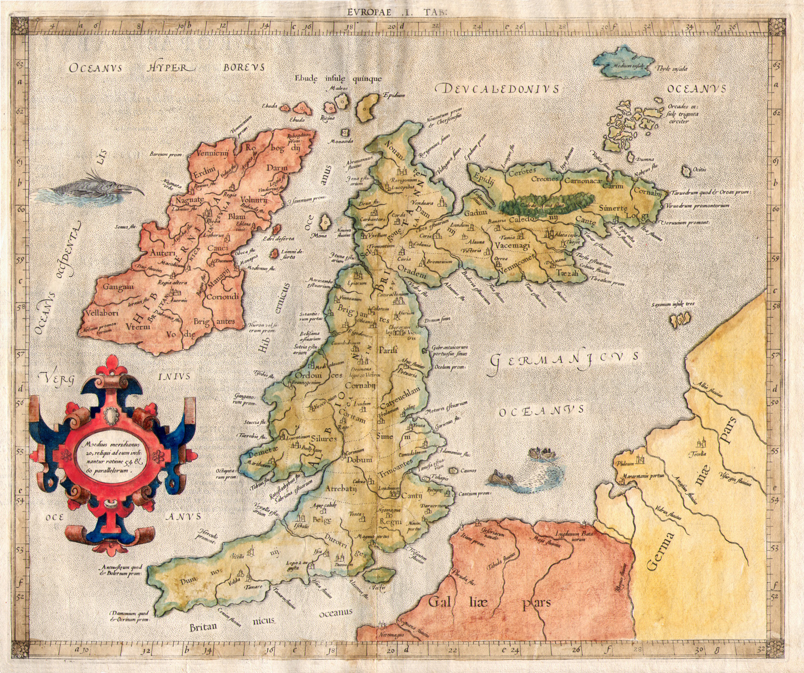 |
See Above |
| 1831 (Map 1B) J. and C. Walker. ‘Lancashire... according to the Doomsday Survey’ from Baines’s History of the County ... of Lancaster (London, 1836) |
 |
See Above |
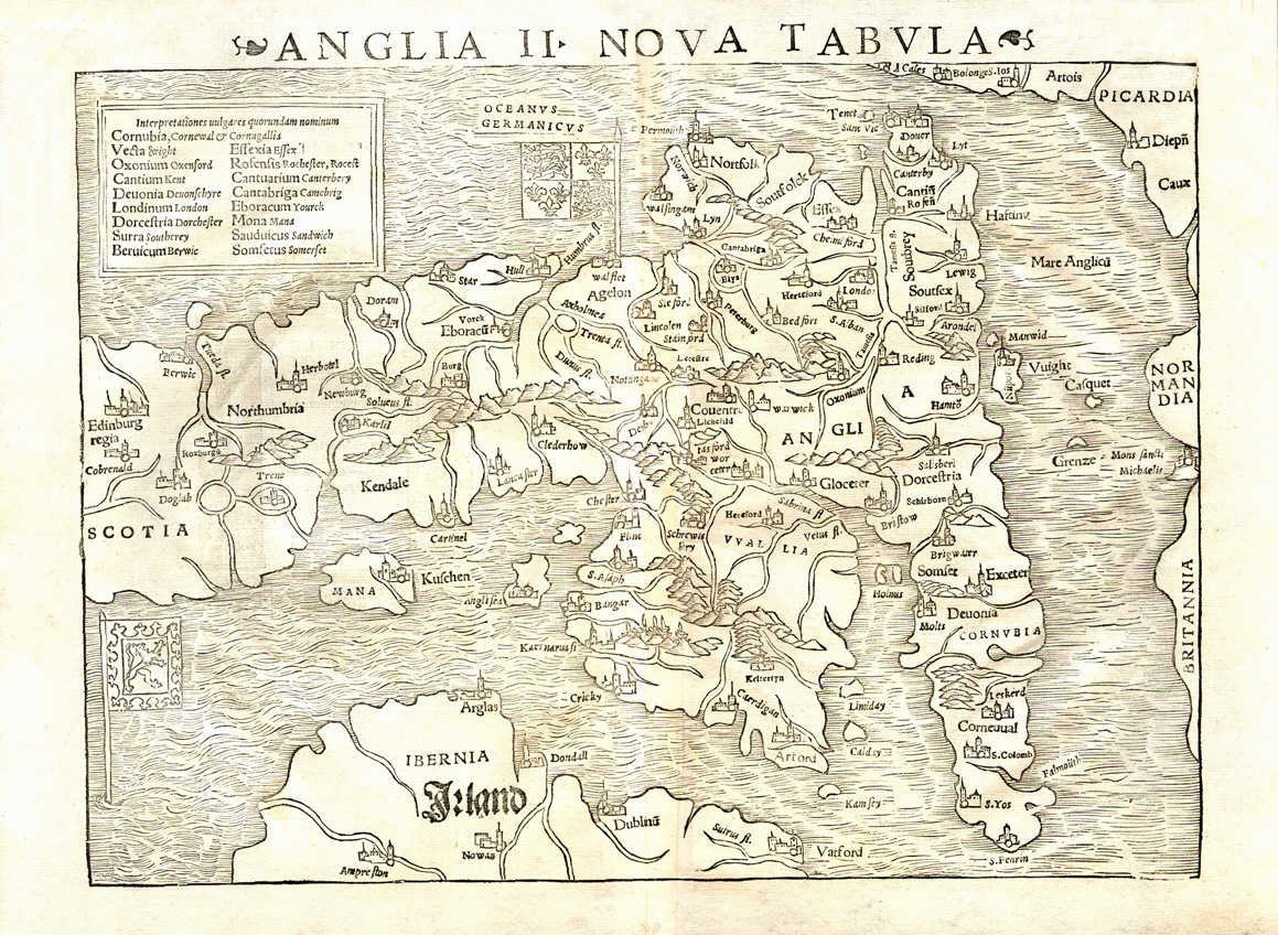
| 1540 (Map 1C) Sebastian Münster. ‘Anglia II Nova Tabula’ woodcut from Ptolemy’s Geographia (Basle, 1540). |
 |
See Above |
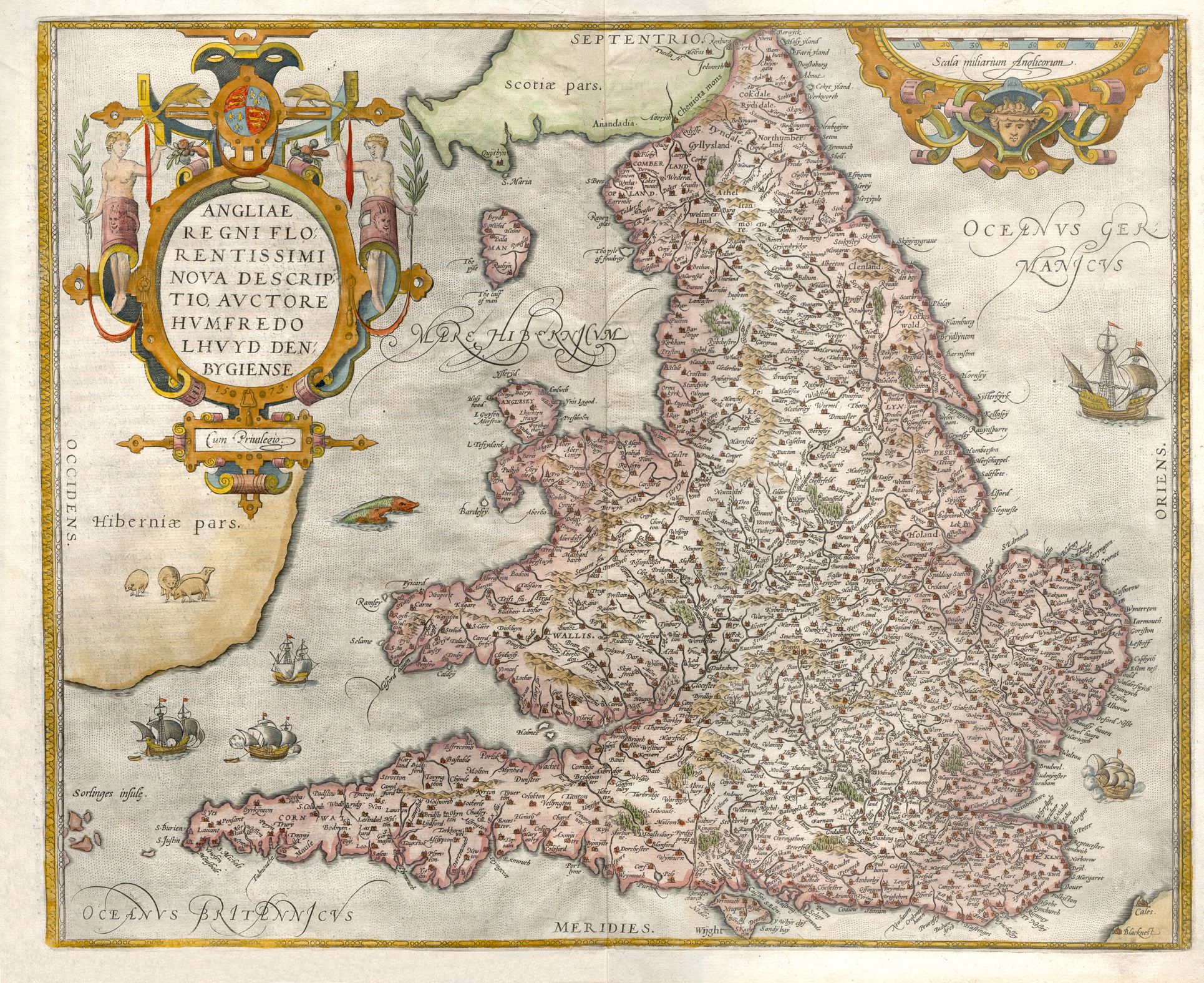
| 1573 (Map 2A) Humphrey Lhuyd. ‘Angliae Regni Florentissimi Nova Descriptio...’ from Ortelius’s Theatrum Orbis Terrarum (Antwerp, 1592) |
 |
See Above |
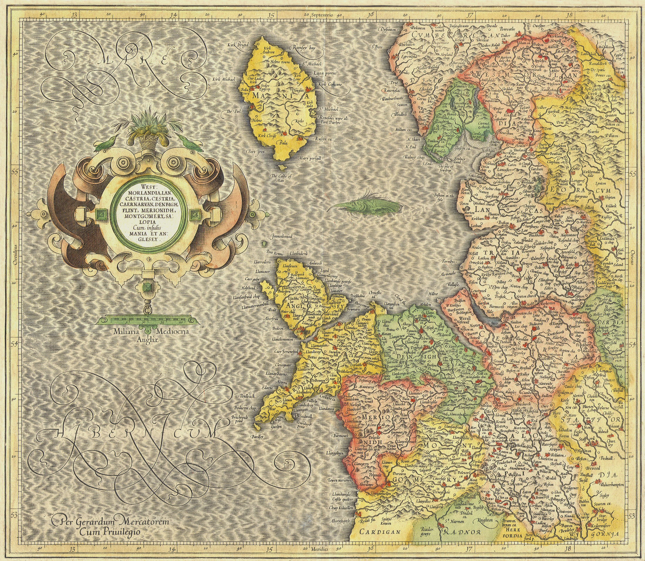
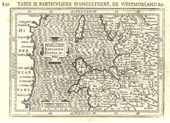
| 1595 (Map 2B) Gerardus Mercator. ‘Westmorlandia, Lancastria, Cestria...’ from Atlas sive Cosmographicae Meditationes... Part III (Dusseldorf, 1595) |
 |
See Above |
| 1607 (Map 2C) Jodocus Hondius. ‘Westmorland, Castria, Cestria...’ from Atlas Minor... (Arnhem, 1609) |
 |
See Above |
| 1637 (Map 2C) Jodocus Hondius. ‘Westmorland, Castria, Cestria...’ (1607) late issue with heavy plate wear from Historia Mundi, or Mercator’s Atlas... (London, 1637) |
 |
See Above |
| 1616 (Map 2D) Petrus Bertius. ‘Westmorland: Lancastria Cestria etc.’ from reduced Mercator Atlas (Amsterdam, 1618) |
 |
See Above |
| 1628 (Map 2E) Jan Jansson. ‘Lancastria, Cestria...’ from Atlas Minor... (Amsterdam, 1630) |
 |
See Above |
| 1630 (Map 2F) Johan Cloppenburg. ‘Westmorlandia, Lancastria, Cestria...’ from his reduced Mercator Atlas (Amsterdam, 1630) |
 |
See Above |
| 1577 (Map 2G) Christopher Saxton. ‘Lancastriae Comitatus Palatin...’ from the first county atlas (London, 1577) |
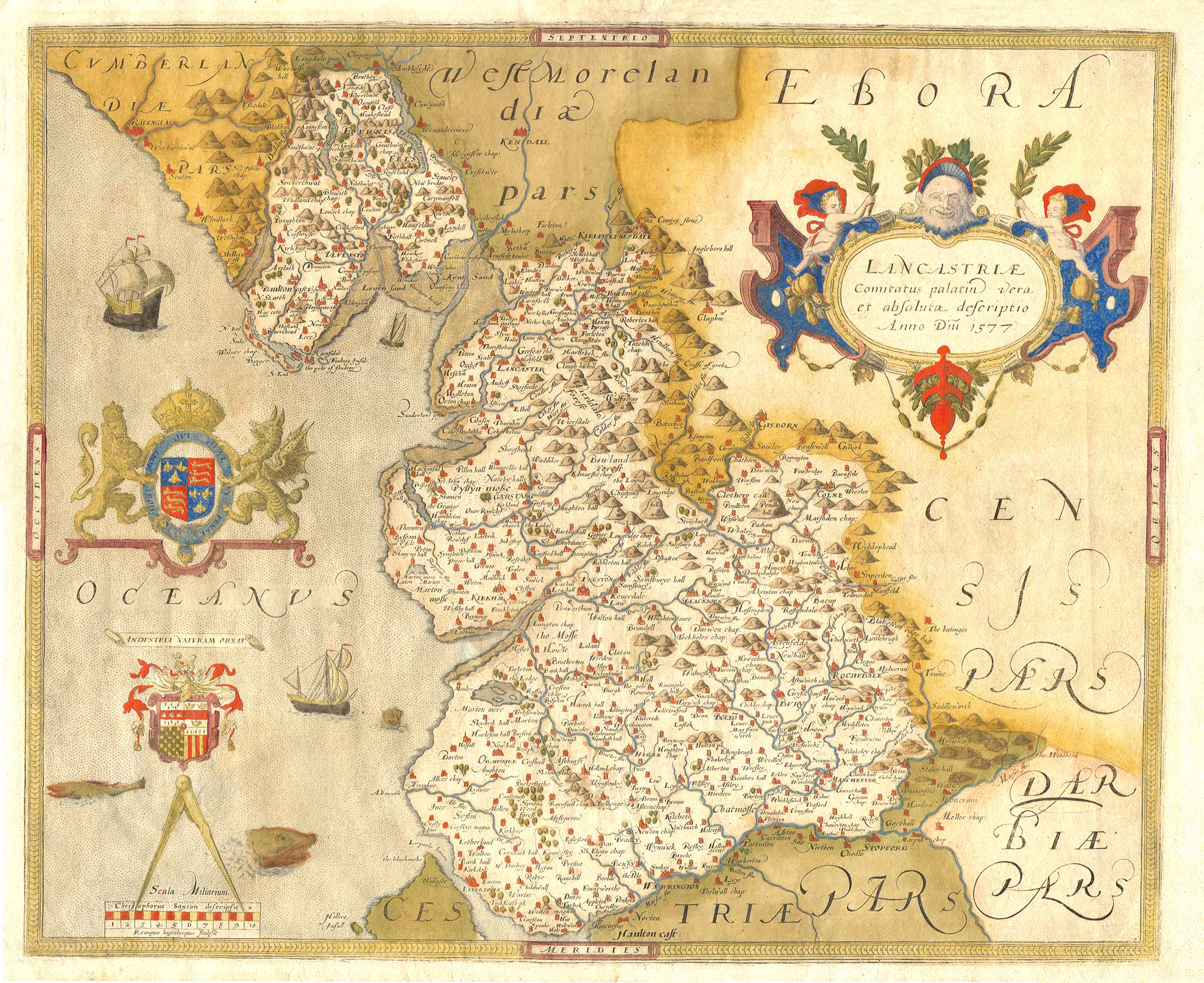 |
See Above |
| 1693 (Map 2H) Christopher Saxton. ‘The County Palatine of Lancaster...’ 1577 as amended by Philip Lea for his county atlas (London, 1693) |
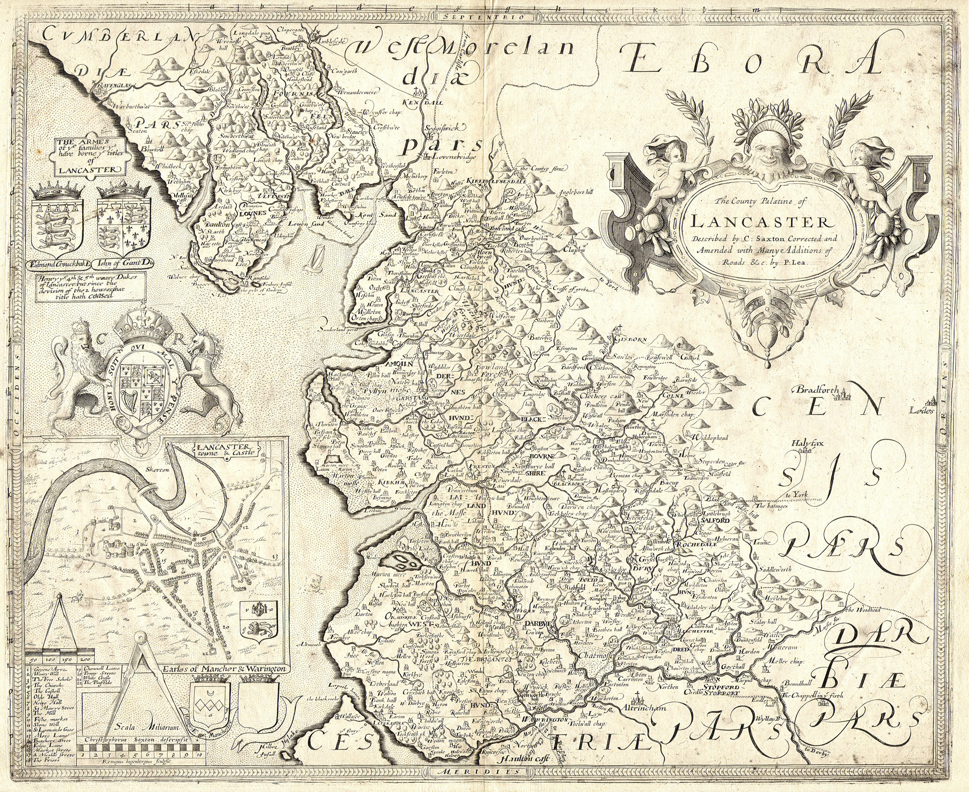 |
See Above |
| c.1770 (Map 2H) The final state of the 1577 Saxton map (Dicey, London, c.1770) with colour coding to indicate successive changes: GREEN: in 1642 by William Web (title, Royal Arms). RED: in 1665 by an unknown owner (town plan, Arms, names, Hundreds ...). BLUE: from c.1683 to 1693 by Philip Lea (roads, borough signs, title ...). MAGENTA: in 1720 by Willdey (imprint in box); in 1749 by Jefferys (imprint removed). |
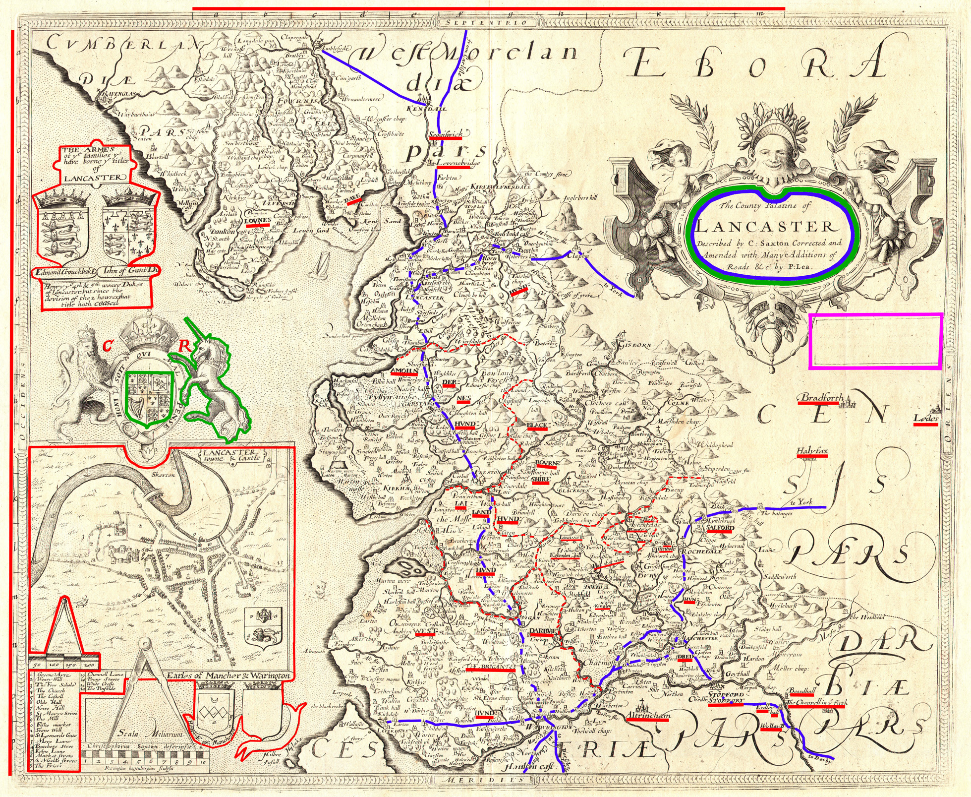 |
See Above |
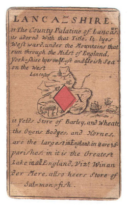
| 1590 (Map 2J) William Bowes. ‘Lancashire’ from a pack of playing cards (London, 1590) Reproduced courtesy of Mr Philip Burden |
 |
See Above |
| c.1660 (Map 2K) William Smith. ‘Lancastriae Comitatus Palatinus...’ (1602) loose sheet issue by Peter Stent (London, c.1660) |
 |
See Above |
| 1821 (Map 2L) Matthew Gregson. ‘Lancashire, 1598 WSR’ inaccurately copied from the 1598 manuscript (B.M. Harl. MS. 6159) from Gregson’s ‘Portfolio of Fragments...’ (Liverpool, 2nd Ed., 1824) |
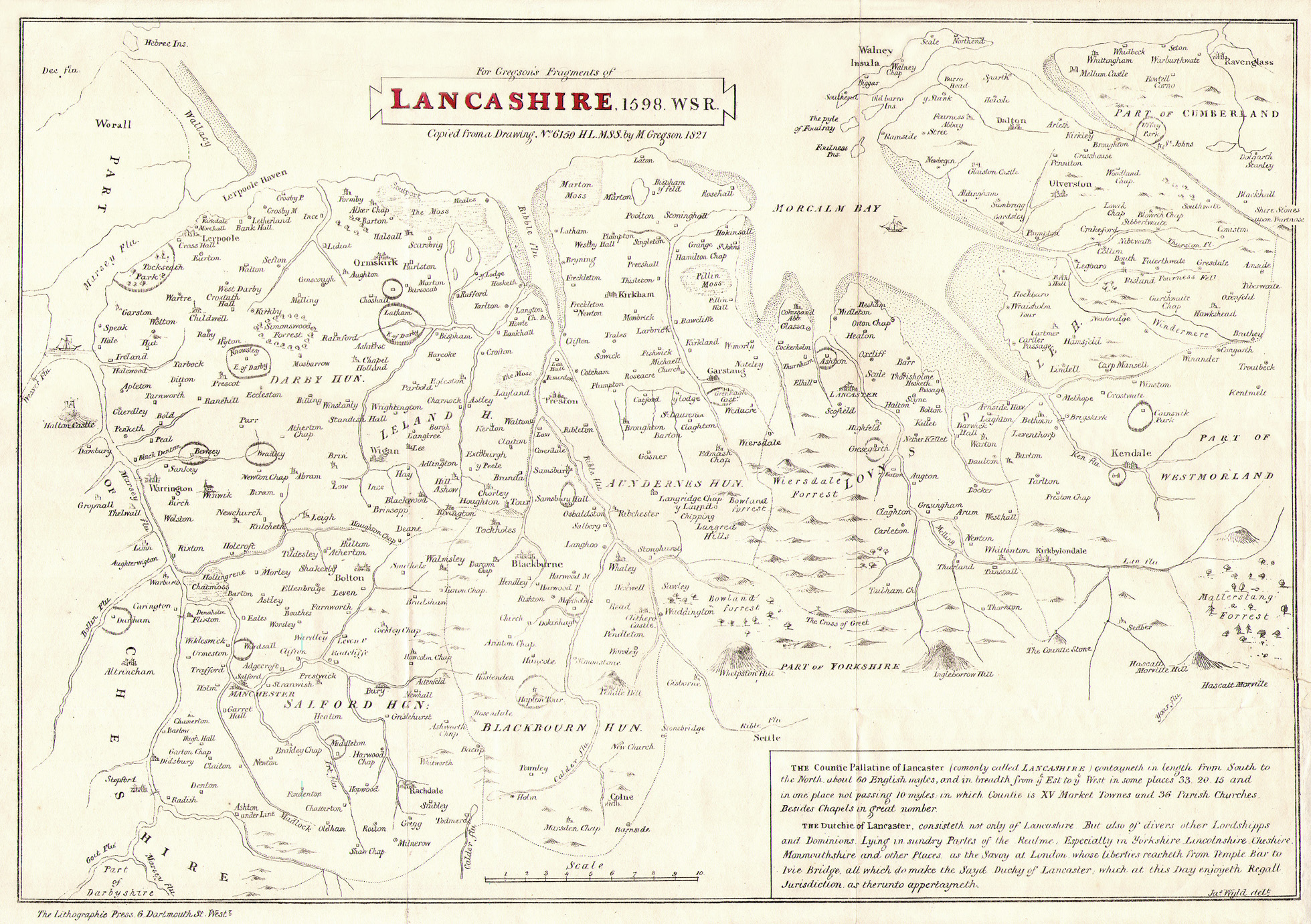 |
See Above |
| Name | Image | Attribution |
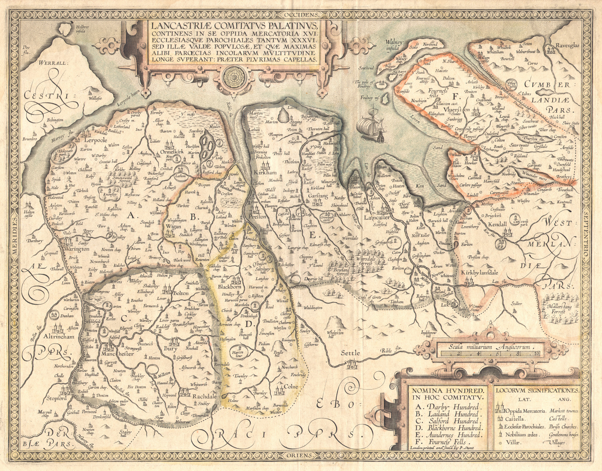
| 1607 (Map 3A) William Hole. ‘Lancastriae Comitatus Palatinus...’ from William Camden’s Britannia (London, 1610) |
 |
See Above |
| 1622 (Map 3B) William Hole. ‘Lancashyre’ from M. Drayton’s Poly-Olbion, Part 2 (London, 1622) |
 |
See Above |
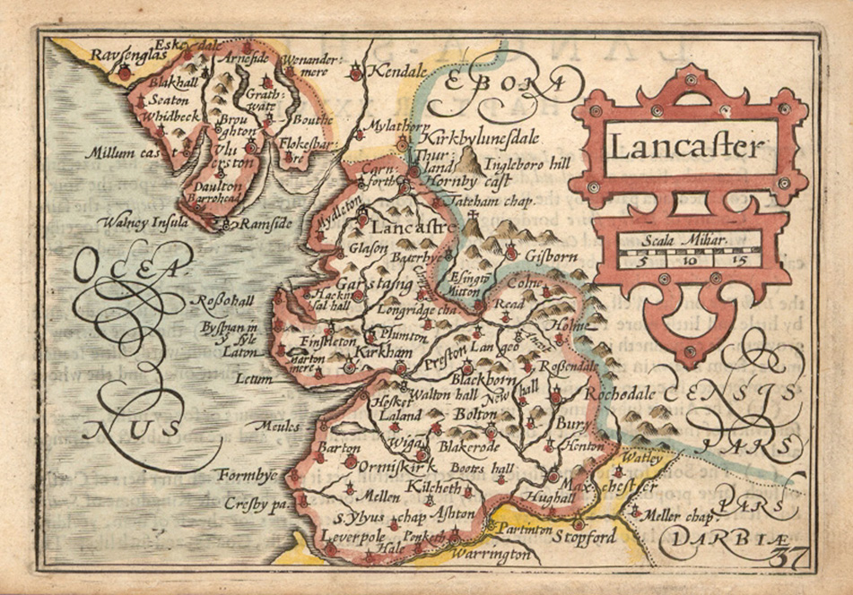
| 1610 (Map 3C) John Speed and Jodocus Hondius. ‘The Countie Palatine of Lancaster...’ from Speed’s Theatre of the Empire of Great Britaine (London, 1632) |
 |
See Above |
| c.1720 (Map 3C) John Speed and Jodocus Hondius. ‘The Countie Palatine of Lancaster...’ (1610) revised by Henry Overton for his England Fully Described... (London, c.1720) Reproduced courtesy of Mr Chris Abram |
 |
See Above |
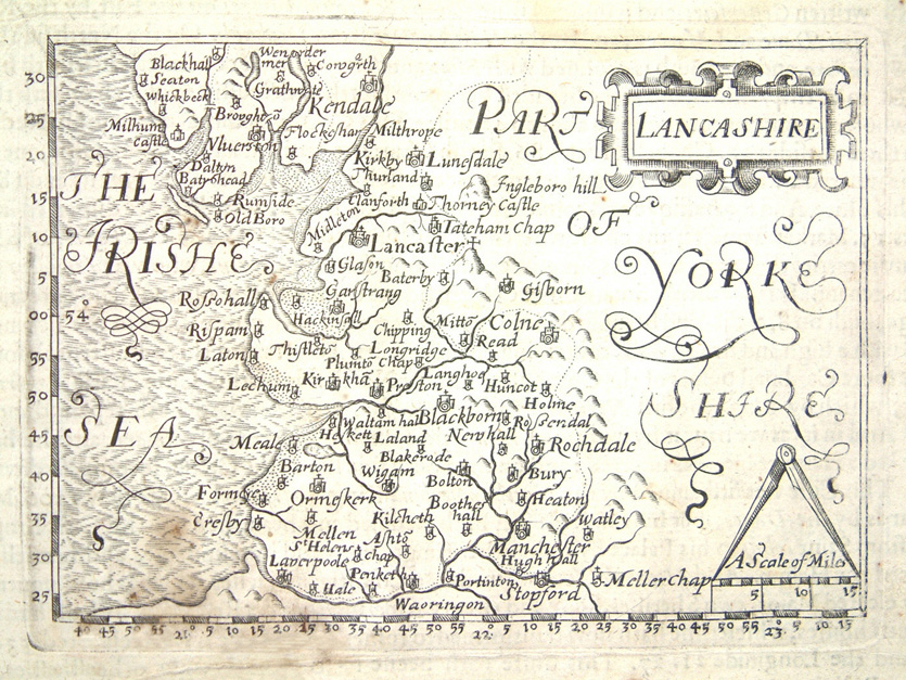
| c.1600 (Map 3D) Pieter van den Keere. ‘Lancastria’ from a reduced Camden’s Britannia (Blaeu, Amsterdam, 1617) |
 |
See Above |
| c.1627 (Map 3D) Pieter van den Keere. ‘Lancastria’ (c.1600) with title in English as ‘Lancaster’ for ‘the Miniature Speed’ from the abridgement of Speed’s Theatre... (Humble, London, 1627) |
 |
See Above |
| 1626 (Map 3E) John Bill. ‘Lancashire’ from Bill’s abridgement of Camden’s Britannia (London,1626) Reproduced courtesy of Mr Philip Burden |
 |
See Above |
|
1635 (Map 3F) |
 |
See Above |
| 1643 (Map 3G) Thomas Jenner. The larger map replacing 3F from Jenner's Book of Names... (London,1657) |
 |
See Above |
| 1645 (Map 3H) Johan Blaeu. ‘Lancastria Palatinatus...’ from Blaeu’s Atlas, vol.5 (Amsterdam, c.1648) |
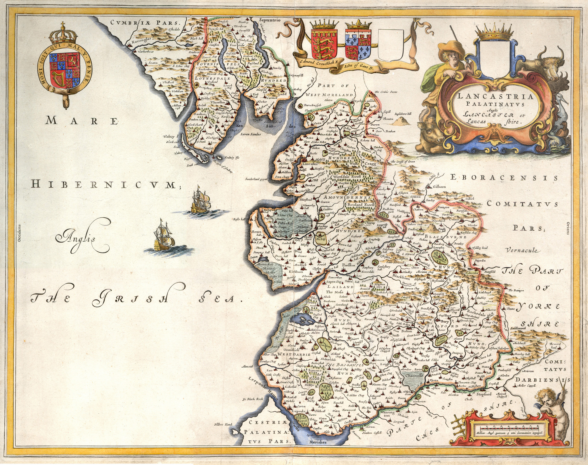 |
See Above |
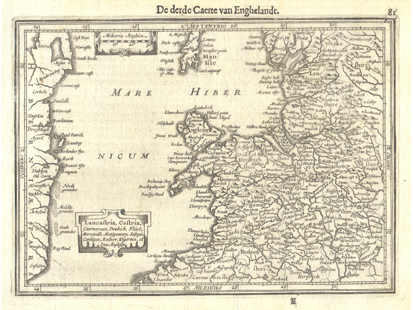
| 1636 (Map 3J) Jan Jansson. 'Comitatus Lancastrensis...' first state of this Lancashire map from his appendix to Mercator-Hondius Atlas (Amsterdam, 1636) |
 |
See Above |
| 1646 (Map 3K) Jan Jansson. ‘Lancastria Palatinatus...’ second state of this Lancashire map (1636) from his Novus Atlas, sive Theatrum Orbis Terrarum (Amsterdam, 1652) |
 |
See Above |
| 1673 (Map 3L) Richard Blome. The large map of Lancashire by Blome. from Blome's Britannia... (London, 1673) |
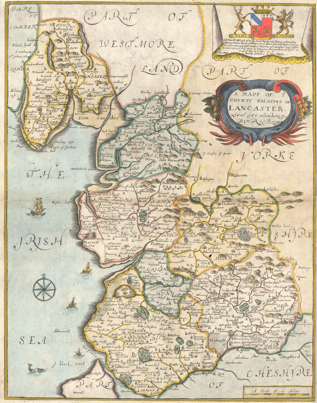 |
See Above |
| 1681 (Map 3M) Richard Blome. The small map of Lancashire by Blome first state from Speed’s Maps Epitomised (London, 1681) |
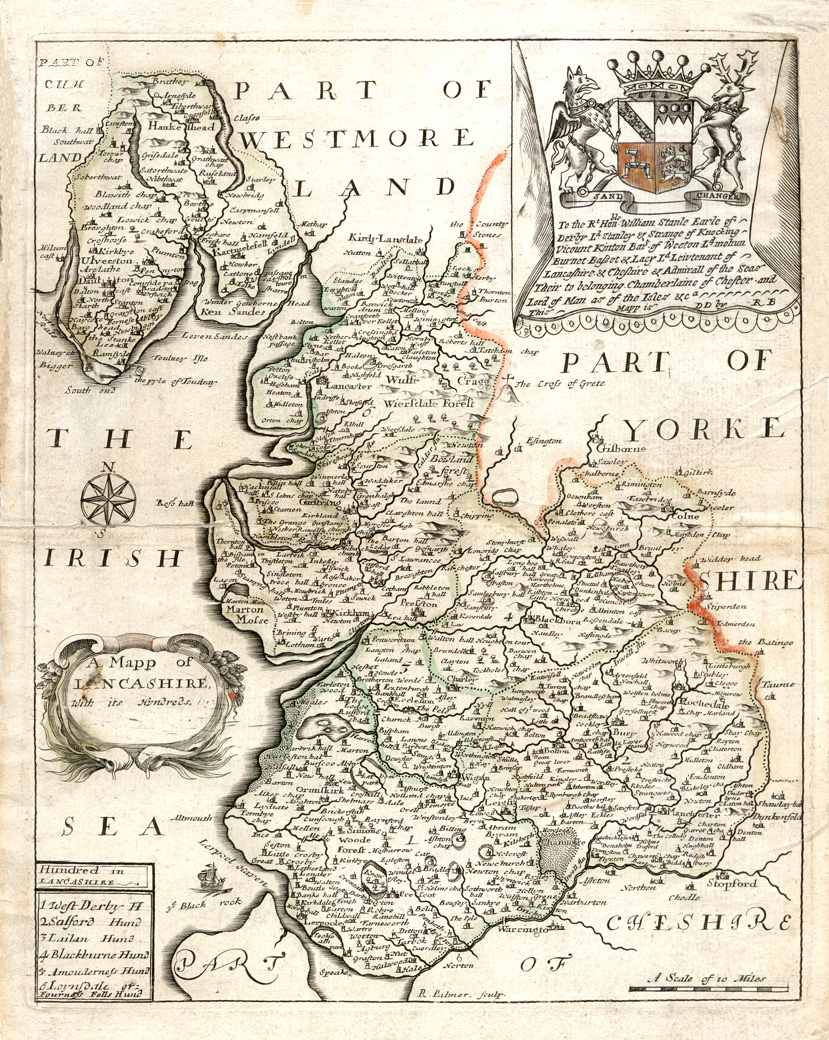 |
See Above |
| 1717 (Map 3M) Richard Blome. The small map of Lancashire by Blome (1681) final state from Thomas Taylor’s England Exactly Described... (London, 1717) |
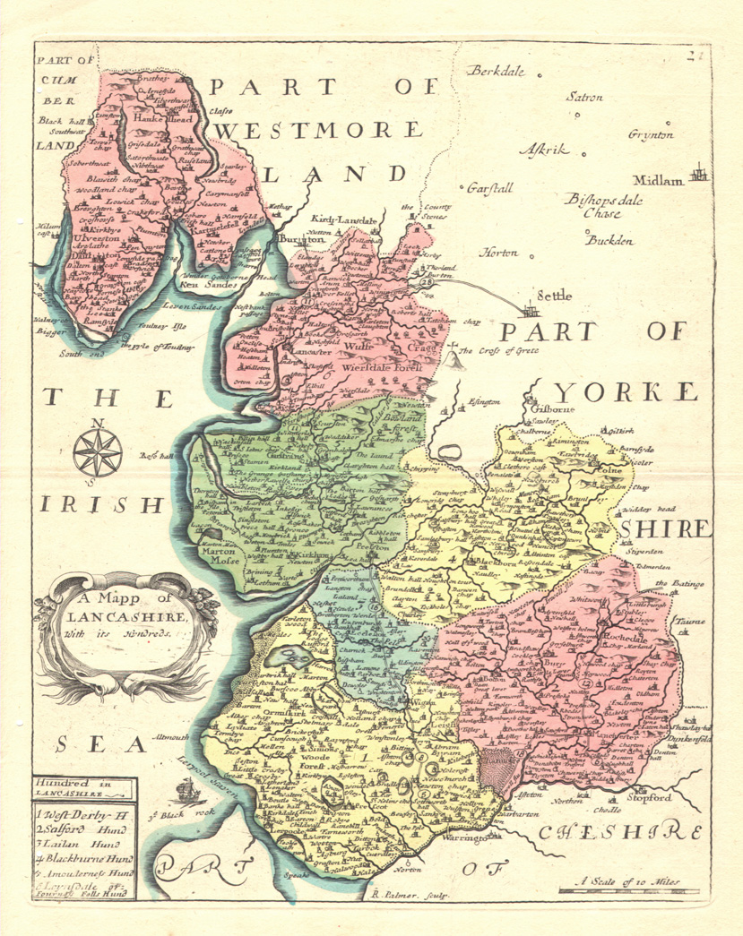 |
See Above |
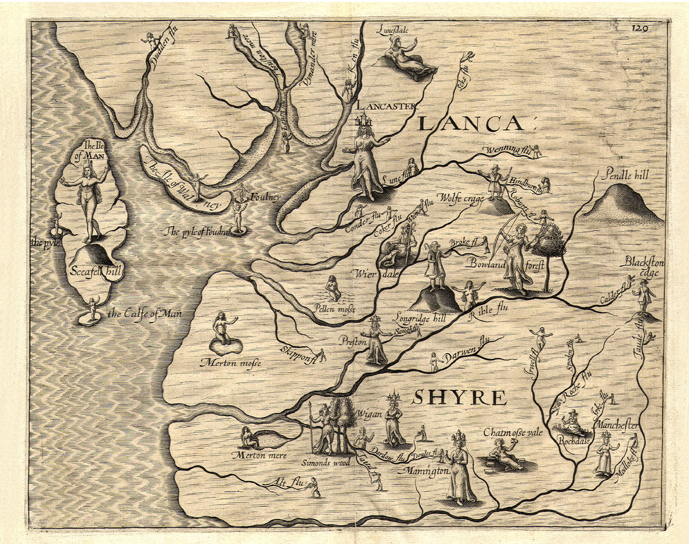
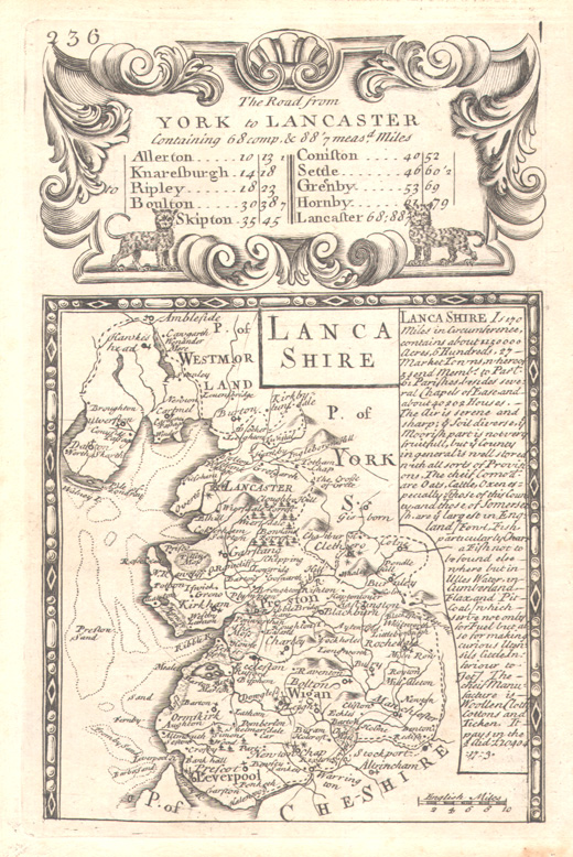
| 1675 (Map 3N) John Ogilby. 'The Road from London to Carlisle' plate 37 in Ogilby's Britannia, Volume the first (London, 1698 reprint) with the left hand section of plate 38 in the same volume. |
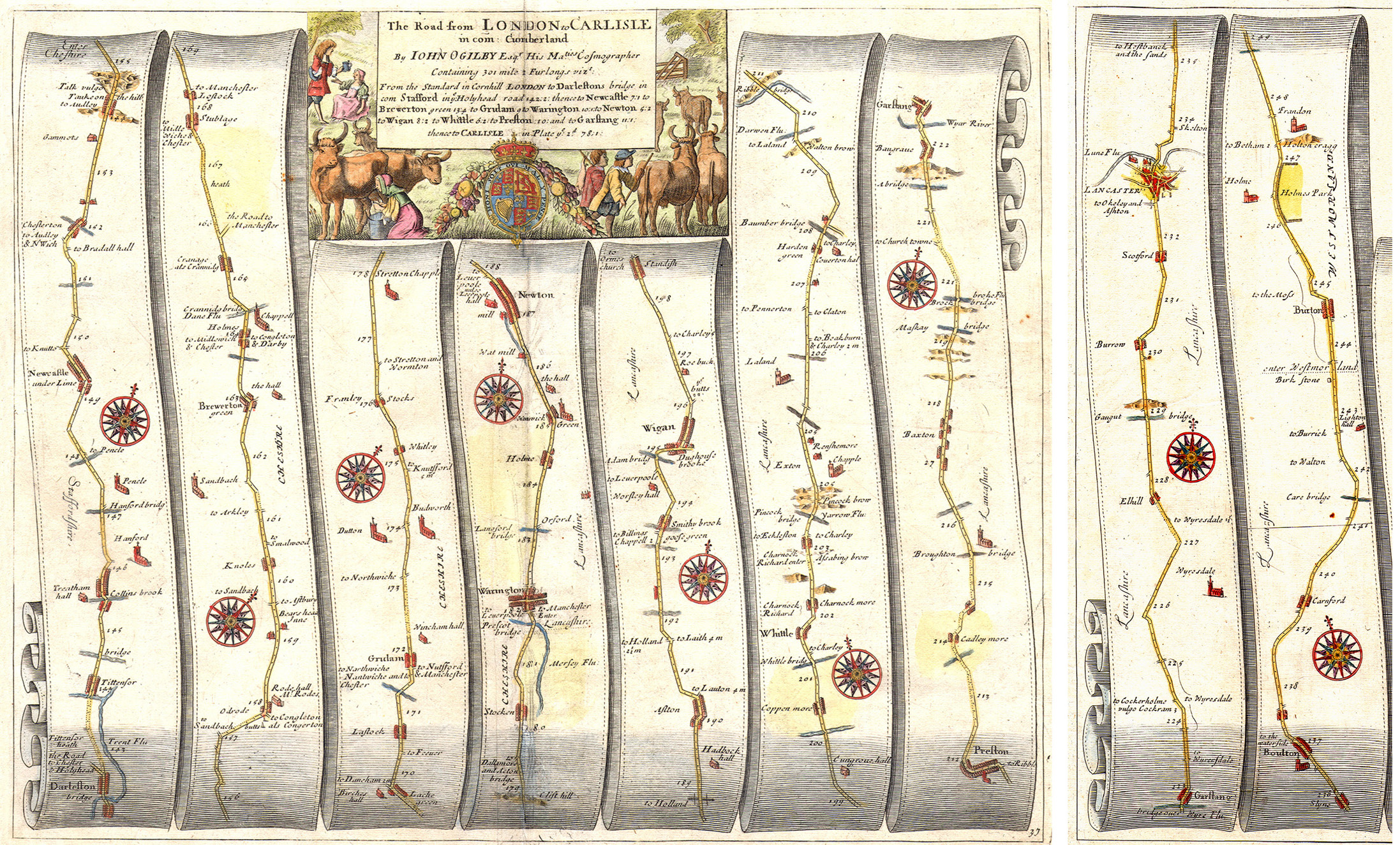 |
See Above |
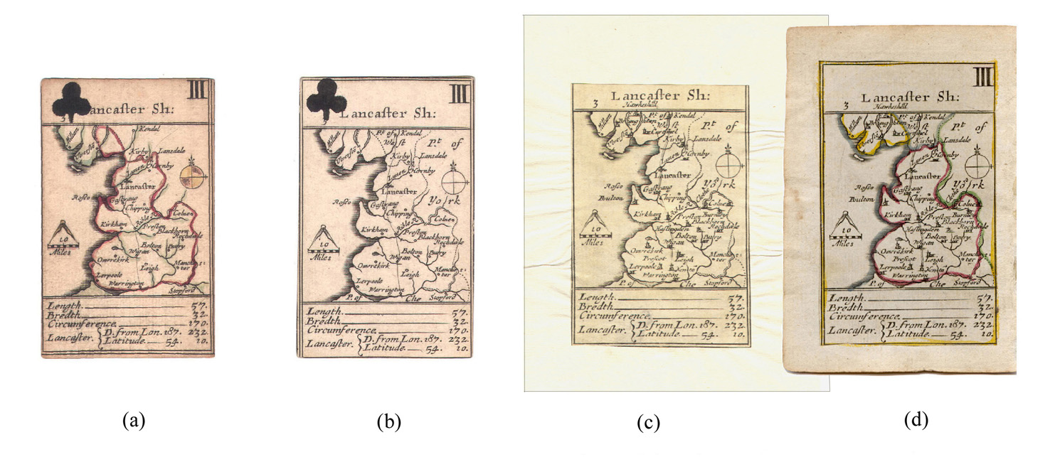
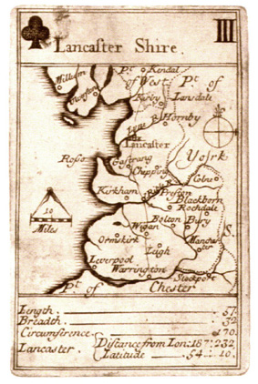
| 1676 (Map 3P) Robert Morden. ‘Lancaster Sh[ire]:’ with stencilled suit mark (a) state 1, (b) state 2 from Morden’s packs of playing cards (London, 1676) Reproduced courtesy of Mr Philip Burden (c) state 3, trimmed and mounted on a thin page by Morden and Pask (London, 1680) (d) state 3, mounted on a thick page by Homan Turpin (London, 1764 or later) |
 |
See Above |
| 1676 (Map 3Q) William Redmayne. ‘Lanca= Shire’ from Redmayme’s pack of playing cards (London, 1676) Reproduced courtesy of Mr Philip Burden |
 |
See Above |
| 1717 (Map 3R) John Lenthall. ‘Lancaster Shire’ copied from Robert Morden (second state) from Lenthall’s pack of playing cards (London, first state, 1717) Reproduced courtesy of Mr Brian Kentish |
 |
See Above |
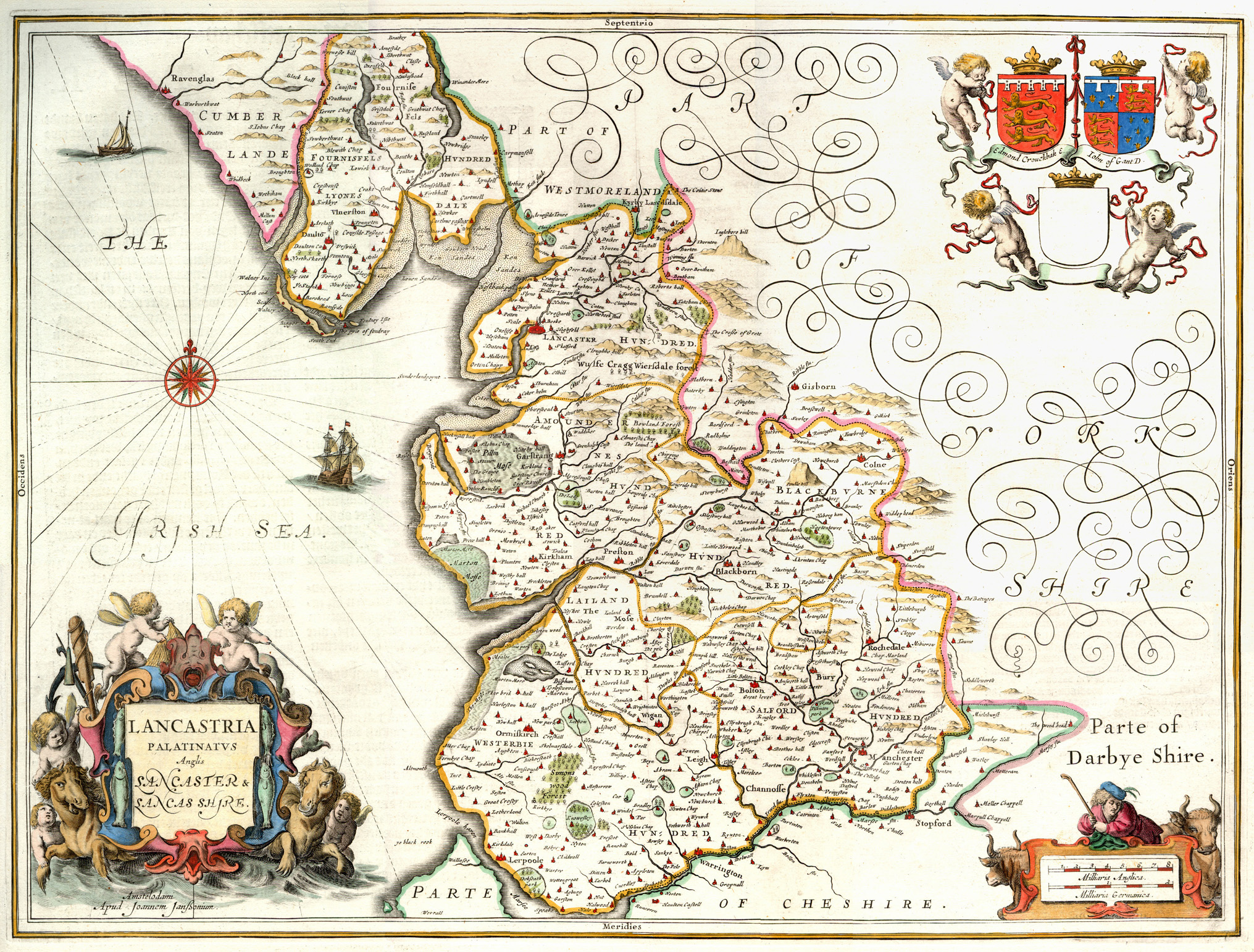
| 1695 (Map 4A) Robert Morden. ‘The County Palatine of Lancaster’ first state of Morden’s large map from Camden’s Britannia (London, 1695) |
 |
See Above |
| 1753 (Map 4A) Robert Morden. ‘The County Palatine of Lancaster’ (1695) final state of Morden’s large map from Camden’s Britannia (London, 1753) |
 |
See Above |
| 1701 (Map 4B) Robert Morden. ‘The County Palatine of Lancaster’ first state of Morden’s small map from The New Description and State of England (London, 1701) |
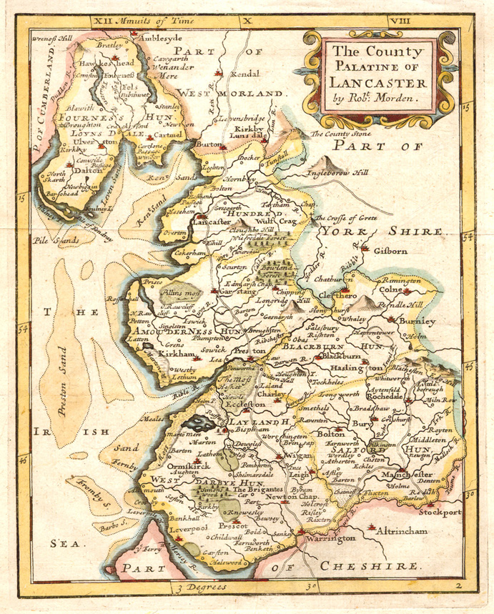 |
See Above |
| 1719 (Map 4B) Robert Morden. ‘The County Palatine of Lancaster’ (1701) final state of Morden’s small map, revised by Herman Moll, from Magna Britannia et Hibernia... (London, 1720) |
 |
See Above |
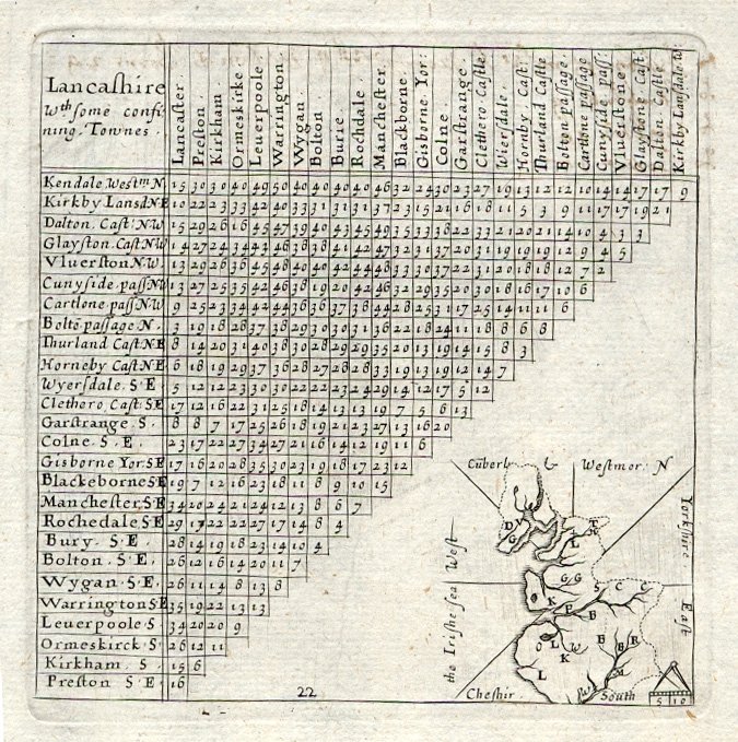
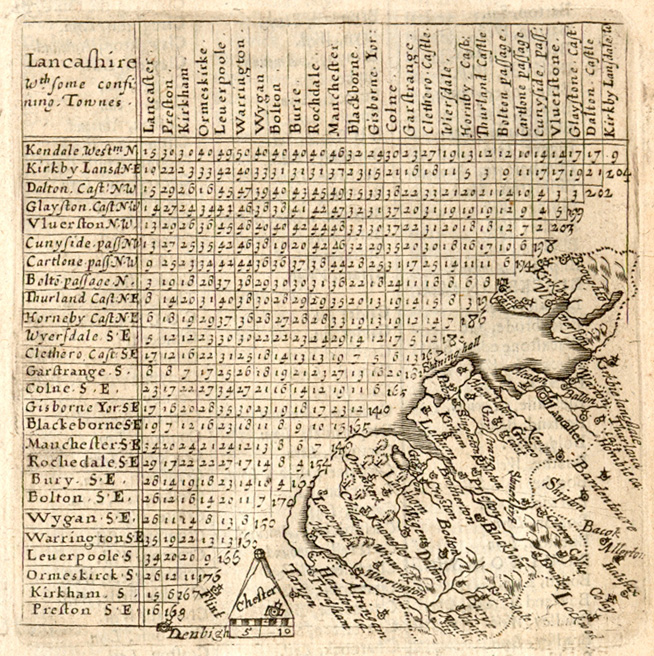
| 1719 (Map 4C) T. Cox and E. Nutt. Lancashire distance table accompanying 4B from Magna Britannia et Hibernia... (London, 1720) |
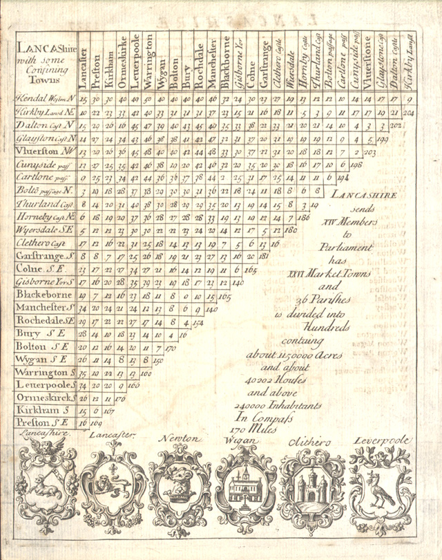 |
See Above |
|
c.1694 (Map 4D) |
 |
See Above |
| 1787 (Map 4D) John Seller. ‘Lancashire’ (c.1694) final state from Francis Grose’s Antiquities of England... (London, 1787) |
 |
See Above |
| 1720 (Map 4E) Emanuel Bowen. His first county map from Britannia Depicta ... (London, c.1720) |
 |
See Above |
| 1724 (Map 4F) Herman Moll. ‘The County Palatine of Lancaster...’ from A New Description of England and Wales... (London, 1724) |
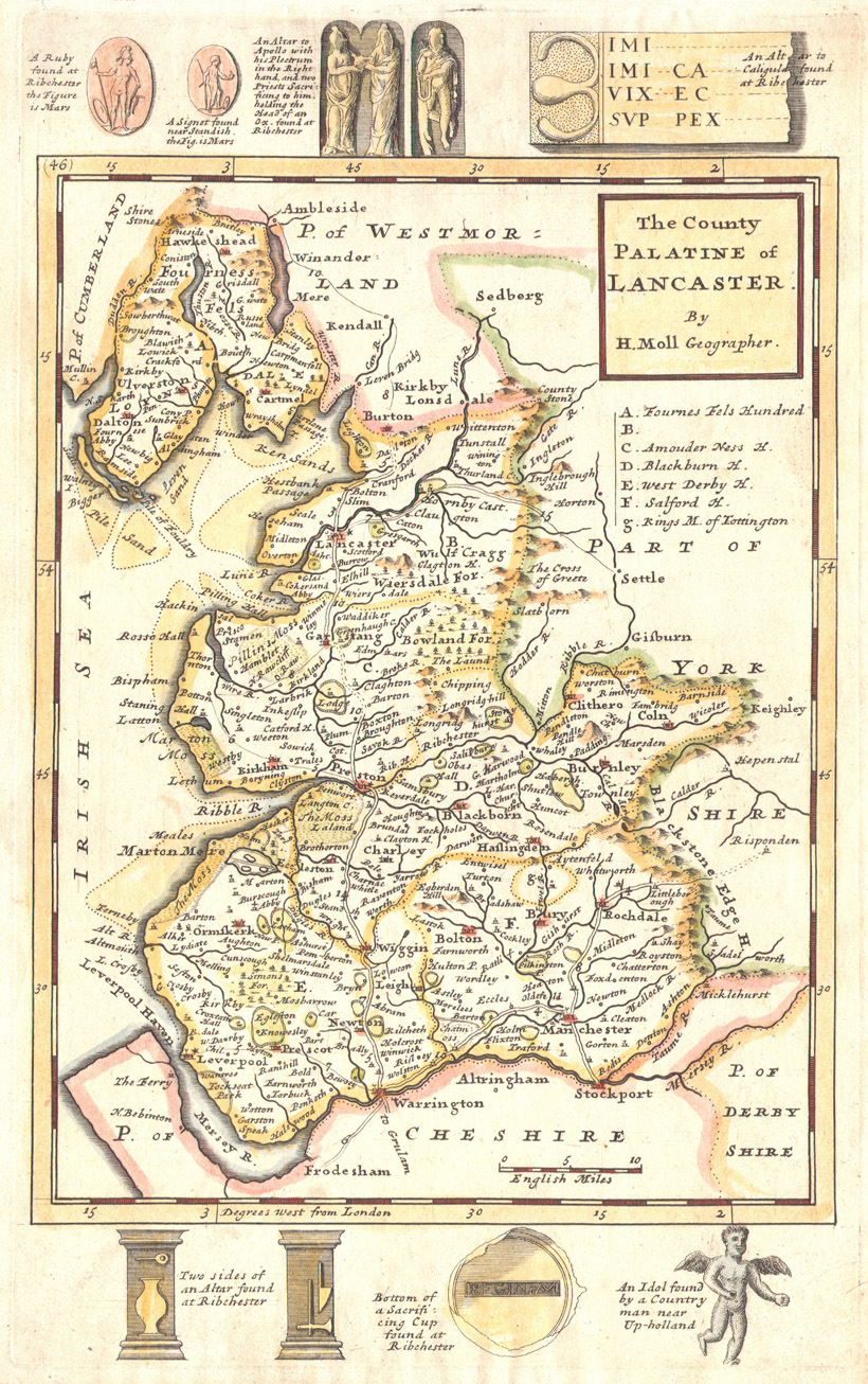 |
See Above |
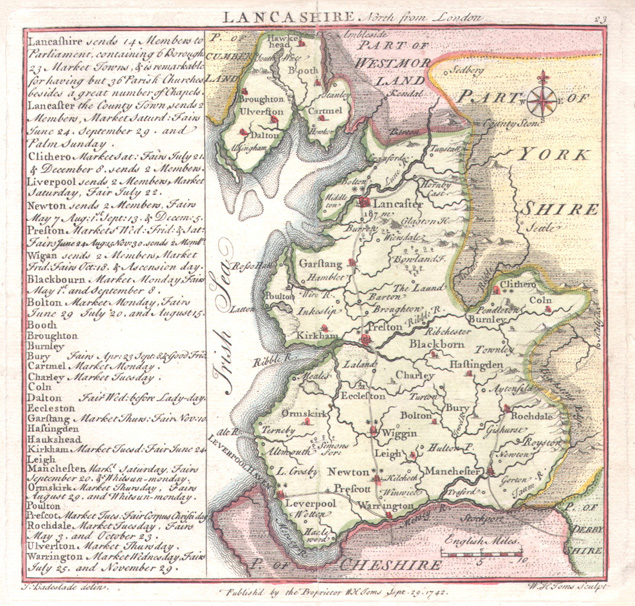
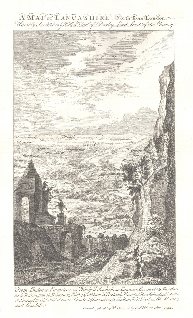
| 1741 (Map 4G) Thomas Badeslade and William Toms.‘Lancashire North from London’ second state from Chorographia Britanniae... (London, 1742) |
 |
See Above |
| c.1746 (Map 4G) Thomas Badeslade and William Toms. ‘Lancashire North from London’ (1741) third state from Chorographia Britanniae... (London, c.1746) |
 |
See Above |
| 1743 (Map 4H) John Cowley. 'An Improved Map of Lancashire...' from The Geography of England... (London,1744) |
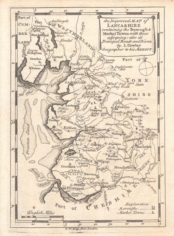 |
See Above |
| 1744 (Map 4J) Anonymous. ‘Lancashire’, in a later state by John Rocque from Adlard and Browne’s England Displayed (London, 1769) |
 |
See Above |
| 1746 (Map 4K) Samuel Simpson. ‘Lancashire’ from Robert Walker’s The Agreeable Historian (London, 1746) |
 |
See Above |
| 1748 (Map 4L) Thomas Hutchinson. ‘A Correct Map of Lancashire’ from Osborne’s Geographia Magnae Britanniae (London, 1748) |
 |
See Above |
| 1748 (Map 4M) Thomas Kitchin and Thomas Jefferys. ‘A Map of Lancashire’ from The Small English Atlas (London,1751) |
 |
See Above |
| 1750 (Map 5A) Thomas Kitchin. ‘Lancashire... Corrected from Astronl. Observatns...’ from The London Magazine (London, 1750) |
 |
See Above |
| 1751 (Map 5B) Emanuel Bowen. 'Lancashire...Regulated by Astronl. Observatns...’ from The Universal Magazine ( London, 1751) |
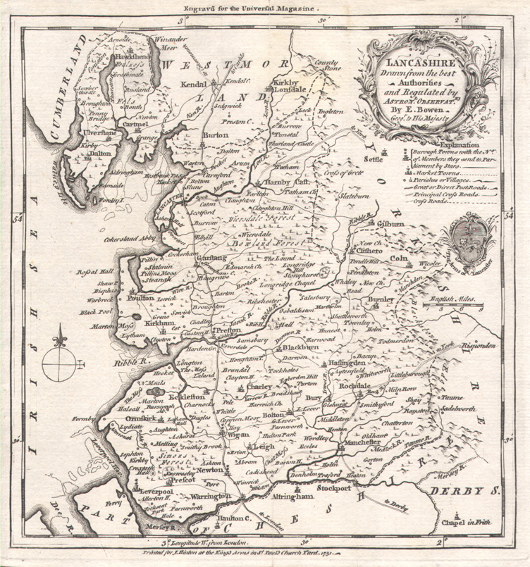 |
See Above |
|
1754 (Map 5C) |
 |
See Above |
| 1759 (Map 5D) John Gibson, ‘Lancashire’ from Carnan’s New and Accurate Maps of the Counties (London, c.1780) |
 |
See Above |
| 1752 (Map 5E) Emanuel Bowen. ‘An Accurate Map of the County Of Lancaster’ Hinton edition before atlas publication (London 1752) |
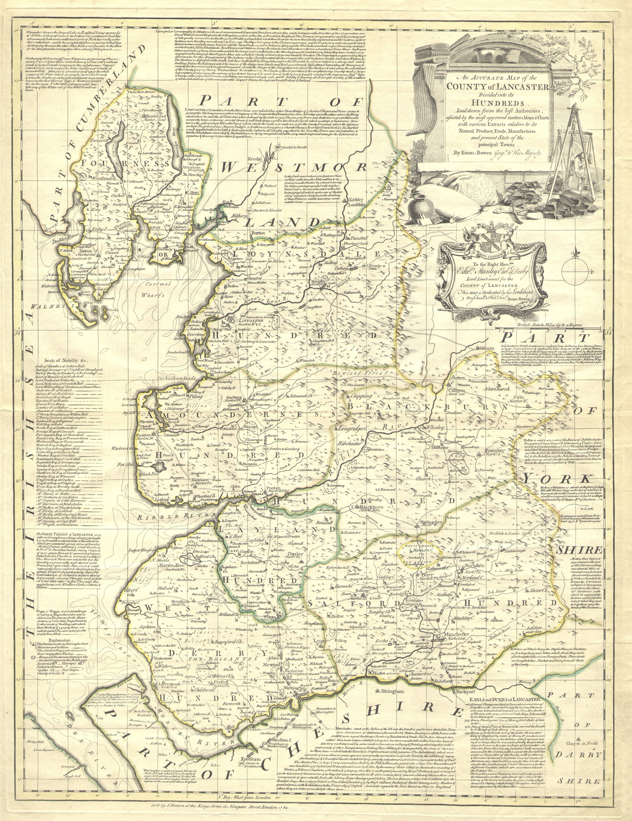 |
See Above |
| 1764 (Map 5F) J. Gibson and E. Bowen. ‘An Accurate Map of the County of Lancaster...’ from The Royal English Atlas (London,c.1764) |
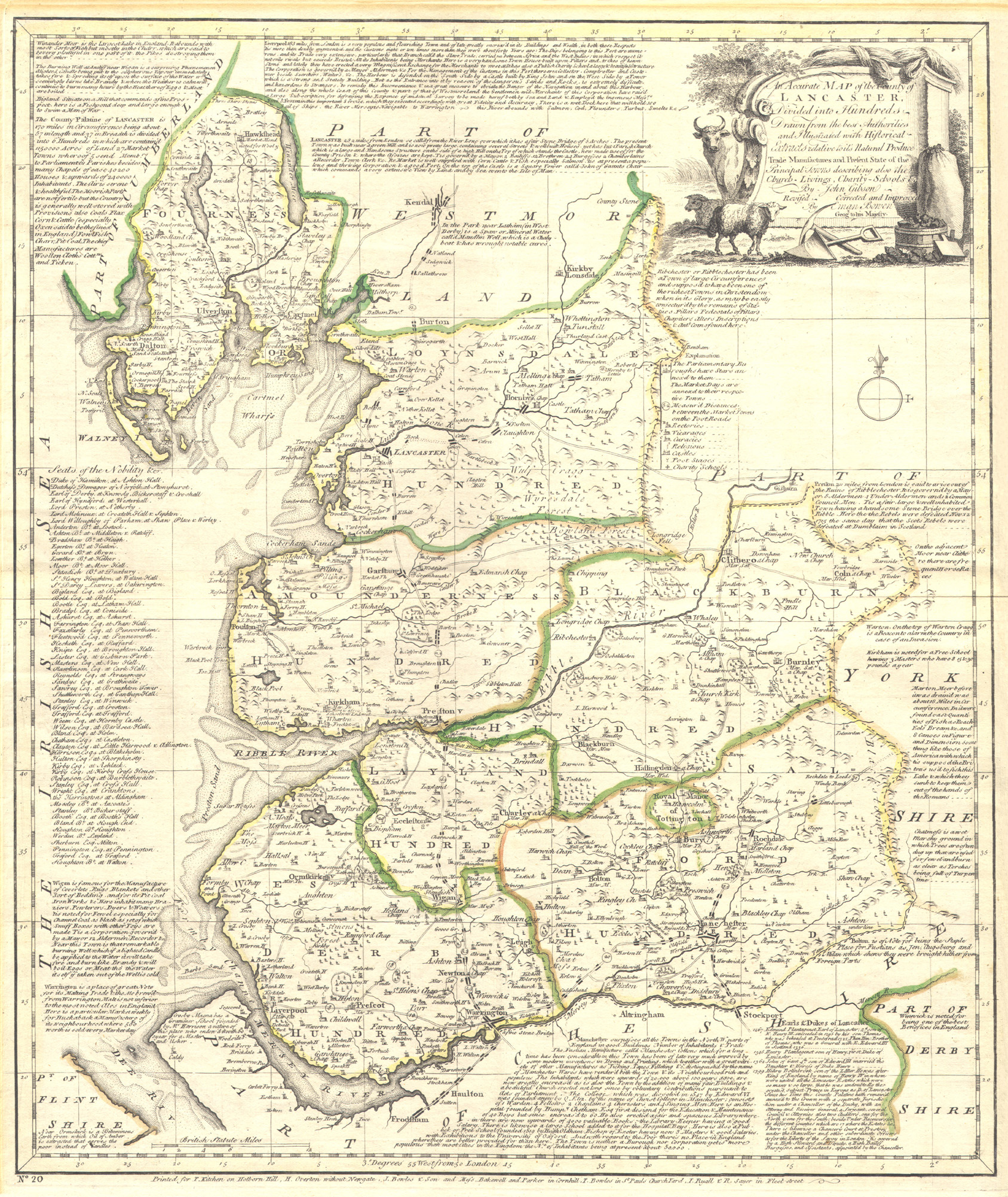 |
See Above |
| 1768 (Map 5G) Thomas Bowen. ‘Lancashire...’ from Atlas Anglicanus... (London,1768) |
 |
See Above |
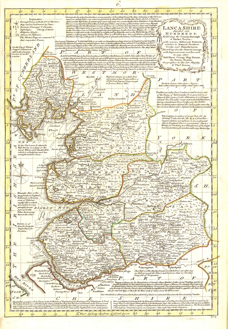
| 1761 (Map 5H) Emanuel Bowen. ‘Lancashire Divided into its Hundreds...’ from the General Magazine of Arts and Sciences (London, 1761) |
 |
See Above |
| 1768 (Map 5J) Thomas Bowen. ‘Lancashire, Drawn from the best Authorities’ from Universal Museum (London, 1768) |
 |
See Above |
| 1764 (Map 5K) Thomas Kitchin. 'A New Map of Lancashire...' from England Illustrated (London, 1764) |
 |
See Above |
| 1765 (Map 5L) Joseph Ellis. ‘A Modern Map of Lancashire’ from Ellis’s English Atlas (London, 1768) |
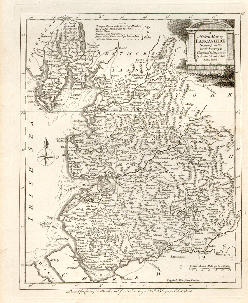 |
See Above |
| 1789 (Map 5M) John Lodge. ‘A New Map of Lancashire...’ from an anonymous atlas (London, 1795) |
 |
See Above |
| 1769 (Map 5N) Thomas Kitchin. ‘Lancashire’ from Kitchin’s Pocket Atlass... (London, 1769) |
 |
See Above |
| 1784 (Map 5P) Thomas Condor. ‘A New Map of Lancashire...’ from New British Traveller... (London, 1784) with adjacent map of Lincolnshire |
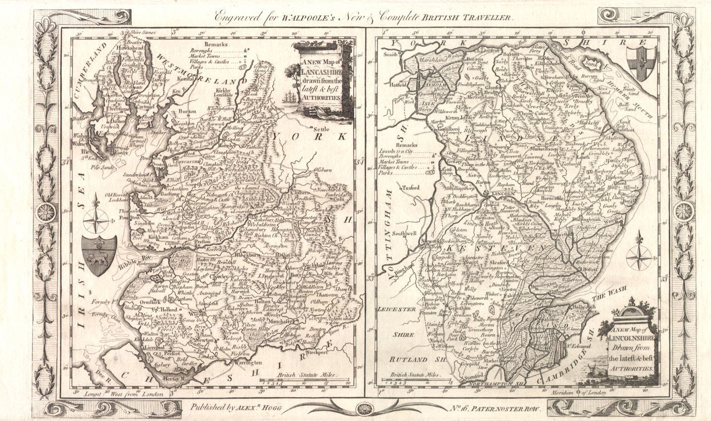 |
See Above |
| 1789 (Map 5Q) John Harrison. ‘A Map of Lancashire... with Improvements’ from Maps of the English Counties (London, 1791) |
 |
See Above |
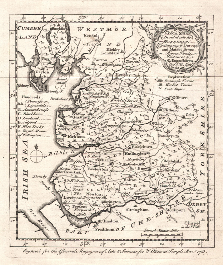
| 1788 (Map 5R) William Yates. ‘The County Palatine of Lancaster...’ eight sheets assembled in the form of a wall-map Reproduced courtesy of Dr William Shannon |
 |
See Above |
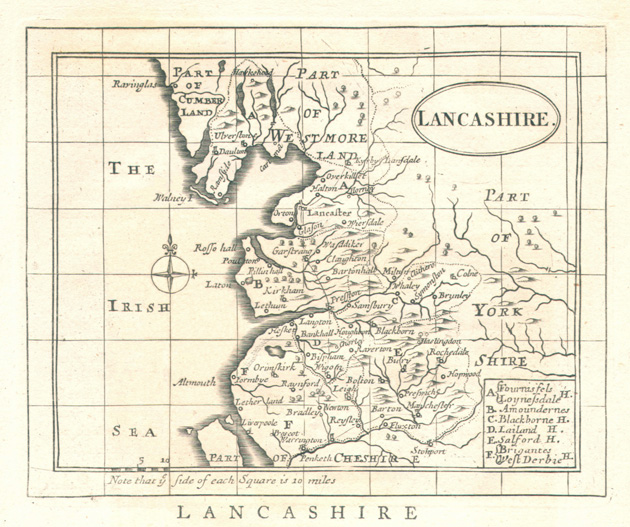
| 1789 (Map 5S) John Cary. ‘Lancashire...’ from Cary’s New and Correct English Atlas (London, 1789) misleadingly dated 1787 in the imprint |
 |
See Above |

.jpg)