

Maps available from the Lancaster University Library collection attract different copyright terms, which will be highlighted wherever possible.
Many maps are available under a Creative Commons (CC BY 4.0) licence where highlighted to allow easy reuse. If this licence does not suit your particular use, please contact the library.
You can use our maps on Blogs, Social Networking or even Commercial Products, but always credit Lancaster University Library.


The Lancaster Archaeological and Historical Society was founded in 1973 and holds talks and meetings from September to April on the last Thursday of the month. Field trips to sites of historical and archaeological interest are made during the summer. The Society's official journal Contrebis is published annually and contains articles on archaeology and local history in Lancashire and the North West of England.

The following maps have been scanned from the Lancaster University Library Map Collection (unless otherwise stated). The jpeg images may be reduced to fit the screen and can usually be enlarged, depending on your browser. The library is able to provide uncompressed original digital files, upon request.
Warning: File sizes for some maps are large, and may download slowly especially on mobile connections. If you right click on the image, and click 'Save Link As' you can save the map and open it in a desktop image viewer, rather than browser, for easier zooming in on details on slower computers.
| Year | Name | Image | Attribution |
| 1607 |
This map is an inset from "The Countie Pallatine of Lancaster described and divided into hundreds, 1610" by John Speed. The original map is available for viewing from the Lancashire Archives Service, and further information on the importance of John Speed’s town plans can be found in this paper from Contrebis Journal titled John Speed's Town Plan of Lancaster in 1607 (2020)
|
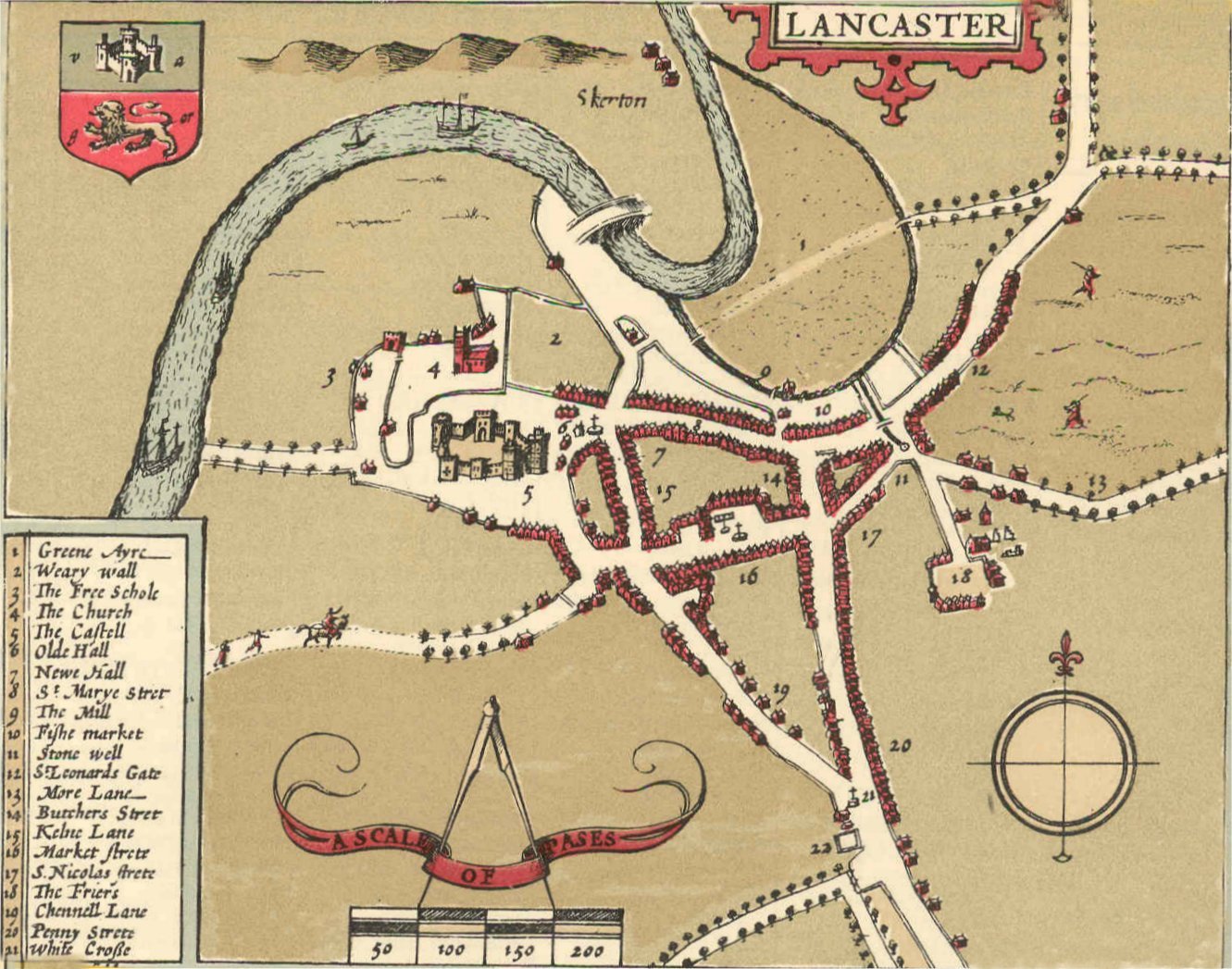 |
Public Domain |
| 1684 | Kenneth Docton. Reconstruction of Lancaster in 1684 from the Towneley map. Information on the availability of early Lancaster maps can be found in this paper from Contrebis Journal titled The Earliest Surveying of the Town of Lancaster (2021) | 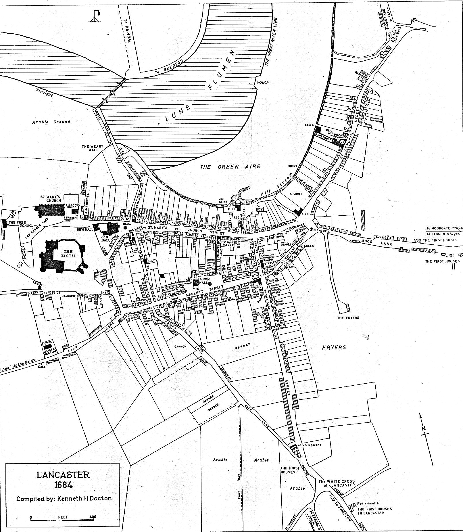 |
Reproduced courtesy of the Historic Society of Lancashire and Cheshire |
| 1778 | Stephen Mackreth. Plan of the town of Lancaster. | 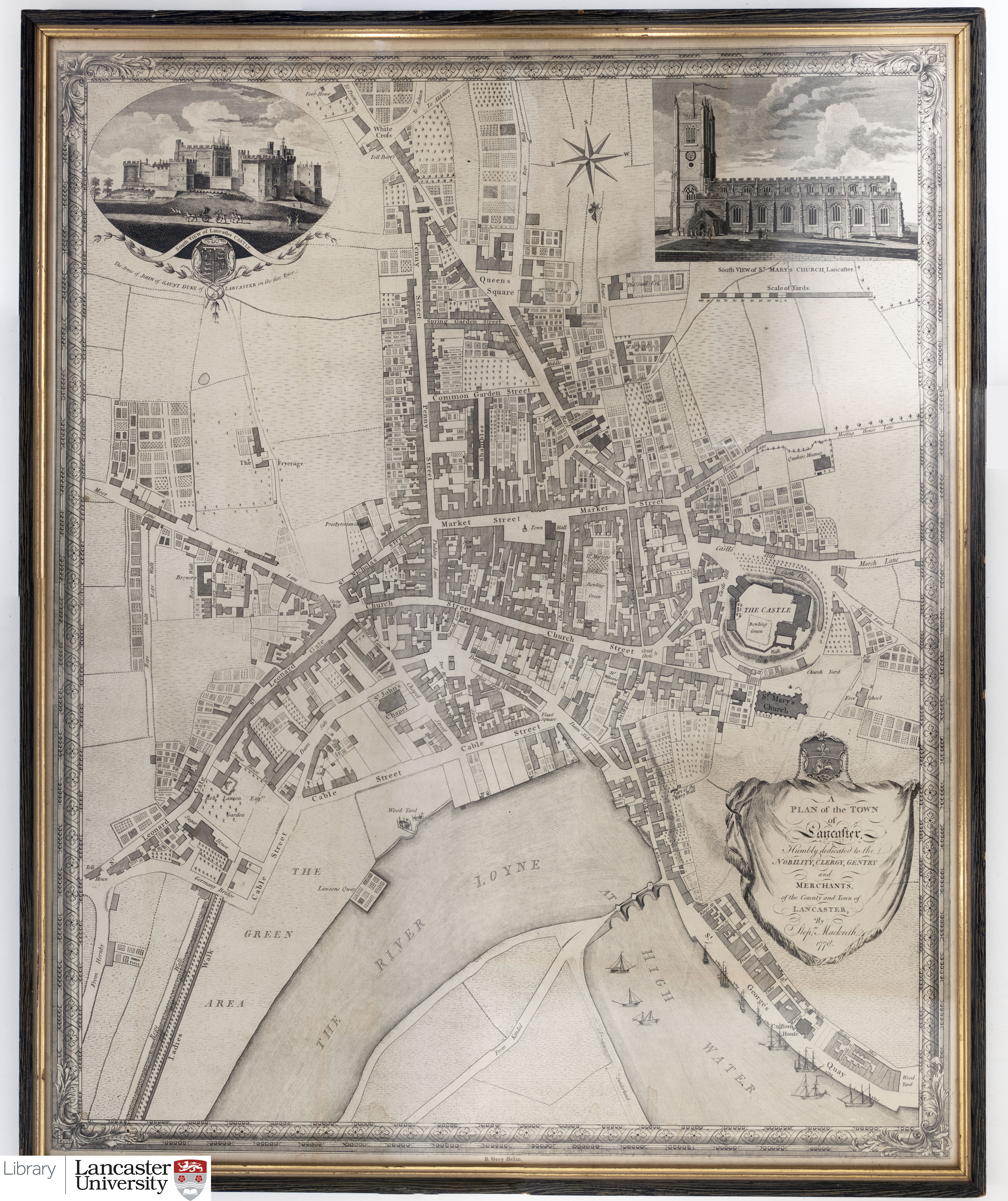 |
CC BY-SA 4.0 |
| 1800 | McIntyre. Plan of Lancaster. | 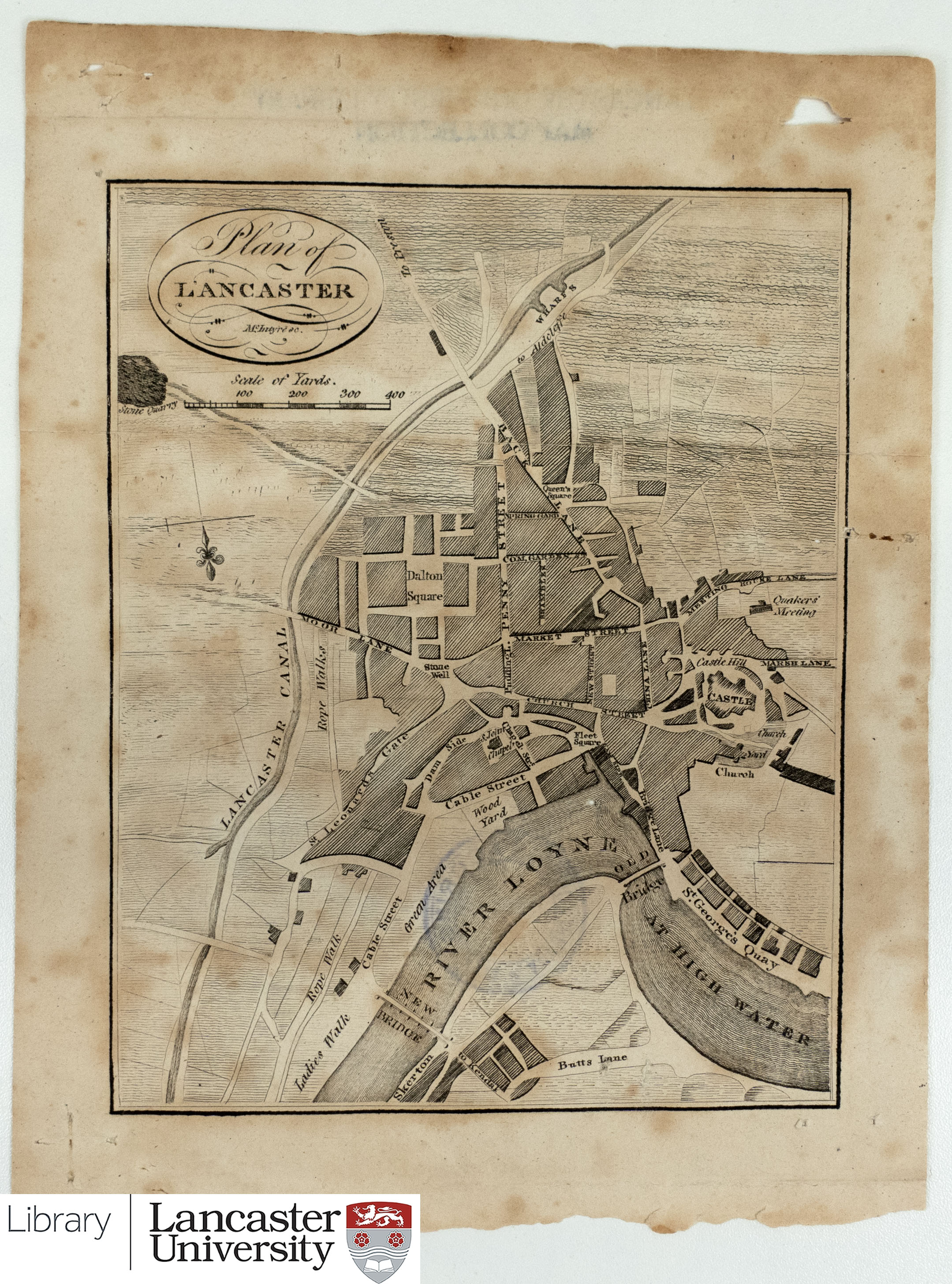 |
CC BY-SA 4.0 |
| 1807 | Christopher Clark. A plan of the town of Lancaster. From An Historical and Descriptive Account of the Town of Lancaster Collected from the Best Authorities by C. Clark. |  |
CC BY-SA 4.0 |
| 1807 |
Christopher Clark: Plan of Lancaster Castle. From An Historical and Descriptive Account of the Town of Lancaster Collected from the Best Authorities by C. Clark. |
 |
|
| 1821 | Jonathan Binns. Map of the town and castle of Lancaster. With inset: Speed’s map of Lancaster, 1610. |
 |
CC BY-SA 4.0 |
| 1824 |
Plan of Lancaster from Baines’ history, directory and gazetteer of the county palatine of Lancaster. |
 |
|
| 1832 | Robert K. Dawson. Lancaster borough/town plan for the Reform Act. | 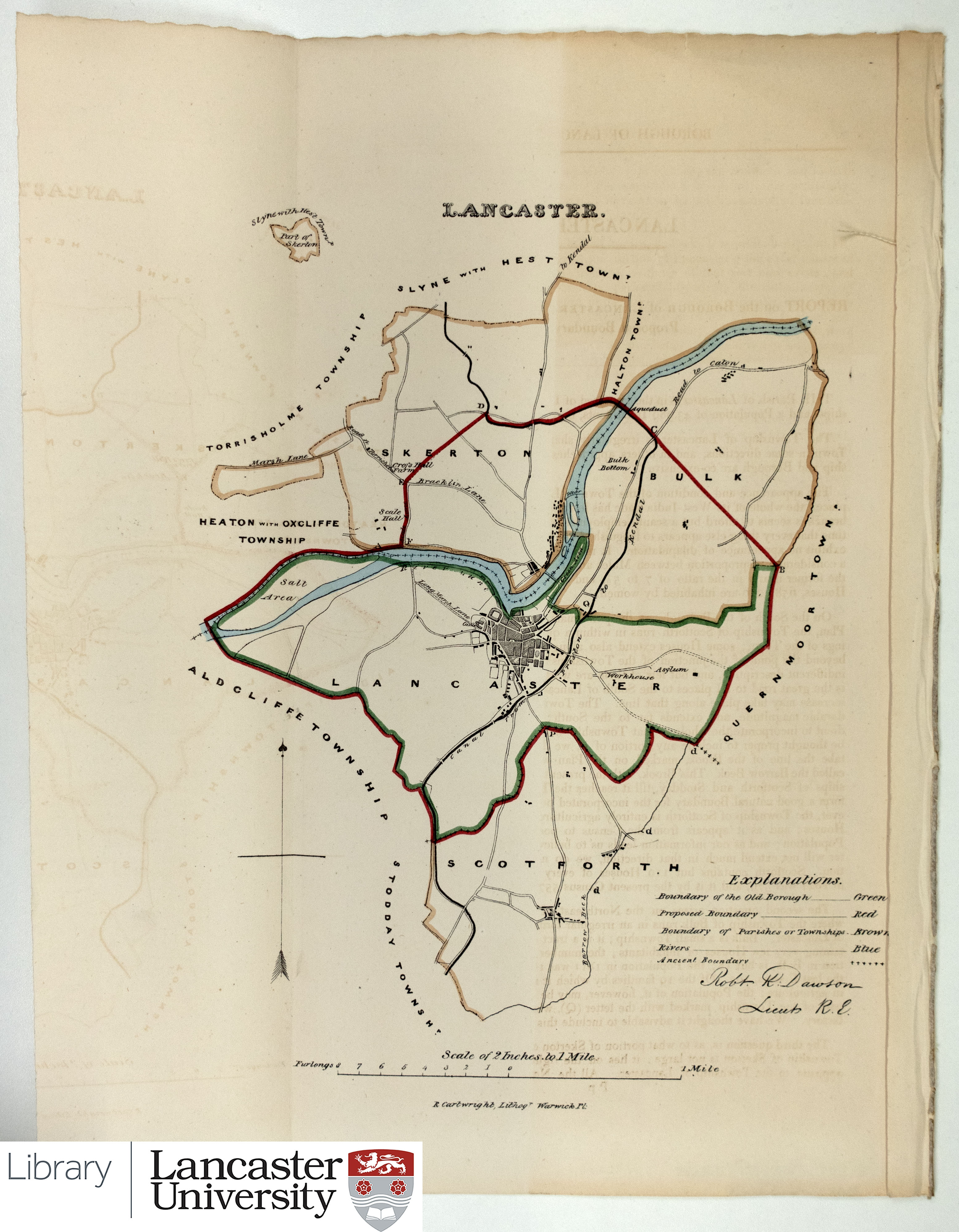 |
CC BY-SA 4.0 |
| 1837 | Robert K. Dawson. Lancaster borough/town/city plan for the Boundary Commission. | 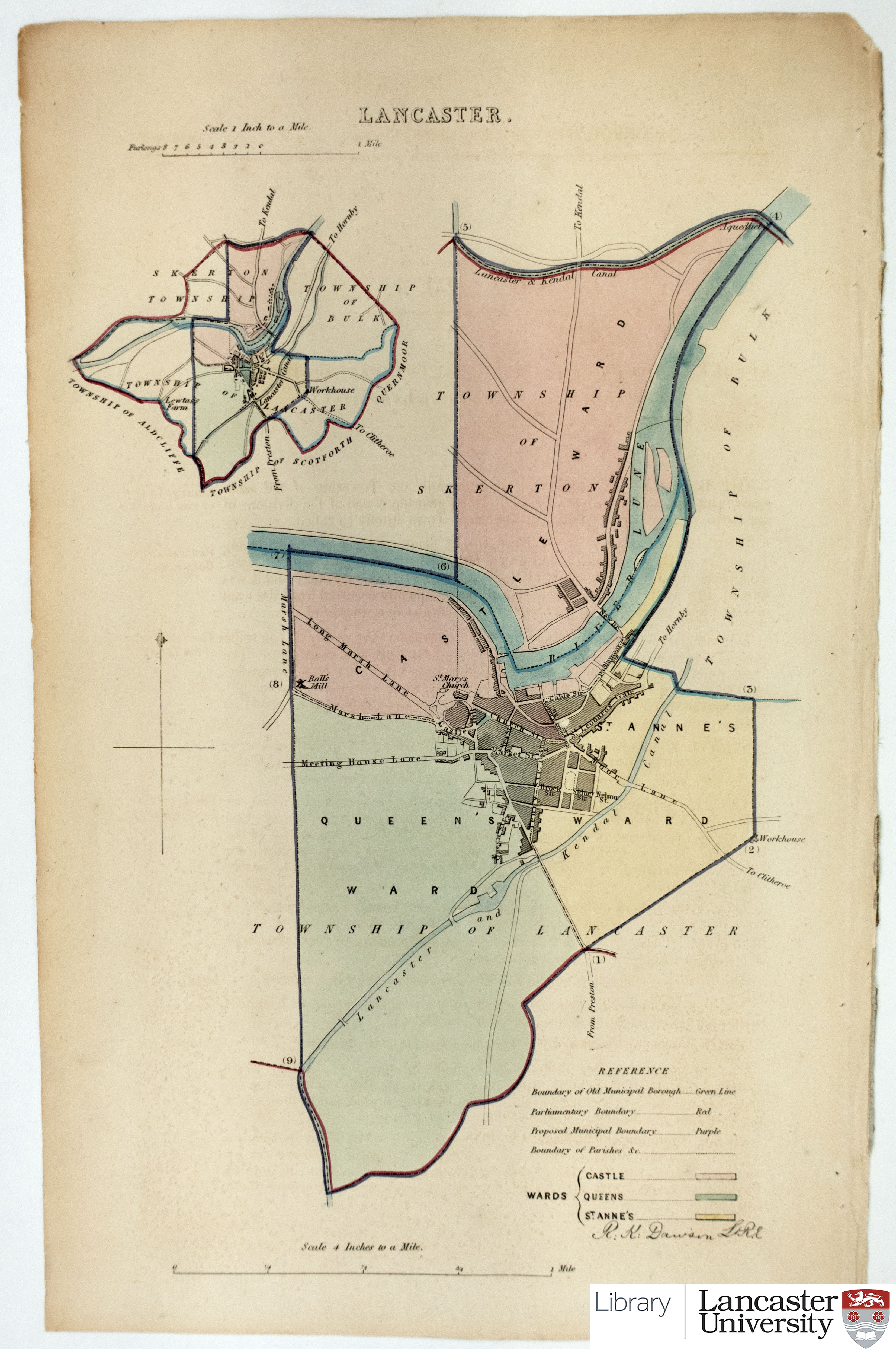 |
CC BY-SA 4.0 |
| 1844/45 survey |
Ordnance Survey 6 inch map. 1st edition. (Sheet 30.) Published 1848. |
 |
Reproduced from 1848 Ordnance Survey® map Available via DigiMaps (University Staff and Students) or National Library of Scotland (Public) |
| 1846 | Ordnance Survey 5 foot plan of Lancaster. Central Lancaster section. |
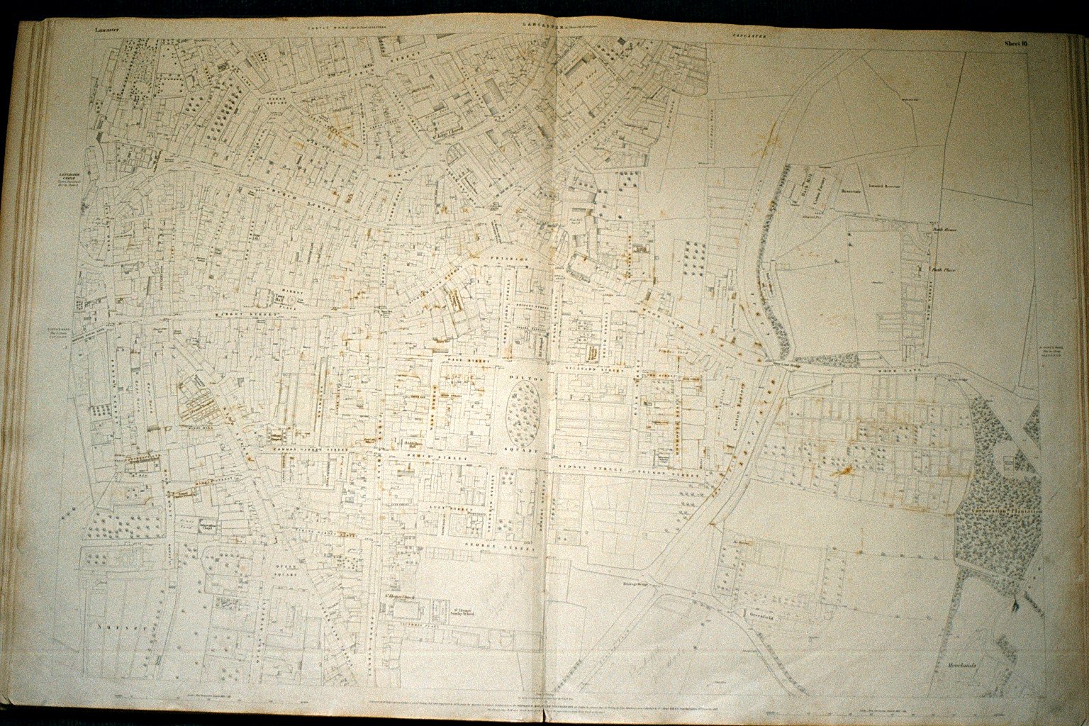 |
Reproduced from 1846 Ordnance Survey® map Available via DigiMaps (University Staff and Students) or National Library of Scotland (Public) |
| 1852 | Ordnance Survey 1 inch map. 1st edition. (Sheet 91) | 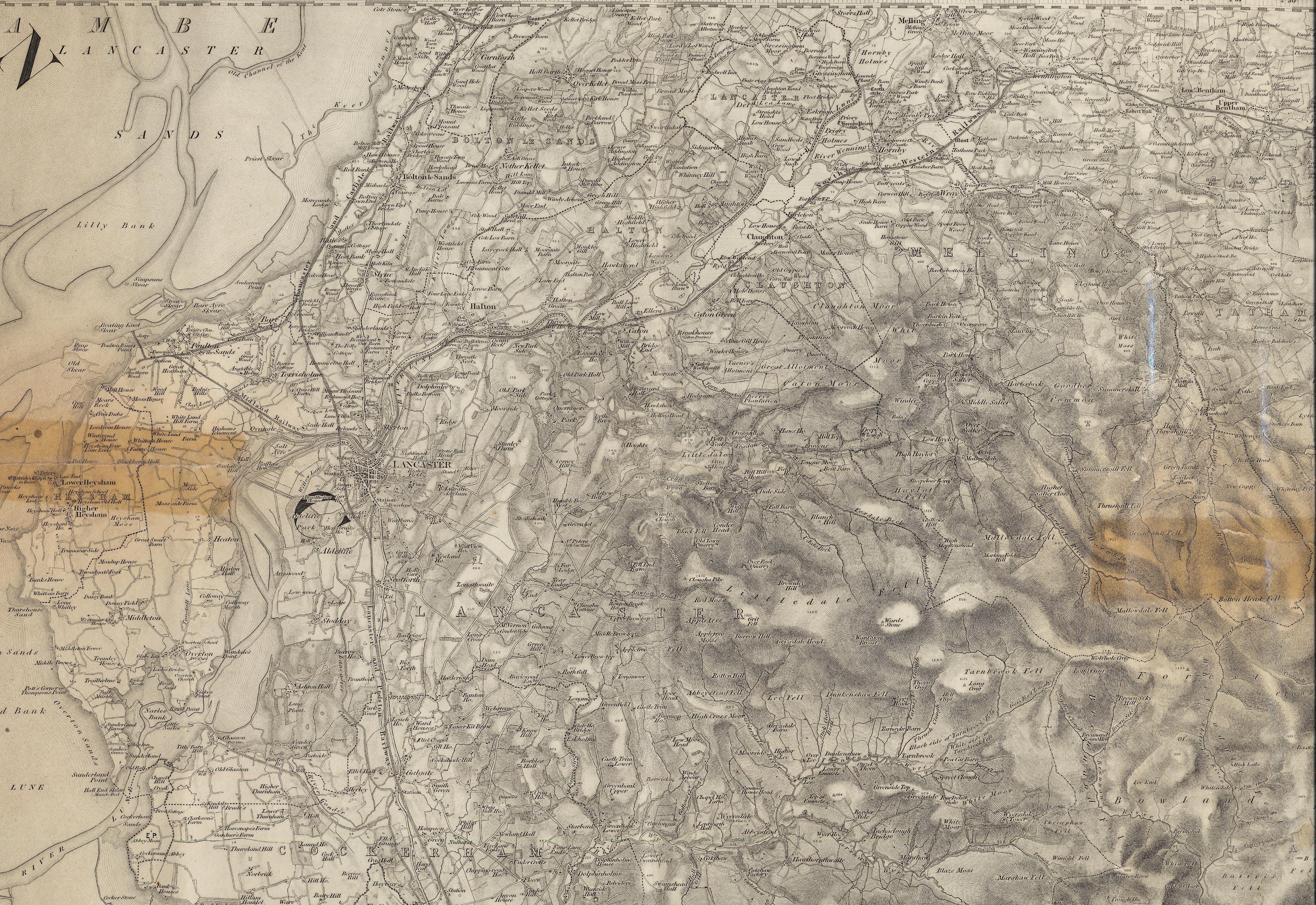 |
Reproduced from 1852 Ordnance Survey® map Available via DigiMaps (University Staff and Students) or National Library of Scotland (Public) |
| 1877 | Harrison & Hall. Plan of the Town and Castle of Lancaster. | 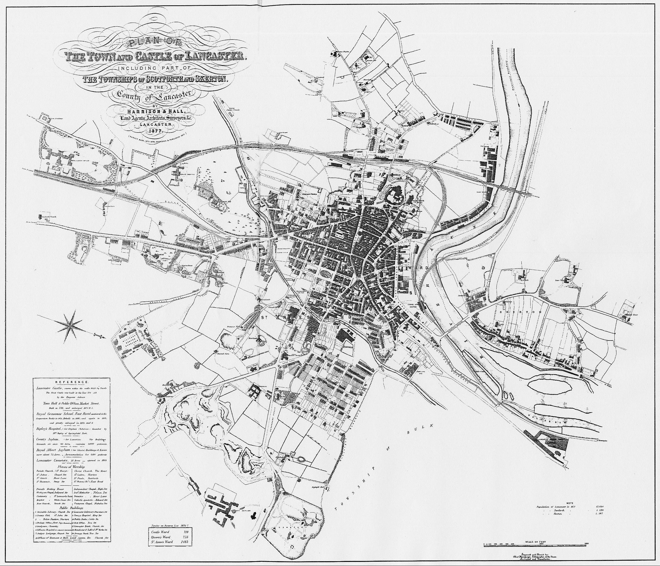 |
Reproduced courtesy of Andrew White. From : White, Andrew. Lancaster : a history. Chichester : Phillimore, 2003 |
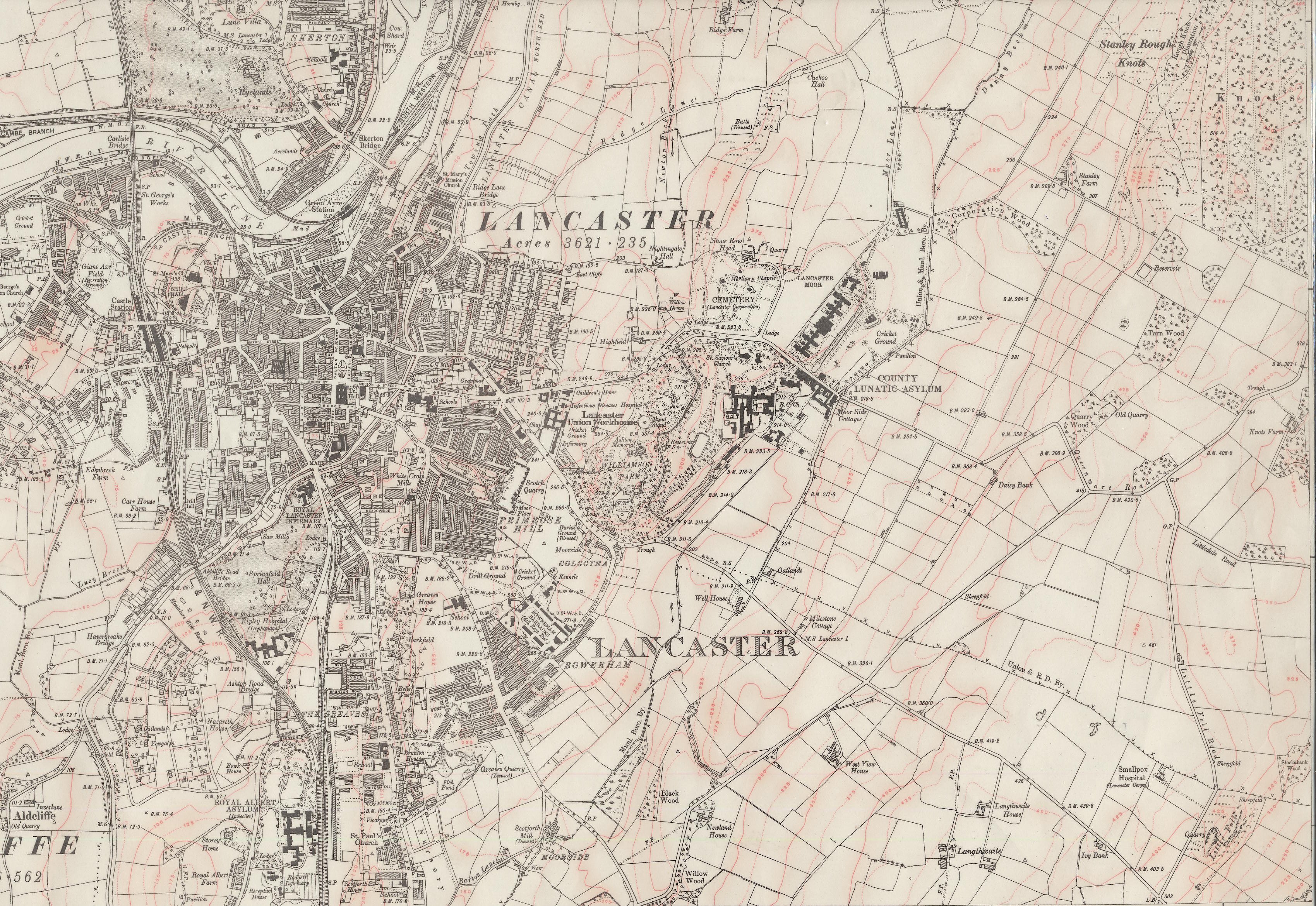
| 1890 survey |
Ordnance Survey 25 inch plan. 1st edition. (Sheet XXX.11) Published 1893. |
 |
Reproduced from 1893 Ordnance Survey® map Available via DigiMaps (University Staff and Students) or National Library of Scotland (Public) |
| 1891 |
Ordnance Survey 6 inch map. 1st revision. (Sheet XXX.) Published 1895. |
 |
Reproduced from 1895 Ordnance Survey® map Available via DigiMaps (University Staff and Students) or National Library of Scotland (Public) |
| 1894 | Map of Lancaster showing streets & ward boundaries. Published with Lancaster Standard, Xmas 1894. | 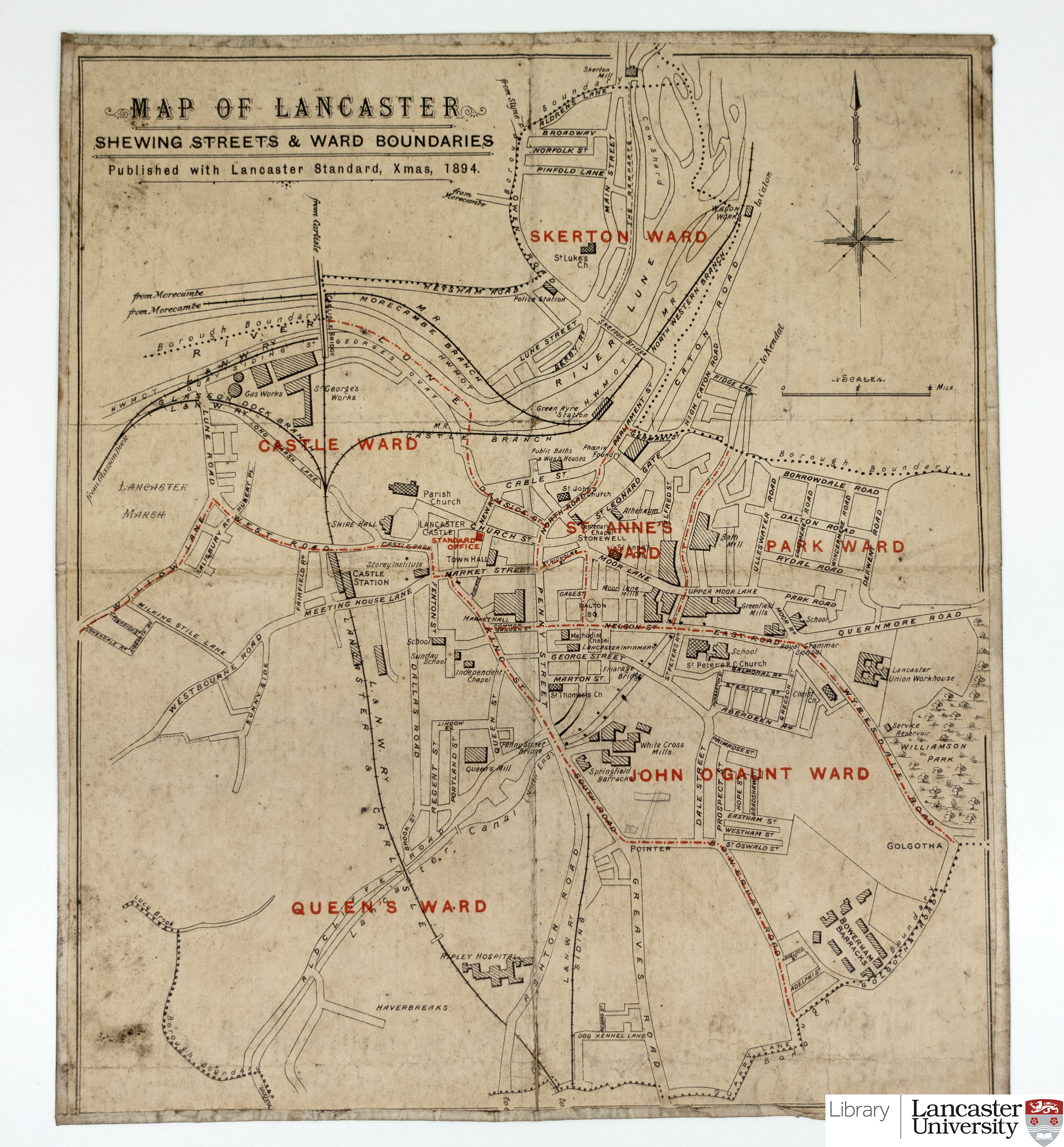 |
CC BY-SA 4.0 |
| 1910 survey revised |
Ordnance Survey 25 inch plan. (Sheet XXX.11) Published 1913. |
 |
Reproduced from 1913 Ordnance Survey® map Available via DigiMaps (University Staff and Students) or National Library of Scotland (Public) |
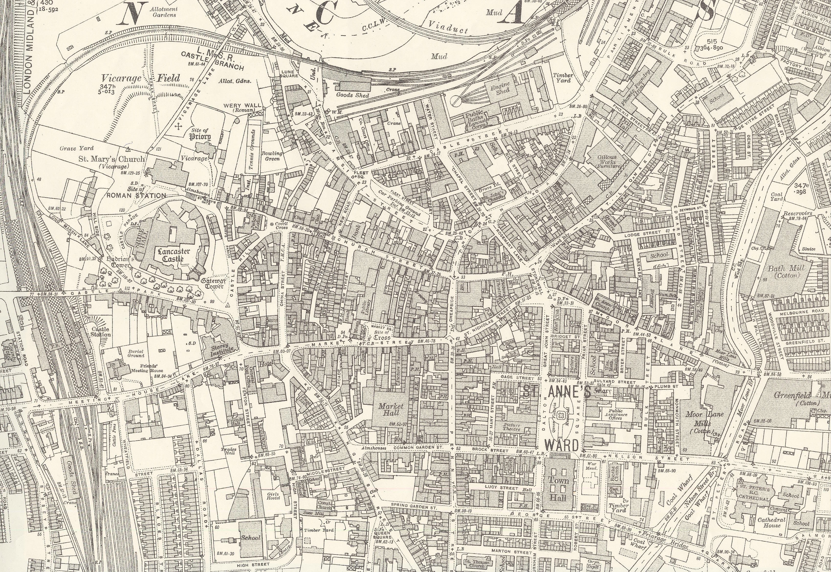
| 1910 survey revised |
Ordnance Survey 6 inch map. (Sheet XXX SE) Central Lancaster section. Published 1919. |
 |
Reproduced from 1919 Ordnance Survey® map Available via DigiMaps (University Staff and Students) or National Library of Scotland (Public) |
| 1921 | Harrison & Moore. Bailrigg Estate Scotforth. |  |
CC BY-SA 4.0 |
| 1931 survey revised |
Ordnance Survey 25 inch plan. (Sheet XXX.11) Published 1933. |
 |
Reproduced from 1933 Ordnance Survey® map Available via DigiMaps (University Staff and Students) or National Library of Scotland (Public) |
| 1931 survey revised, with additions in 1938 |
Ordnance Survey 6 inch map. (Sheet XXX SE) Published 1946. |
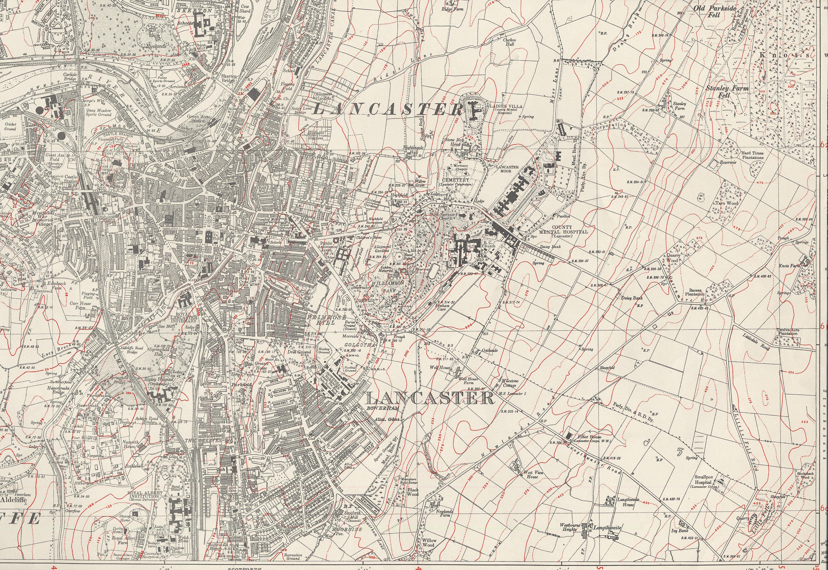 |
Reproduced from 1946 Ordnance Survey® map Available via DigiMaps (University Staff and Students) or National Library of Scotland (Public) |