
The University Library map collection contains a wide range of maps published by the Ordnance Survey. These include historical maps, motoring maps, outdoor leisure maps, administrative maps, and detailed town plans. This guide lists a selection of the maps available.
Copyright: Ordnance Survey maps are subject to Crown copyright for a period of 50 years after publication. The University has an educational licence with the Ordnance Survey which allows reproduction of O.S. maps for teaching, lecturing and University research purposes. Copies must be limited to a specific size depending on the scale of the map, and bear an acknowledgement. Further details are available in the Map Collection.
Digital OS Maps: The EDINA Digimap service provides access to modern Ordnance Survey digital mapping & also to the Ancient Roam historic map collection for earlier Ordnance Survey maps (1846 to end of 20th Century).
National Library of Scotland: The majority of Ordnance Survey maps within our collection from between 1840s-1960s are also held and have been digitised in excellent quality by the National Library of Scotland. Their collection is extensive and this is a very useful free public resource.
1:25,000 Explorer & Outdoor Leisure maps are held for such areas as Blackpool & Preston, Forest of Bowland, Lancaster & Morecambe, the English Lakes, Yorkshire Dales, Three Peaks, Malham and Upper Wharfedale, South Pennines, Snowdonia National Park etc.
These are held on shelves in the Map Area on A floor.
The library holds copies of early Ordnance Survey maps in the Map Cabinets on A floor, drawers labelled as below. Note that some of the following may be incomplete sets.
Lancashire
Cumberland
Westmorland
The library holds multiple incomplete series of OS maps between 1950-97. These maps were catalogued using 2-letter area codes according to Ordnance Survey's National Grid. These maps can be found in the Map Cabinets on A floor.
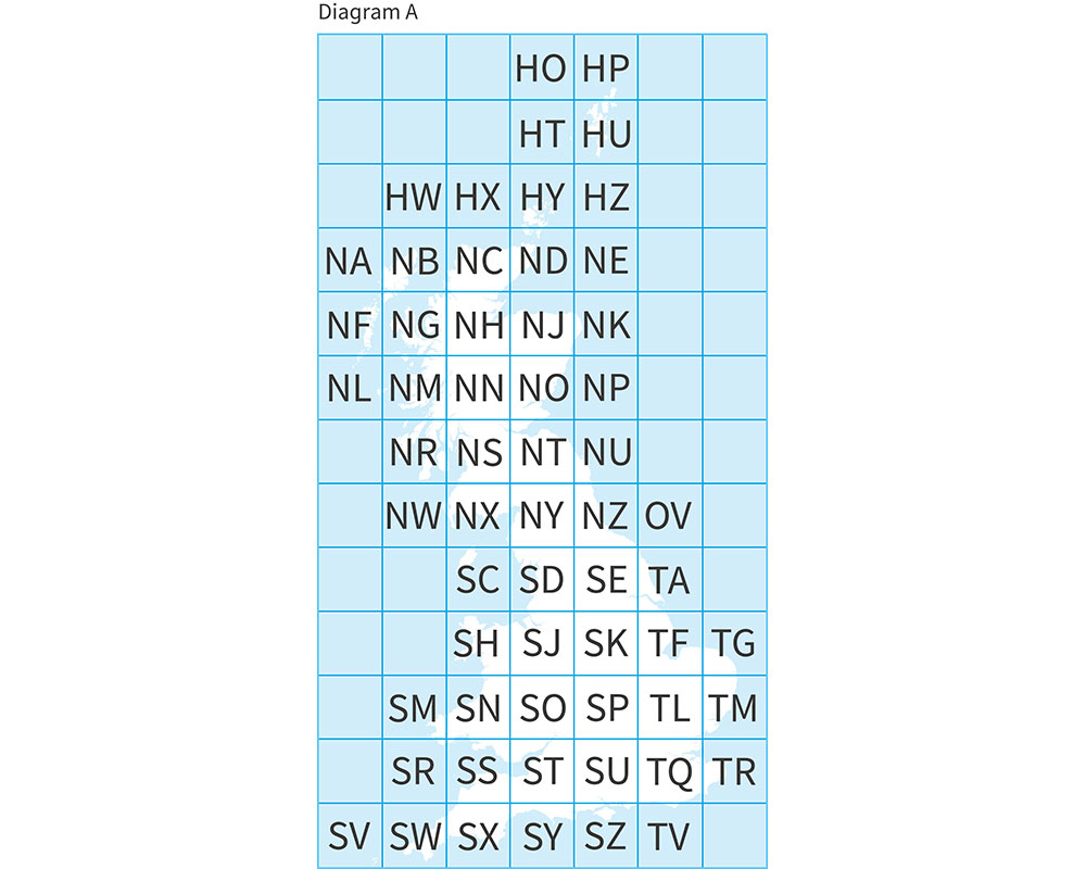 SD (broadly Lancashire)
SJ (broadly Cheshire)
NX (broadly Cumbria)
NY (broadly Cumbria)
The Ordnance Survey publishes a range of historical maps, the library's map collection includes the following:
Held in Map Cabinet labelled 'Ancient Britain' and on shelves in the Map Area on A floor.