

Maps available from the Lancaster University Library collection attract different copyright terms, which will be highlighted wherever possible.
Many maps are available under a Creative Commons (CC BY 4.0) licence where highlighted to allow easy reuse. If this licence does not suit your particular use, please contact the library.
You can use our maps on Blogs, Social Networking or even Commercial Products, but always credit Lancaster University Library.
The following maps have been scanned from the Lancaster University Library Map Collection (unless otherwise stated). The jpeg images may be reduced to fit the screen and can usually be enlarged, depending on your browser. The library is able to provide uncompressed original digital files, upon request.
Warning: File sizes for some maps are large, and may download slowly especially on mobile connections. If you right click on the image, and click 'Save Link As' you can save the map and open it in a desktop image viewer, rather than browser, for easier zooming in on details on slower computers.
| Year | Name | Image | Attribution |
| 1834 | C. & J. Greenwood. Map of the East Riding of the County of York from an Actual Survey. |  |
CC BY-SA 4.0 |
| 1834 | C. & J. Greenwood. Map of the West Riding of the County of York from an Actual Survey. |  |
CC BY-SA 4.0 |
| c.1848 | Joshua Archer. Yorkshire West Riding. |  |
CC BY-SA 4.0 |
| c.1900 | John Bartholomew. Yorkshire. |  |
CC BY-SA 4.0 |
Upon digitisation of the Lancaster Maps collection, a number of historic battle maps were discovered and digitised. These possibly were contained within the archives, as materials to support research into battles fought with the support of Lancashire and Lancastrian Army Regiments.
|
Year |
Name | Image | Attribution |
| c.1744 | Draught of ye Bay of Bulls between the Town of Rotta & Fort St. Catherine... For Mr Tindal's Continuation of Mr Rapin's History of England. |  |
CC BY-SA 4.0 |
| c.1744 | An Exact Draught of the Bay and Harbour of Vigo, 1702. For Mr Tindal's Continuation of Mr Rapin's History of England. |  |
CC BY-SA 4.0 |
| c.1744 |
Battle of Maestricht, 1703. For Mr Tindal's Continuation of Mr Rapin's History of England. |
 |
CC BY-SA 4.0 |
| c.1744 | Plan of the Battle of Eckeren, 1703. For Mr Tindal's Continuation of Mr Rapin's History of England. |  |
CC BY-SA 4.0 |
| c.1744 | Plan of the City and Castle of Alicant, besieged by... 1708-09. For Mr Tindal's Continuation of Mr Rapin's History of England. |  |
CC BY-SA 4.0 |
| c.1744 |
Mons, the Capital City of Hainault in the Low Countries, Holland, Netherlands... 1691-1709. For Mr Tindal's Continuation of Mr Rapin's History of England. |
 |
CC BY-SA 4.0 |
| c.1817 |
Lieutenant R. P. Read. Geographical Plan of the Island & Forts of Saint Helena. This is the island that Napoleon was exiled to in 1815 after surrendering to the British. He remained here until his death in 1821. |
 |
|
| 1818 | Drawing by Charles St Clare, based on an original by A. Boyer., “Map of the Battle of Preston, |  |
Local History Resources for Schools, Regional Heritage Centre |
| 1854 | Captain Biddulph, R.A. A Sketch shewing position of Investing Corps of Allied Armies before Sebastopol. |  |
CC BY-SA 4.0 |
| Year | Name | Image | Attribution |
| 1808 | Unknown author. Lancashire, Westmoreland, Cumberland & a part of Yorkshire with a Sketch of the Soils Canals &c. |  |
CC BY-SA 4.0 |
| c.1900 | W. & A. K. Johnston's Railway Map of England & Wales. Also showing canals. |  |
CC BY-SA 4.0 |
| c.1900 |
Gall & Inglis. The Carlisle Road railway map. The 'Strip' Route Maps No. 21. 8 feet long. Note: the image of this map is curved due to the digitisation process however the physical map in our collection is not curved. |
 |
CC BY-SA 4.0 |
| Year | Name | Image | Attribution |
| 1804 | David Ogilvy & Son. A Map of England and Wales. Engraved for Ogilvy's General Itinerary. Road map. |  |
CC BY-SA 4.0 |
| 1819 | Pigot's Map of Manchester and Salford. |  |
CC BY-SA 4.0 |
| 1924 | Ordnance Survey. Roman Britain. |  |
CC BY-SA 4.0 |
| 1935 | Ordnance Survey. Britain in the Dark Ages (South sheet). |  |
CC BY-SA 4.0 |
| Year | Name | Image | Attribution |
| 1822 | Unknown author. Plan of Dutton Hall Estate in the County of Lancaster. |  |
CC BY-SA 4.0 |
| 1844 | Rev. R R Rothwell & R R Rothwell Esq. Plan of Estates in the Township of Crompton, Parish of Oldham and County of Lancaster. | 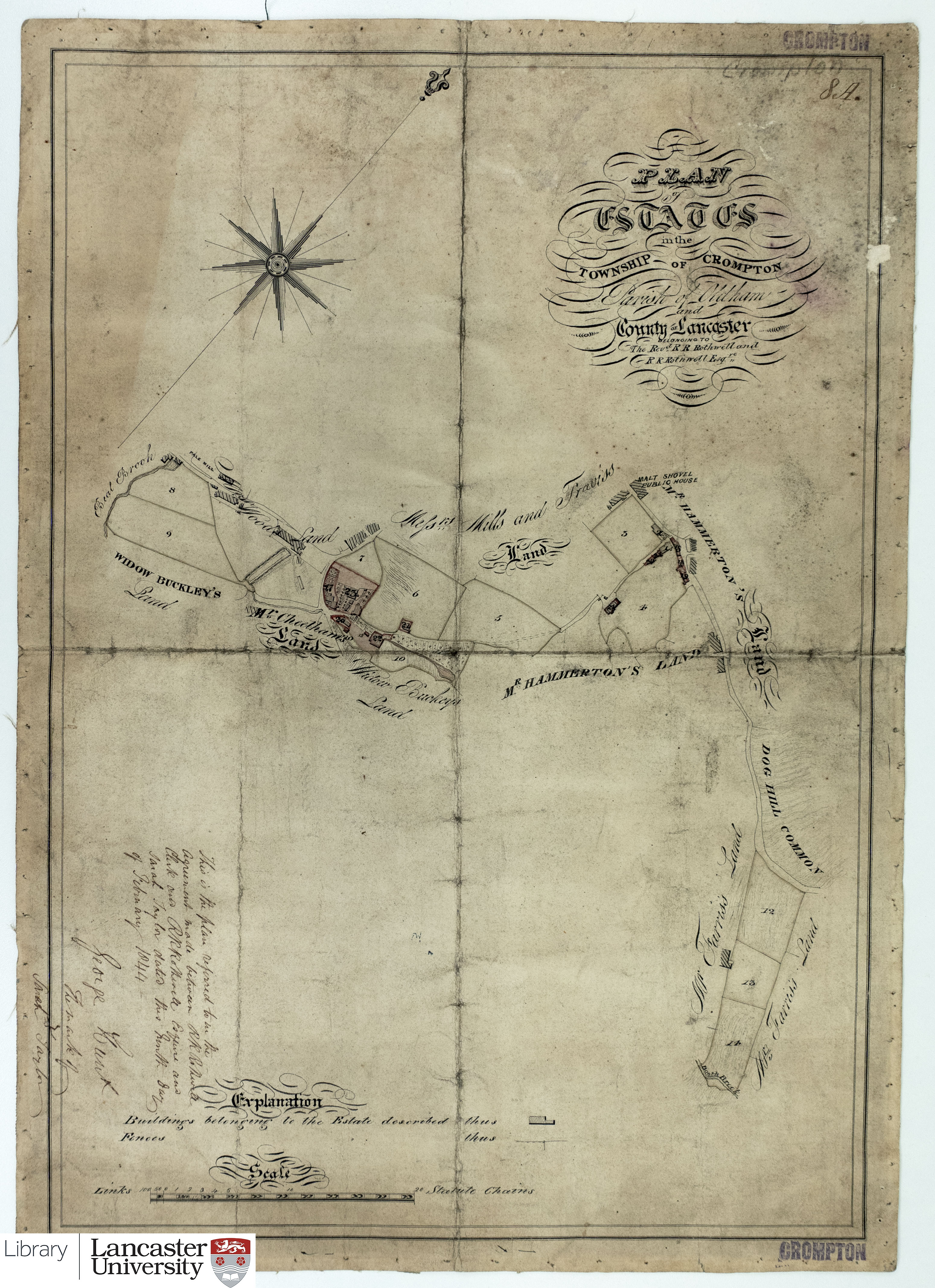 |
CC BY-SA 4.0 |
| c.1845 | Rev. R R Rothwell & R R Rothwell Esq. Plan of Sopping's Estate in the Township of Turton, Parish of Bolton and County of Lancaster. | 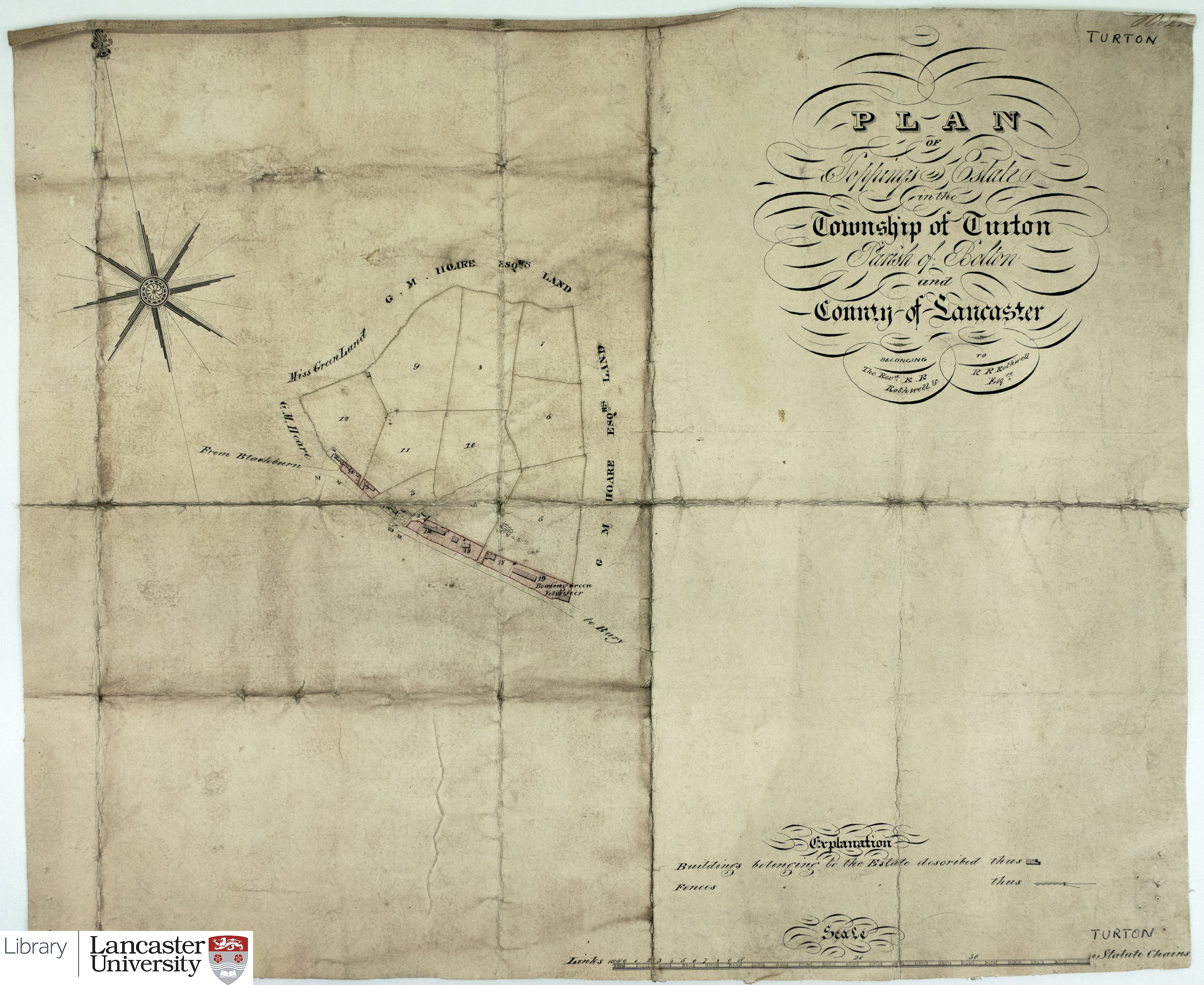 |
CC BY-SA 4.0 |
| c.1845 | Rev. R R Rothwell & R R Rothwell Esq. Plan of Dandy Birk Estate in the Township of Claughton, Parish of Garstang and County of Lancaster. | 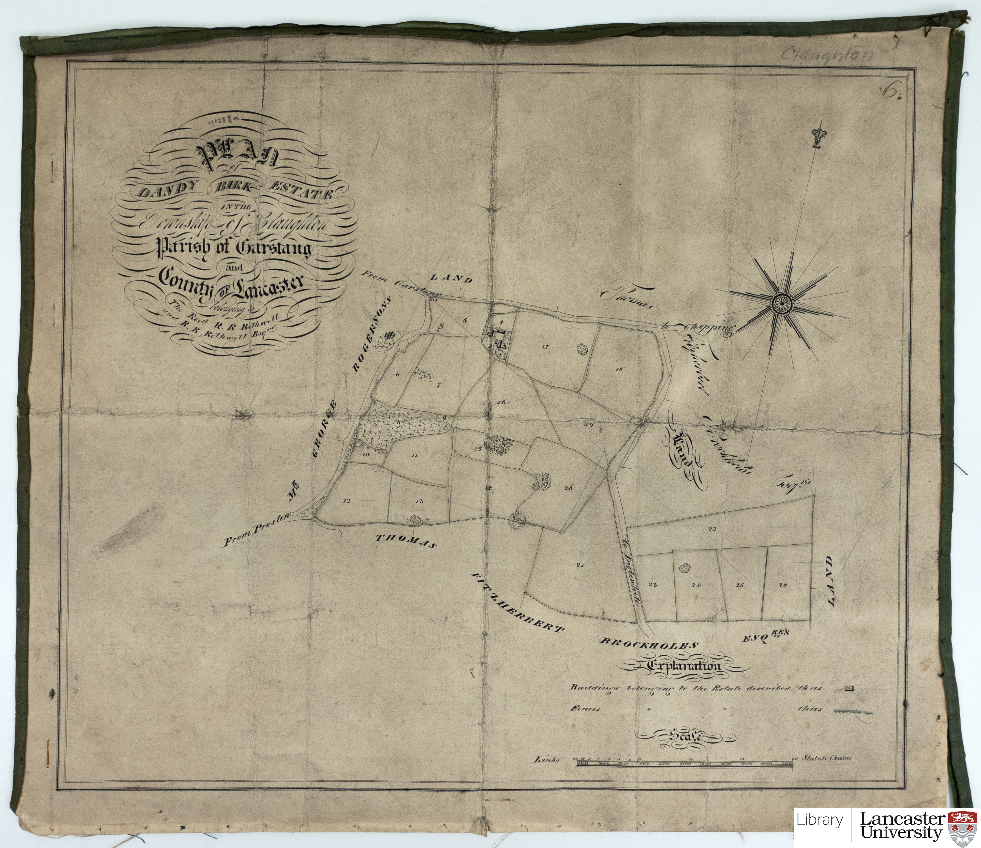 |
CC BY-SA 4.0 |
| 1848 |
Rev. R R Rothwell & R R Rothwell Esq. Plan of Estates in the Township of Euxton, Parish of Leyland and County of Lancaster. |
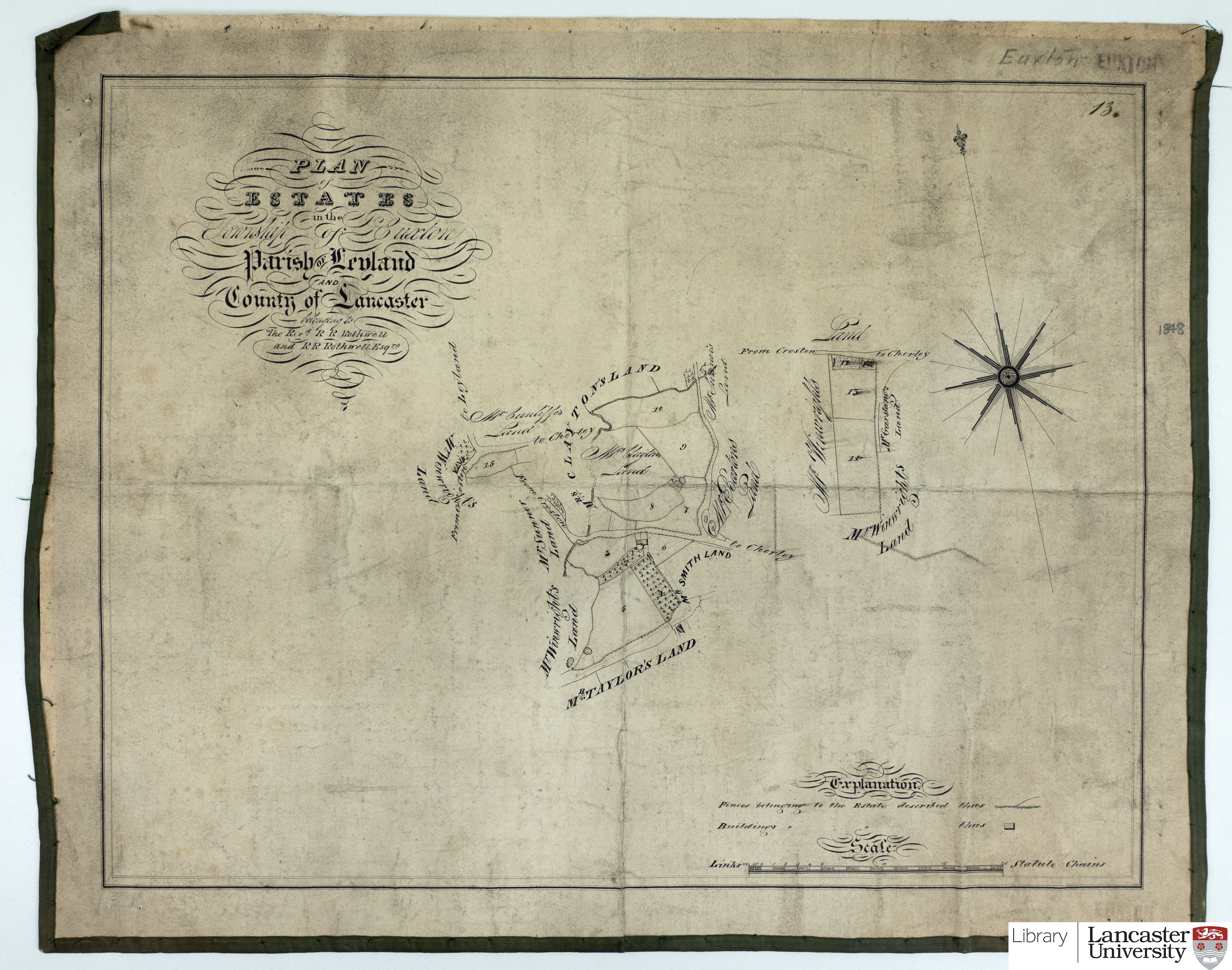 |
CC BY-SA 4.0 |
| 1848 | Rev. R R Rothwell & R R Rothwell Esq. Plan of Estates in the Township of Failsworth, Parish of Manchester and County of Lancaster. | 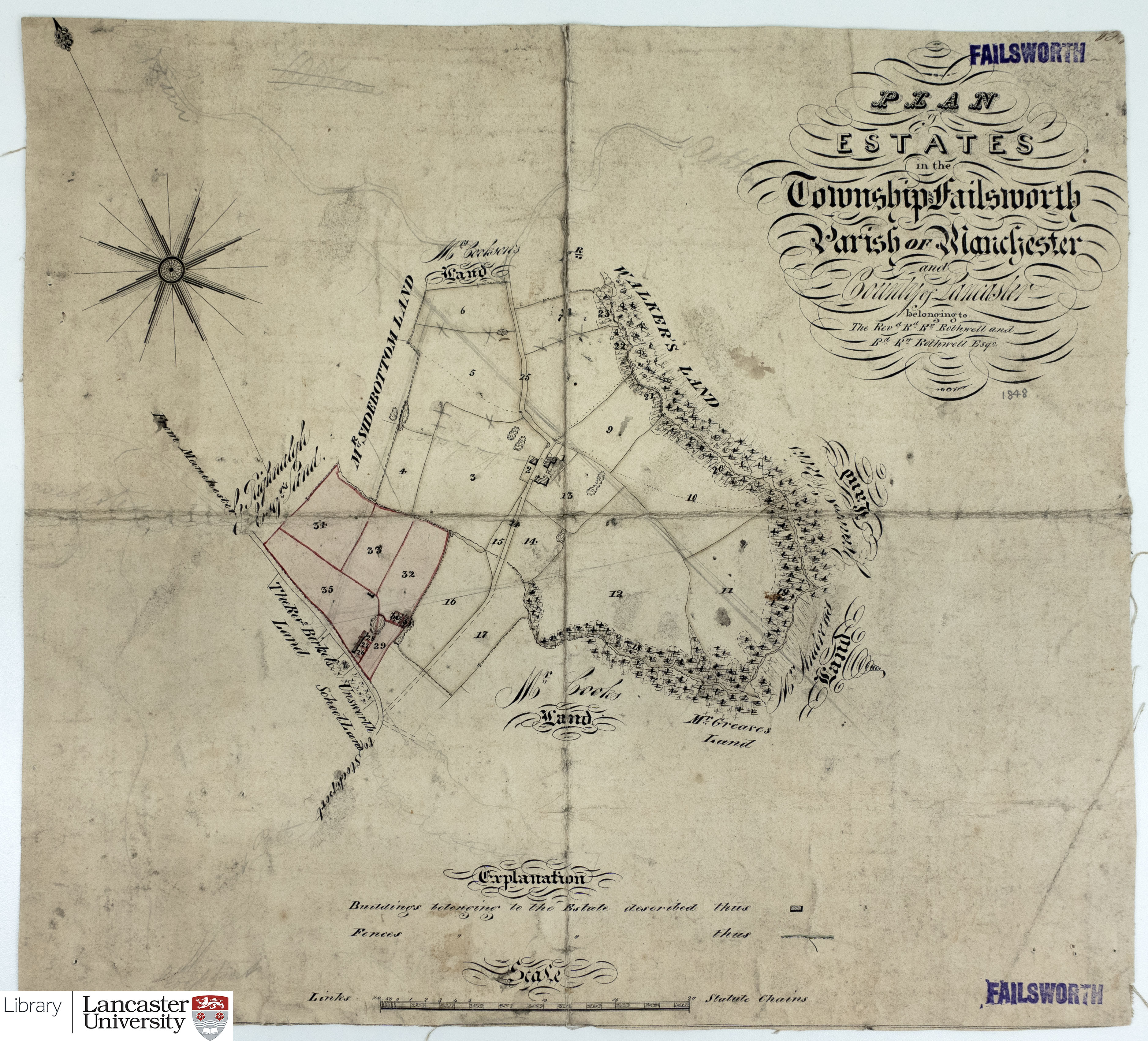 |
CC BY-SA 4.0 |
| 1921 | Harrison & Moore. Bailrigg Estate Scotforth. |  |
CC BY-SA 4.0 |
| Year | Name | Image | Attribution |
| c.1723 | Greenville Collins. Irish Sea & Isle of Man. | 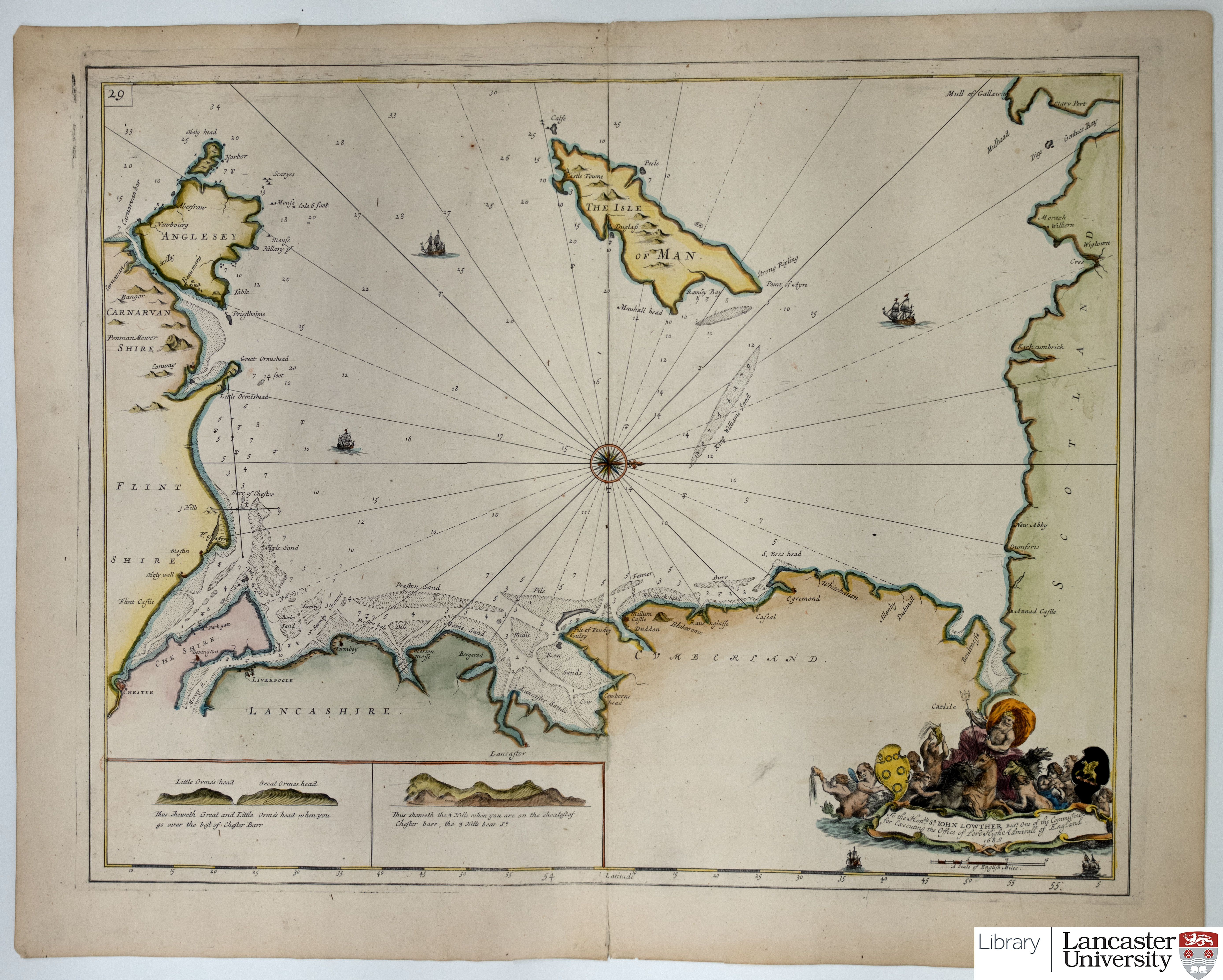 |
CC BY-SA 4.0 |
| c.1744 | A correct chart of the English Channel... For Mr Tindal's Continuation of Mr Rapin's History. |  |
CC BY-SA 4.0 |
| c.1744 | A correct chart of the Mediterranean Sea... For Mr Tindal's Continuation of Mr Rapin's History. | 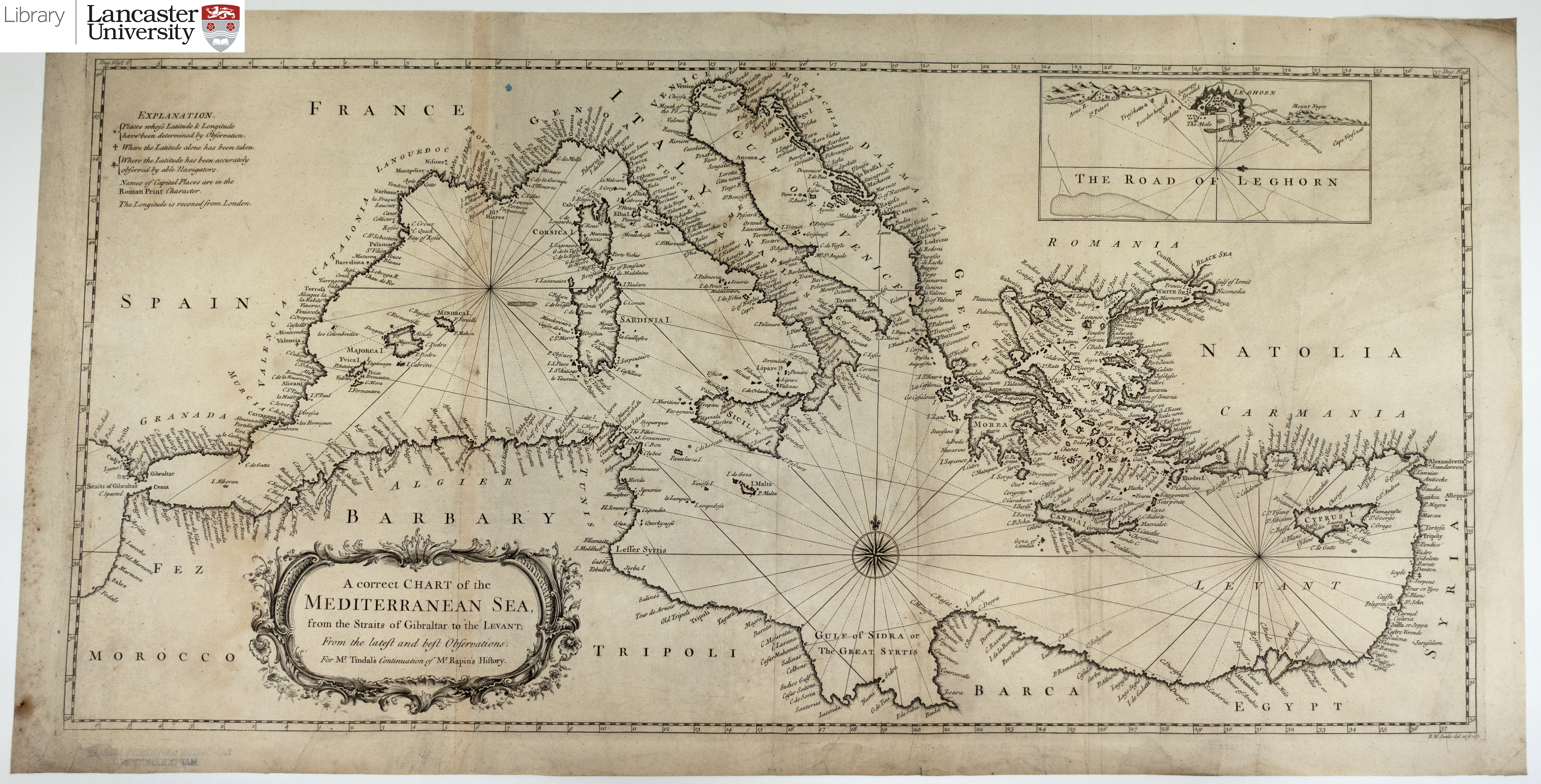 |
CC BY-SA 4.0 |
| c.1744 | A correct chart of the Bay of Biscay... For Mr Tindal's Continuation of Mr Rapin's History. | 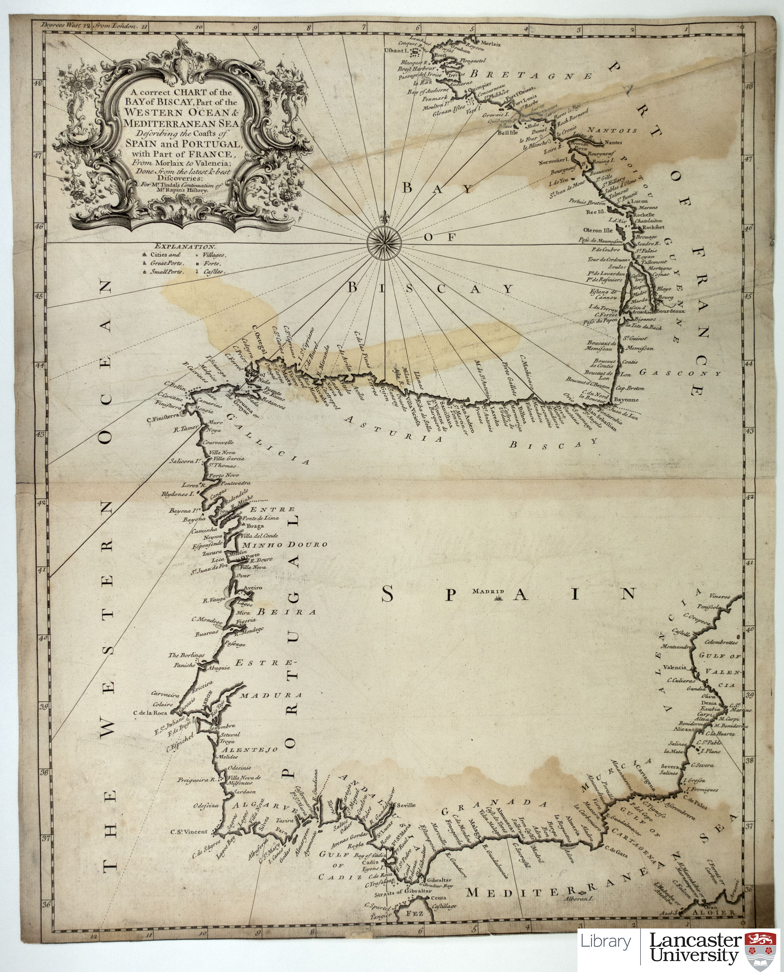 |
CC BY-SA 4.0 |